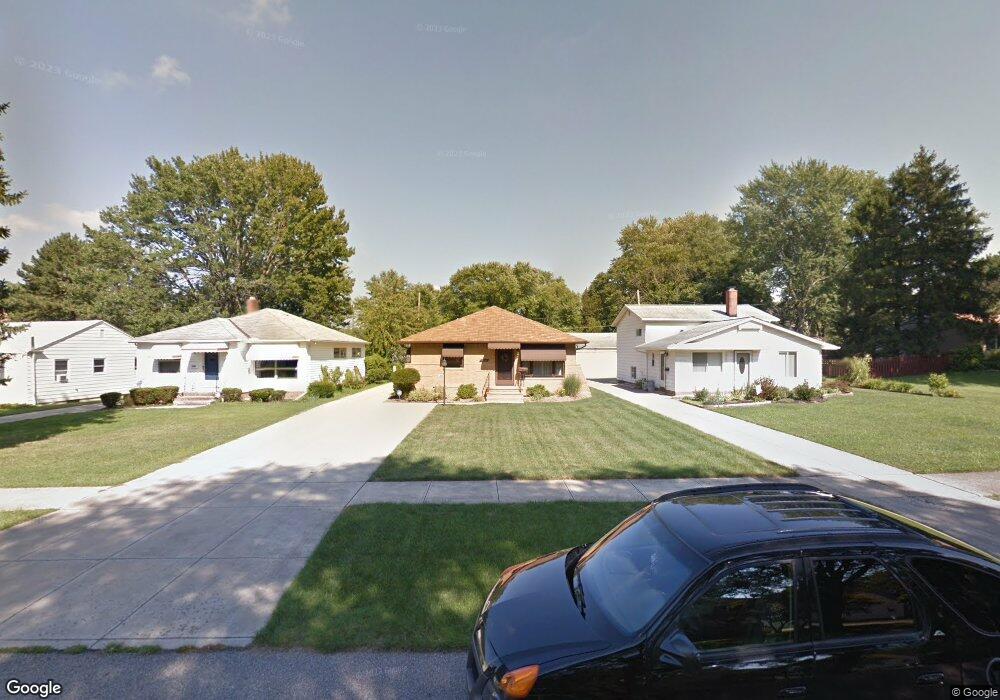
5869 W 224th St Cleveland, OH 44126
Estimated Value: $241,755 - $291,000
3
Beds
1
Bath
1,305
Sq Ft
$206/Sq Ft
Est. Value
About This Home
This home is located at 5869 W 224th St, Cleveland, OH 44126 and is currently estimated at $268,439, approximately $205 per square foot. 5869 W 224th St is a home located in Cuyahoga County with nearby schools including Gilles-Sweet Elementary School, Lewis F Mayer Middle School, and Fairview High School.
Ownership History
Date
Name
Owned For
Owner Type
Purchase Details
Closed on
Apr 18, 2000
Sold by
Gibson Celia I
Bought by
Kohout Katherine M
Current Estimated Value
Home Financials for this Owner
Home Financials are based on the most recent Mortgage that was taken out on this home.
Original Mortgage
$111,200
Interest Rate
8.22%
Purchase Details
Closed on
May 12, 1995
Sold by
Leak Margaret
Bought by
Gibson William and Gibson Celia I
Home Financials for this Owner
Home Financials are based on the most recent Mortgage that was taken out on this home.
Original Mortgage
$62,400
Interest Rate
7.99%
Mortgage Type
New Conventional
Purchase Details
Closed on
Apr 12, 1984
Sold by
Mccurdy Margaret C
Bought by
Leak Margaret
Purchase Details
Closed on
Jan 1, 1975
Bought by
Mccurdy Margaret C
Create a Home Valuation Report for This Property
The Home Valuation Report is an in-depth analysis detailing your home's value as well as a comparison with similar homes in the area
Home Values in the Area
Average Home Value in this Area
Purchase History
| Date | Buyer | Sale Price | Title Company |
|---|---|---|---|
| Kohout Katherine M | $139,900 | Insignia Title Agency Ltd | |
| Gibson William | $104,000 | -- | |
| Leak Margaret | -- | -- | |
| Mccurdy Margaret C | -- | -- |
Source: Public Records
Mortgage History
| Date | Status | Borrower | Loan Amount |
|---|---|---|---|
| Previous Owner | Kohout Katherine M | $111,200 | |
| Previous Owner | Gibson William | $62,400 |
Source: Public Records
Tax History Compared to Growth
Tax History
| Year | Tax Paid | Tax Assessment Tax Assessment Total Assessment is a certain percentage of the fair market value that is determined by local assessors to be the total taxable value of land and additions on the property. | Land | Improvement |
|---|---|---|---|---|
| 2024 | $5,184 | $75,005 | $14,035 | $60,970 |
| 2023 | $5,223 | $64,860 | $9,840 | $55,020 |
| 2022 | $5,093 | $64,855 | $9,835 | $55,020 |
| 2021 | $5,201 | $64,860 | $9,840 | $55,020 |
| 2020 | $4,786 | $52,330 | $7,950 | $44,380 |
| 2019 | $4,256 | $149,500 | $22,700 | $126,800 |
| 2018 | $4,051 | $52,330 | $7,950 | $44,380 |
| 2017 | $4,030 | $45,750 | $9,980 | $35,770 |
| 2016 | $4,003 | $45,750 | $9,980 | $35,770 |
| 2015 | $3,780 | $45,750 | $9,980 | $35,770 |
| 2014 | $3,780 | $43,580 | $9,490 | $34,090 |
Source: Public Records
Map
Nearby Homes
- 22250 Mastick Rd
- 22537 Lenox Dr
- 22640 Lenox Dr
- 22276 Sycamore Dr
- 22636 Mastick Rd
- 22439 Haber Dr
- 22934 Mastick Rd Unit 102
- 5951 Rockport Ln
- 22534 Bard Ave
- 22895 Mastick Rd
- 4530 Clague Rd
- 5300 Sherwood Dr
- 23052 Mastick Rd
- 22503 Sandy Ln
- 4590 Brendan Ln
- 4666 Brendan Cir
- 21877 Seabury Ave
- 4550 Georgette Ave
- 4505 Oak Cir
- 4570 W 228th St
- 5849 W 224th St
- 5891 W 224th St
- 5845 W 224th St
- 5915 W 224th St
- 5825 W 224th St
- 5935 W 224th St
- 5860 W 224th St
- 5870 W 224th St
- 5840 W 224th St
- 5890 W 224th St
- 5838 W 224th St
- 5955 W 224th St
- 5910 W 224th St
- 5940 W 224th St
- 22280 Mastick Rd
- 22380 Mastick Rd
- 5960 W 224th St
- 22390 Mastick Rd
- 22220 Mastick Rd
- 22450 Mastick Rd