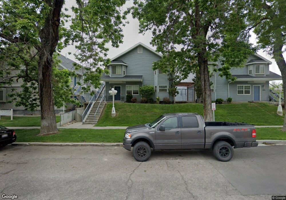
587 N 200 E Provo, UT 84606
Joaquin NeighborhoodEstimated Value: $293,963 - $305,000
2
Beds
1
Bath
704
Sq Ft
$424/Sq Ft
Est. Value
About This Home
This home is located at 587 N 200 E, Provo, UT 84606 and is currently estimated at $298,241, approximately $423 per square foot. 587 N 200 E is a home located in Utah County with nearby schools including Provo Peaks School, Centennial Middle School, and Timpview High School.
Ownership History
Date
Name
Owned For
Owner Type
Purchase Details
Closed on
Mar 7, 2012
Sold by
Boulter Acel Rock
Bought by
Boulter Acel Rock and Boulter Launn O
Current Estimated Value
Home Financials for this Owner
Home Financials are based on the most recent Mortgage that was taken out on this home.
Original Mortgage
$48,000
Interest Rate
3.92%
Mortgage Type
New Conventional
Purchase Details
Closed on
Dec 24, 1996
Sold by
Boulter A Roy
Bought by
Boulter A Roy A and Boulter Georgia M
Purchase Details
Closed on
Dec 23, 1996
Sold by
Zollinger David Jesse and Solomon Karlee Lyn
Bought by
Boulter A Roy
Create a Home Valuation Report for This Property
The Home Valuation Report is an in-depth analysis detailing your home's value as well as a comparison with similar homes in the area
Home Values in the Area
Average Home Value in this Area
Purchase History
| Date | Buyer | Sale Price | Title Company |
|---|---|---|---|
| Boulter Acel Rock | -- | None Available | |
| Boulter A Roy A | -- | Mountain West Title Company | |
| Boulter A Roy | -- | -- | |
| Boulter A Roy | -- | -- |
Source: Public Records
Mortgage History
| Date | Status | Borrower | Loan Amount |
|---|---|---|---|
| Previous Owner | Boulter Acel Rock | $48,000 |
Source: Public Records
Tax History
| Year | Tax Paid | Tax Assessment Tax Assessment Total Assessment is a certain percentage of the fair market value that is determined by local assessors to be the total taxable value of land and additions on the property. | Land | Improvement |
|---|---|---|---|---|
| 2025 | $1,439 | $154,935 | -- | -- |
| 2024 | $1,439 | $141,680 | $0 | $0 |
| 2023 | $1,552 | $150,590 | $0 | $0 |
| 2022 | $1,440 | $140,855 | $0 | $0 |
| 2021 | $1,210 | $206,500 | $24,800 | $181,700 |
| 2020 | $1,193 | $190,900 | $22,900 | $168,000 |
| 2019 | $1,039 | $172,800 | $20,000 | $152,800 |
| 2018 | $948 | $160,000 | $20,000 | $140,000 |
| 2017 | $833 | $77,220 | $0 | $0 |
| 2016 | $827 | $71,500 | $0 | $0 |
| 2015 | $756 | $66,000 | $0 | $0 |
| 2014 | $689 | $62,700 | $0 | $0 |
Source: Public Records
Map
Nearby Homes
- 466 N 200 E
- 433 N 300 E
- 136 E 400 N Unit 108
- 136 E 400 N Unit 107
- 232 E 400 N
- 380 N 200 E
- 639 N University Ave Unit 10
- 394 N 300 E
- 567 N University Ave Unit 209
- 36 W 700 N Unit 206
- 620 N 100 St W
- 232 E 300 N
- 246 N 200 E
- 513 E 700 N
- 541 E 500 N Unit 12
- 261 N 400 E Unit 301
- 948 N 50 E Unit 301
- 194 N 100 E
- 386 N 500 E
- 250 N 100 W Unit 109
- 587 N 200 E
- 587 N 200 E
- 587 N 200 E
- 587 N 200 E
- 587 N 200 E Unit 102
- 587 N 200 E
- 587 N 200 E
- 587 N 200 E
- 587 N 200 E
- 587 N 200 E Unit 205
- 587 N 200 E Unit 204
- 587 N 200 E Unit 103
- 587 N 200 E Unit 201
- 587 N 200 E Unit 203
- 587 N 200 E Unit 104
- 587 N 200 E Unit 105
- 587 N 200 E Unit 202
- 591 N 200 E Unit 205
- 591 N 200 E
- 591 N 200 E
Your Personal Tour Guide
Ask me questions while you tour the home.