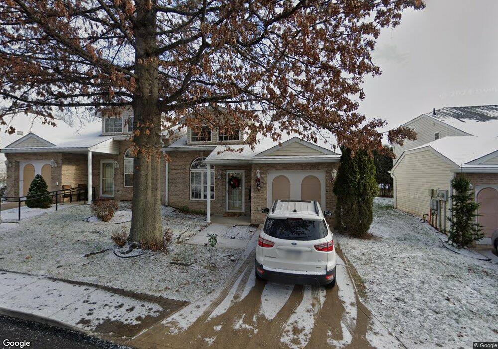
587 Newport Dr Unit 587 Pittsburgh, PA 15235
Penn Hills Township NeighborhoodEstimated Value: $201,332 - $250,000
3
Beds
2
Baths
1,625
Sq Ft
$135/Sq Ft
Est. Value
About This Home
This home is located at 587 Newport Dr Unit 587, Pittsburgh, PA 15235 and is currently estimated at $219,083, approximately $134 per square foot. 587 Newport Dr Unit 587 is a home located in Allegheny County with nearby schools including Penn Hills Elementary School, Linton Middle School, and Penn Hills Senior High School.
Ownership History
Date
Name
Owned For
Owner Type
Purchase Details
Closed on
Feb 24, 2021
Sold by
Rodgers Lucinda D
Bought by
Williams Patricia M
Current Estimated Value
Purchase Details
Closed on
Oct 12, 2015
Sold by
Rullo Staci L
Bought by
Rodgers Lucinda D
Home Financials for this Owner
Home Financials are based on the most recent Mortgage that was taken out on this home.
Original Mortgage
$116,000
Interest Rate
3.92%
Mortgage Type
New Conventional
Purchase Details
Closed on
Mar 4, 1998
Sold by
Amore Companies Inc
Bought by
Washington Troye L
Create a Home Valuation Report for This Property
The Home Valuation Report is an in-depth analysis detailing your home's value as well as a comparison with similar homes in the area
Home Values in the Area
Average Home Value in this Area
Purchase History
| Date | Buyer | Sale Price | Title Company |
|---|---|---|---|
| Williams Patricia M | $155,000 | -- | |
| Williams Patricia M | $155,000 | Barristers Land Abstract | |
| Rodgers Lucinda D | $145,000 | None Available | |
| Washington Troye L | $111,000 | -- |
Source: Public Records
Mortgage History
| Date | Status | Borrower | Loan Amount |
|---|---|---|---|
| Previous Owner | Rodgers Lucinda D | $116,000 |
Source: Public Records
Tax History Compared to Growth
Tax History
| Year | Tax Paid | Tax Assessment Tax Assessment Total Assessment is a certain percentage of the fair market value that is determined by local assessors to be the total taxable value of land and additions on the property. | Land | Improvement |
|---|---|---|---|---|
| 2025 | $5,368 | $128,500 | -- | $128,500 |
| 2024 | $5,368 | $128,500 | -- | $128,500 |
| 2023 | $5,368 | $128,500 | $0 | $128,500 |
| 2022 | $5,303 | $128,500 | $0 | $128,500 |
| 2021 | $1,435 | $128,500 | $0 | $128,500 |
| 2020 | $5,119 | $128,500 | $0 | $128,500 |
| 2019 | $5,119 | $128,500 | $0 | $128,500 |
| 2018 | $608 | $128,500 | $0 | $128,500 |
| 2017 | $4,688 | $128,500 | $0 | $128,500 |
| 2016 | $608 | $128,500 | $0 | $128,500 |
| 2015 | $608 | $128,500 | $0 | $128,500 |
| 2014 | $4,410 | $128,500 | $0 | $128,500 |
Source: Public Records
Map
Nearby Homes
- 501 Hoover Rd
- 117 Oak Ave
- 109 Burton Dr
- 256 Duff Rd
- 264 Duff Rd
- 11717 Joan Dr
- 117 Rose Ave
- 130 Elizabeth Dr
- 279 Richland Dr
- appx 360 Rodi Rd
- 0 Park Dr Unit 1699468
- 418 Pennwood Dr
- 634 Homewood Dr
- 505 Veronica Dr
- 531 Burton Dr
- 543 Burton Dr
- 630 Veronica Dr
- 733 Veronica Dr
- 11522 Clematis Blvd
- 25 Duff Rd
- 585 Newport Dr Unit 585
- 593 Newport Dr Unit 593
- 595 Newport Dr Unit 595
- 583 Newport Dr Unit 583
- 581 Newport Dr Unit 581
- 586 Newport Dr
- 584 Newport Dr
- 456 Shadywood Dr
- 458 Shadywood Dr
- 460 Shadywood Dr
- 592 Newport Dr
- 462 Shadywood Dr
- 597 Newport Dr Unit 597
- 464 Shadywood Dr
- 594 Newport Dr
- 582 Newport Dr
- 466 Shadywood Dr
- 599 Newport Dr Unit 599
- 580 Newport Dr Unit 580
- 575 Newport Dr