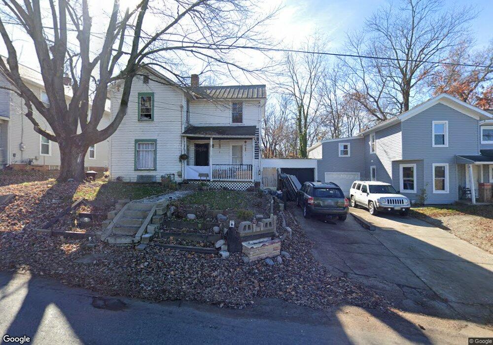
587 Robinson Rd Wooster, OH 44691
Estimated Value: $136,000 - $152,000
4
Beds
1
Bath
1,369
Sq Ft
$103/Sq Ft
Est. Value
About This Home
This home is located at 587 Robinson Rd, Wooster, OH 44691 and is currently estimated at $141,183, approximately $103 per square foot. 587 Robinson Rd is a home located in Wayne County with nearby schools including Cornerstone Elementary School, Edgewood Middle School, and Wooster High School.
Ownership History
Date
Name
Owned For
Owner Type
Purchase Details
Closed on
Jan 10, 2020
Sold by
Hunter William E
Bought by
H W Hunter Properties V Llc
Current Estimated Value
Purchase Details
Closed on
Sep 14, 2015
Sold by
Hunter William E and Hunter Nancy J
Bought by
Hunter William E and William E Hunter Revocable Trust
Purchase Details
Closed on
Jun 16, 2015
Sold by
Renner Penny and Claus Sandra
Bought by
Hunter William E
Purchase Details
Closed on
Oct 29, 1987
Bought by
Weygandt Early Ann
Create a Home Valuation Report for This Property
The Home Valuation Report is an in-depth analysis detailing your home's value as well as a comparison with similar homes in the area
Home Values in the Area
Average Home Value in this Area
Purchase History
| Date | Buyer | Sale Price | Title Company |
|---|---|---|---|
| H W Hunter Properties V Llc | -- | None Available | |
| Hunter William E | -- | Attorney | |
| Hunter William E | $77,000 | Attorney | |
| Weygandt Early Ann | $26,000 | -- |
Source: Public Records
Tax History Compared to Growth
Tax History
| Year | Tax Paid | Tax Assessment Tax Assessment Total Assessment is a certain percentage of the fair market value that is determined by local assessors to be the total taxable value of land and additions on the property. | Land | Improvement |
|---|---|---|---|---|
| 2024 | $1,264 | $27,710 | $7,360 | $20,350 |
| 2023 | $1,264 | $27,710 | $7,360 | $20,350 |
| 2022 | $1,275 | $21,990 | $5,840 | $16,150 |
| 2021 | $1,250 | $21,990 | $5,840 | $16,150 |
| 2020 | $1,189 | $21,990 | $5,840 | $16,150 |
| 2019 | $1,103 | $19,390 | $5,560 | $13,830 |
| 2018 | $1,106 | $19,390 | $5,560 | $13,830 |
| 2017 | $1,114 | $19,390 | $5,560 | $13,830 |
| 2016 | $1,148 | $18,640 | $5,340 | $13,300 |
| 2015 | $1,128 | $18,640 | $5,340 | $13,300 |
| 2014 | $1,129 | $18,640 | $5,340 | $13,300 |
| 2013 | $1,170 | $19,030 | $5,730 | $13,300 |
Source: Public Records
Map
Nearby Homes
- 211 Minerva St
- 2754 Millersburg Rd
- 202 Palmer St
- 229 N Walnut St
- 227 N Walnut St
- 638 High St
- 349 W North St
- 365 Lucca St
- 1174 Columbus Rd
- 323 N Grant St
- 554 Nold Ave
- 2530 Tuckahoe Rd
- 423 N Market St
- 406 N Walnut St
- 1296 Gallo Dr
- 412 Emerick St
- 450 N Grant St
- 534 N Buckeye St
- 329 E Bowman St
- 537 N Grant St
- 595 Robinson Rd
- 595 Robinson Rd
- 575 Robinson Rd
- 549 Robinson Rd
- 1018 Madison Ave
- 613 Robinson Rd
- 547 Robinson Rd
- 1036 Madison Ave
- 602 Robinson Rd
- 627 Robinson Rd
- 616 Robinson Rd
- 580 Robinson Rd
- 1060 Madison Ave
- 631 Robinson Rd
- 1084 Madison Ave
- 626 Robinson Rd
- 639 Robinson Rd
- 636 Robinson Rd
- 649 Robinson Rd
- 640 Robinson Rd