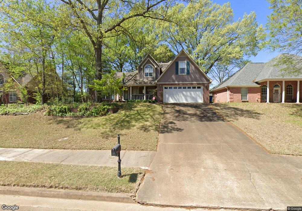
5871 Michaelson Dr Olive Branch, MS 38654
Estimated Value: $282,000 - $314,020
4
Beds
3
Baths
2,246
Sq Ft
$133/Sq Ft
Est. Value
About This Home
This home is located at 5871 Michaelson Dr, Olive Branch, MS 38654 and is currently estimated at $299,755, approximately $133 per square foot. 5871 Michaelson Dr is a home located in DeSoto County with nearby schools including Olive Branch Elementary School, Chickasaw Elementary School, and Olive Branch Middle School.
Ownership History
Date
Name
Owned For
Owner Type
Purchase Details
Closed on
May 28, 2021
Sold by
Meador Vickie and Foster Vicki S
Bought by
Meador Vickie and Meador Donald
Current Estimated Value
Home Financials for this Owner
Home Financials are based on the most recent Mortgage that was taken out on this home.
Original Mortgage
$76,275
Interest Rate
2.9%
Mortgage Type
New Conventional
Create a Home Valuation Report for This Property
The Home Valuation Report is an in-depth analysis detailing your home's value as well as a comparison with similar homes in the area
Home Values in the Area
Average Home Value in this Area
Purchase History
| Date | Buyer | Sale Price | Title Company |
|---|---|---|---|
| Meador Vickie | -- | Amrock |
Source: Public Records
Mortgage History
| Date | Status | Borrower | Loan Amount |
|---|---|---|---|
| Closed | Meador Vickie | $76,275 |
Source: Public Records
Tax History Compared to Growth
Tax History
| Year | Tax Paid | Tax Assessment Tax Assessment Total Assessment is a certain percentage of the fair market value that is determined by local assessors to be the total taxable value of land and additions on the property. | Land | Improvement |
|---|---|---|---|---|
| 2024 | $1,064 | $15,294 | $2,500 | $12,794 |
| 2023 | $1,064 | $15,294 | $0 | $0 |
| 2022 | $1,064 | $15,294 | $2,500 | $12,794 |
| 2021 | $1,787 | $15,294 | $2,500 | $12,794 |
| 2020 | $1,643 | $14,239 | $2,500 | $11,739 |
| 2019 | $1,643 | $14,239 | $2,500 | $11,739 |
| 2017 | $1,605 | $25,274 | $13,887 | $11,387 |
| 2016 | $1,692 | $14,519 | $2,500 | $12,019 |
| 2015 | $1,992 | $26,538 | $14,519 | $12,019 |
| 2014 | $1,692 | $14,519 | $0 | $0 |
| 2013 | $1,634 | $14,519 | $0 | $0 |
Source: Public Records
Map
Nearby Homes
- 6041 Allen Pkwy W
- 5676 Southbend Ln
- 9821 Morgan Manor Dr
- 5648 Blocker St
- 5841 Blocker St
- 9800 Cherokee Dr
- 5295 Blocker St
- 10082 Lacey Dr
- 9759 Pigeon Roost Park Cir
- 2914 Cypress Lake Dr S
- 9919 Adina Cove
- 9598 Nielsen Dr
- 9113 Rue Orleans Ln
- 6180 Rd
- 5195 Mary Ln N
- 9270 College St
- 10227 Williford Dr
- 6748 Cockrum Rd
- 10475 Courtney Cove
- 9745 Riggan Dr
- 5885 Michaelson Dr
- 5857 Michaelson Dr
- 5872 Eagleston Dr
- 5899 Michaelson Dr
- 5843 Michaelson Dr
- 5886 Eagleston Dr
- 5858 Eagleston Dr
- 5864 Michaelson Dr
- 5878 Michaelson Dr
- 5900 Eagleston Dr
- 5844 Eagleston Dr
- 5850 Michaelson Dr
- 5892 Michaelson Dr
- 5829 Michaelson Dr
- 5913 Michaelson Dr
- 5836 Michaelson Dr
- 5830 Eagleston Dr
- 5906 Michaelson Dr
- 5815 Michaelson Dr
- 5927 Michaelson Dr