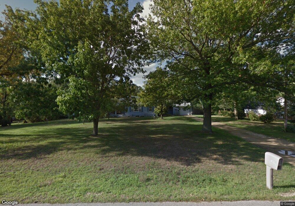
5872 Broad St Roscoe, IL 61073
Estimated Value: $213,494 - $232,000
3
Beds
2
Baths
1,498
Sq Ft
$146/Sq Ft
Est. Value
About This Home
This home is located at 5872 Broad St, Roscoe, IL 61073 and is currently estimated at $219,124, approximately $146 per square foot. 5872 Broad St is a home with nearby schools including Ledgewood Elementary School, Stone Creek School, and Kinnikinnick School.
Ownership History
Date
Name
Owned For
Owner Type
Purchase Details
Closed on
Feb 16, 2021
Sold by
Glen L Gabel Ii Trust
Bought by
Gabel Benjamin Michael
Current Estimated Value
Home Financials for this Owner
Home Financials are based on the most recent Mortgage that was taken out on this home.
Original Mortgage
$73,000
Outstanding Balance
$64,933
Interest Rate
2.65%
Mortgage Type
New Conventional
Estimated Equity
$154,191
Create a Home Valuation Report for This Property
The Home Valuation Report is an in-depth analysis detailing your home's value as well as a comparison with similar homes in the area
Home Values in the Area
Average Home Value in this Area
Purchase History
| Date | Buyer | Sale Price | Title Company |
|---|---|---|---|
| Gabel Benjamin Michael | $125,000 | None Listed On Document |
Source: Public Records
Mortgage History
| Date | Status | Borrower | Loan Amount |
|---|---|---|---|
| Open | Gabel Benjamin Michael | $73,000 |
Source: Public Records
Tax History
| Year | Tax Paid | Tax Assessment Tax Assessment Total Assessment is a certain percentage of the fair market value that is determined by local assessors to be the total taxable value of land and additions on the property. | Land | Improvement |
|---|---|---|---|---|
| 2024 | $3,697 | $47,519 | $7,986 | $39,533 |
| 2022 | $3,228 | $38,985 | $6,552 | $32,433 |
| 2021 | $3,064 | $36,623 | $6,155 | $30,468 |
| 2020 | $2,994 | $35,292 | $5,931 | $29,361 |
| 2019 | $2,897 | $33,711 | $5,665 | $28,046 |
| 2018 | $2,704 | $32,392 | $5,443 | $26,949 |
| 2017 | $2,780 | $31,242 | $5,250 | $25,992 |
| 2016 | $2,665 | $30,741 | $5,166 | $25,575 |
| 2015 | $2,544 | $29,863 | $5,018 | $24,845 |
| 2014 | $946 | $29,486 | $4,955 | $24,531 |
Source: Public Records
Map
Nearby Homes
- 0000 Joncey Dr
- 5651 Thompson Dr
- 5790 Ada Dr
- 9960 Bitterroot Rd
- 5683 Oak Village Dr Unit 5683
- 10458 Main St
- 11392 Edgemere Terrace
- 6346 Smoke Tree Cir
- 6609 Sawmill Dr
- 11548 Chatt Ct
- 11422 Bayberry Dr
- 9573 Twin Deer Run
- 11831 Bowen Pkwy
- 9.41 Acres Bluestem Rd
- 6493 Prairie Flower
- 7334 Hawthorne Ridge
- 7822 Burr Oak Rd
- 410 Pine White Rd
- 10582 Atwood Rd
- 10113 Monarch Rd Unit 3
- 5916 Broad St
- 5871 Chestnut St
- 10835 4th St
- 5924 Broad St
- 10825 4th St
- 5913 Chestnut St
- 5865 Broad St
- 5938 Broad St
- 5841 Broad St
- 5915 Broad St
- 5939 Chestnut St
- 5833 Broad St
- 5956 Broad St
- 5870 Chestnut St
- 10822 4th St
- 5912 Chestnut St
- 5951 Chestnut St
- 5955 Broad St
- 5828 Chestnut St
- 5874 Harrison St
Your Personal Tour Guide
Ask me questions while you tour the home.