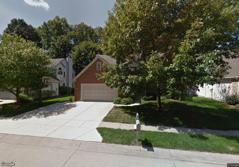
5872 Manning Rd Indianapolis, IN 46228
Snacks/Guion Creek NeighborhoodEstimated Value: $338,136 - $381,000
4
Beds
3
Baths
2,413
Sq Ft
$150/Sq Ft
Est. Value
About This Home
This home is located at 5872 Manning Rd, Indianapolis, IN 46228 and is currently estimated at $361,534, approximately $149 per square foot. 5872 Manning Rd is a home located in Marion County with nearby schools including Pike High School, Indiana Math & Science Academy West, and Enlace Academy.
Ownership History
Date
Name
Owned For
Owner Type
Purchase Details
Closed on
Jun 5, 2020
Sold by
Doak Timothy L and Doak Joan F
Bought by
Maddox Ayanna B
Current Estimated Value
Home Financials for this Owner
Home Financials are based on the most recent Mortgage that was taken out on this home.
Original Mortgage
$240,562
Outstanding Balance
$213,240
Interest Rate
3.2%
Mortgage Type
Construction
Estimated Equity
$148,294
Create a Home Valuation Report for This Property
The Home Valuation Report is an in-depth analysis detailing your home's value as well as a comparison with similar homes in the area
Home Values in the Area
Average Home Value in this Area
Purchase History
| Date | Buyer | Sale Price | Title Company |
|---|---|---|---|
| Maddox Ayanna B | $245,000 | Landquest Title Services |
Source: Public Records
Mortgage History
| Date | Status | Borrower | Loan Amount |
|---|---|---|---|
| Open | Maddox Ayanna B | $240,562 |
Source: Public Records
Tax History Compared to Growth
Tax History
| Year | Tax Paid | Tax Assessment Tax Assessment Total Assessment is a certain percentage of the fair market value that is determined by local assessors to be the total taxable value of land and additions on the property. | Land | Improvement |
|---|---|---|---|---|
| 2024 | $3,020 | $291,500 | $49,400 | $242,100 |
| 2023 | $3,020 | $293,200 | $49,400 | $243,800 |
| 2022 | $2,915 | $295,000 | $49,400 | $245,600 |
| 2021 | $2,373 | $228,900 | $30,800 | $198,100 |
| 2020 | $2,404 | $232,200 | $30,800 | $201,400 |
| 2019 | $2,239 | $215,800 | $30,800 | $185,000 |
| 2018 | $2,122 | $204,300 | $30,800 | $173,500 |
| 2017 | $2,024 | $194,700 | $30,800 | $163,900 |
| 2016 | $1,988 | $191,300 | $30,800 | $160,500 |
| 2014 | $1,880 | $188,000 | $30,800 | $157,200 |
| 2013 | $1,923 | $189,600 | $30,800 | $158,800 |
Source: Public Records
Map
Nearby Homes
- 3304 W Northgate Dr
- 3515 W 57th St
- 3155 W 57th St
- 6063 Morning Dove Dr
- 3420 Julie Ln
- 3229 Weller Dr
- 3714 Turfway Ct
- 6038 Estate Ave
- 3560 W 62nd St
- 3428 Ellyn Dr
- 5506 W Kessler Boulevard Dr N
- 6192 Morning Dove Dr
- 6130 King Ave
- 3153 Kelsey Cir
- 3453 W 54th St
- 6357 Hollingsworth Dr
- 5315 Manning Rd
- 2530 Lincoln Ln
- 6422 Hollingsworth Dr
- 3445 W 53rd St
- 5866 Manning Rd
- 5878 Manning Rd
- 5871 Manning Rd
- 5877 Manning Rd
- 5865 Manning Rd
- 5854 Manning Rd
- 5883 Manning Rd
- 5859 Manning Rd
- 5878 Dapple Trace
- 5889 Manning Rd
- 5872 Dapple Trace
- 5853 Manning Rd
- 5848 Manning Rd
- 5866 Dapple Trace
- 5861 Dapple Trace
- 5895 Manning Rd
- 5847 Manning Rd
- 5842 Manning Rd
- 3604 Sommersworth Ln
- 5841 Manning Rd