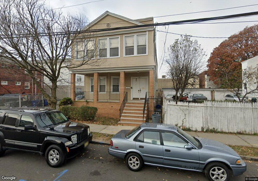
588 4th St Unit 590 Newark, NJ 07107
Upper Roseville NeighborhoodEstimated Value: $594,482 - $684,000
--
Bed
--
Bath
2,460
Sq Ft
$264/Sq Ft
Est. Value
About This Home
This home is located at 588 4th St Unit 590, Newark, NJ 07107 and is currently estimated at $649,621, approximately $264 per square foot. 588 4th St Unit 590 is a home located in Essex County with nearby schools including First Avenue Elementary School, Dr. William H. Horton School, and Rafael Hernandez School.
Ownership History
Date
Name
Owned For
Owner Type
Purchase Details
Closed on
Jan 14, 1992
Sold by
Melillo Jane and Melillo Richard
Bought by
Bethlehem Baptist Church
Current Estimated Value
Purchase Details
Closed on
Oct 4, 1990
Sold by
Melillo James V
Bought by
Mellillo James and Mellillo Stabile,R
Purchase Details
Closed on
Nov 28, 1989
Sold by
Melillo Angela
Bought by
Melillo James
Create a Home Valuation Report for This Property
The Home Valuation Report is an in-depth analysis detailing your home's value as well as a comparison with similar homes in the area
Home Values in the Area
Average Home Value in this Area
Purchase History
| Date | Buyer | Sale Price | Title Company |
|---|---|---|---|
| Bethlehem Baptist Church | $155,000 | -- | |
| Bethlehem Baptist Church | $155,000 | -- | |
| Mellillo James | -- | -- | |
| Melillo James | -- | -- |
Source: Public Records
Tax History Compared to Growth
Tax History
| Year | Tax Paid | Tax Assessment Tax Assessment Total Assessment is a certain percentage of the fair market value that is determined by local assessors to be the total taxable value of land and additions on the property. | Land | Improvement |
|---|---|---|---|---|
| 2025 | $7,724 | $207,200 | $51,100 | $156,100 |
| 2024 | $7,724 | $207,200 | $51,100 | $156,100 |
| 2022 | $7,741 | $207,200 | $51,100 | $156,100 |
| 2021 | $7,737 | $207,200 | $51,100 | $156,100 |
| 2020 | $7,874 | $207,200 | $51,100 | $156,100 |
| 2019 | $7,793 | $207,200 | $51,100 | $156,100 |
| 2018 | $7,652 | $207,200 | $51,100 | $156,100 |
| 2017 | $7,376 | $207,200 | $51,100 | $156,100 |
| 2016 | $7,128 | $207,200 | $51,100 | $156,100 |
| 2015 | $6,856 | $207,200 | $51,100 | $156,100 |
| 2014 | $6,425 | $207,200 | $51,100 | $156,100 |
Source: Public Records
Map
Nearby Homes
- 191 1st Ave W
- 575 N 6th St
- 575 N 6th St Unit 4
- 582 3rd St Unit 584
- 582 3rd St
- 580 3rd St
- 600 N 6th St Unit 1103
- 600 N 6th St Unit B3
- 600 N 6th St
- 277 2nd Ave W Unit 2
- 277 2nd Ave W
- 457 N 7th St
- 150 S 10th St
- 489 N 11th St Unit 491
- 682 N 7th St
- 349 Parker St Unit 351
- 684 N 7th St
- 341 Parker St Unit 343
- 727 N 6th St
- 108 Davenport Ave
- 596 4th St
- 185 1st Ave W
- 187 1st Ave W
- 573 N 5th St
- 579 N 5th St
- 579 N 5th St Unit 2
- 598 4th St
- 598-600 4th St
- 191 1st Ave W Unit 2
- 581 N 5th St
- 581 N 5th St Unit 1R
- 177 1st Ave W Unit 179
- 593 4th St
- 602 4th St Unit 604
- 595 4th St
- 587 N 5th St
- 597 4th St Unit 599
- 597 4th St Unit 2
- 175 1st Ave W
- 0 N 4th St Unit 3