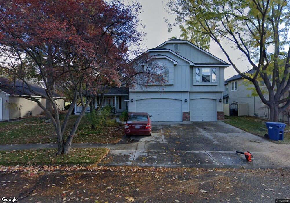
5882 N Dalspring Ave Boise, ID 83713
West Boise NeighborhoodEstimated Value: $765,000 - $873,000
7
Beds
4
Baths
3,290
Sq Ft
$245/Sq Ft
Est. Value
About This Home
This home is located at 5882 N Dalspring Ave, Boise, ID 83713 and is currently estimated at $806,545, approximately $245 per square foot. 5882 N Dalspring Ave is a home located in Ada County with nearby schools including Cecil D. Andrus Elementary School, Lowell Scott Middle School, and Centennial High School.
Ownership History
Date
Name
Owned For
Owner Type
Purchase Details
Closed on
Dec 5, 1998
Sold by
Woods Edward S and Woods Julia
Bought by
Mcconnehey Diane and Mcconnehey Brock
Current Estimated Value
Purchase Details
Closed on
May 29, 1998
Sold by
Woolston Daniel L and Woolston Esther E
Bought by
Woods Edward S and Woods Julia
Home Financials for this Owner
Home Financials are based on the most recent Mortgage that was taken out on this home.
Original Mortgage
$300,000
Interest Rate
7.13%
Mortgage Type
Purchase Money Mortgage
Create a Home Valuation Report for This Property
The Home Valuation Report is an in-depth analysis detailing your home's value as well as a comparison with similar homes in the area
Home Values in the Area
Average Home Value in this Area
Purchase History
| Date | Buyer | Sale Price | Title Company |
|---|---|---|---|
| Mcconnehey Diane | -- | -- | |
| Woods Edward S | -- | Pioneer Title Company |
Source: Public Records
Mortgage History
| Date | Status | Borrower | Loan Amount |
|---|---|---|---|
| Previous Owner | Woods Edward S | $300,000 |
Source: Public Records
Tax History Compared to Growth
Tax History
| Year | Tax Paid | Tax Assessment Tax Assessment Total Assessment is a certain percentage of the fair market value that is determined by local assessors to be the total taxable value of land and additions on the property. | Land | Improvement |
|---|---|---|---|---|
| 2025 | $3,771 | $711,600 | -- | -- |
| 2024 | $3,490 | $695,300 | -- | -- |
| 2023 | $3,490 | $626,400 | $0 | $0 |
| 2022 | $4,390 | $775,200 | $0 | $0 |
| 2021 | $4,422 | $629,400 | $0 | $0 |
| 2020 | $3,956 | $496,900 | $0 | $0 |
| 2019 | $4,934 | $485,300 | $0 | $0 |
| 2018 | $4,561 | $421,100 | $0 | $0 |
| 2017 | $4,553 | $399,900 | $0 | $0 |
| 2016 | $4,476 | $382,400 | $0 | $0 |
| 2015 | $2,062 | $361,900 | $0 | $0 |
| 2012 | -- | $283,600 | $0 | $0 |
Source: Public Records
Map
Nearby Homes
- 13268 W Elmspring Dr
- 13312 W Elmspring Dr
- 13388 W Elmspring Dr
- 5530 N Papago Ave
- 13325 W Bluebell Dr
- 13246 W Bluebell Dr
- 6247 N Bellecreek Ave
- 12773 W Engelmann Dr
- 800 E Ashbourne Ln
- 764 E Ashbourne Ln
- 752 E Ashbourne Ln
- 909 E Joplin Ln
- 873 E Joplin Ln
- 13617 W Wrigley Ct
- 814 E Joplin Ln
- 5139 N Brookfield Place
- 3353 S Eagle Brook Ln
- 5360 N Noble Fir Ave
- 617 E Fishing Creek Ln
- 5095 N Blue Ash Ave
- 5846 N Dalspring Ave
- 5898 N Dalspring Ave
- 13240 W
- 13245 W Annabrook Dr
- 13232 W Annabrook Dr
- 13240 W Hobble Creek Ct
- 5824 N Dalspring Ave
- 13248 W Annabrook Dr
- 13262 W Hobble Creek Ct
- 5796 N Dalspring Ave
- 13271 W Annabrook Dr
- 13241 W Hobble Creek Ct
- 13270 W Annabrook Dr
- 13189 W Bluebonnet Ct
- 13167 W Bluebonnet Ct
- 5770 N Dalspring Ave
- 13213 W Bluebonnet Ct
- 13263 W Hobble Creek Ct
- 13293 W Annabrook Dr
- 5749 N Rosebrook Ave