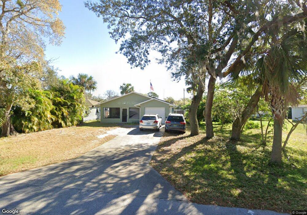
5883 Azalea St Port Orange, FL 32127
Harbor Oaks NeighborhoodEstimated Value: $181,000 - $267,000
2
Beds
1
Bath
1,291
Sq Ft
$176/Sq Ft
Est. Value
About This Home
This home is located at 5883 Azalea St, Port Orange, FL 32127 and is currently estimated at $226,985, approximately $175 per square foot. 5883 Azalea St is a home located in Volusia County with nearby schools including Port Orange Elementary School, Silver Sands Middle School, and Spruce Creek High School.
Ownership History
Date
Name
Owned For
Owner Type
Purchase Details
Closed on
Feb 28, 2017
Sold by
Crouch Alan R and Crouch Jacqueline E
Bought by
Defrancesco Gail A and Heath Mark R
Current Estimated Value
Home Financials for this Owner
Home Financials are based on the most recent Mortgage that was taken out on this home.
Original Mortgage
$94,225
Outstanding Balance
$78,115
Interest Rate
4.16%
Estimated Equity
$148,870
Purchase Details
Closed on
May 15, 1991
Bought by
Crouch Alan R and Crouch Jacqueline E
Create a Home Valuation Report for This Property
The Home Valuation Report is an in-depth analysis detailing your home's value as well as a comparison with similar homes in the area
Home Values in the Area
Average Home Value in this Area
Purchase History
| Date | Buyer | Sale Price | Title Company |
|---|---|---|---|
| Defrancesco Gail A | -- | -- | |
| Crouch Alan R | $10,000 | -- |
Source: Public Records
Mortgage History
| Date | Status | Borrower | Loan Amount |
|---|---|---|---|
| Open | Defrancesco Gail A | $94,225 | |
| Closed | Defrancesco Gail A | -- |
Source: Public Records
Tax History Compared to Growth
Tax History
| Year | Tax Paid | Tax Assessment Tax Assessment Total Assessment is a certain percentage of the fair market value that is determined by local assessors to be the total taxable value of land and additions on the property. | Land | Improvement |
|---|---|---|---|---|
| 2025 | $1,487 | $132,262 | -- | -- |
| 2024 | $1,487 | $128,535 | -- | -- |
| 2023 | $1,487 | $124,792 | $0 | $0 |
| 2022 | $1,496 | $121,157 | $0 | $0 |
| 2021 | $1,516 | $117,628 | $0 | $0 |
| 2020 | $1,474 | $116,004 | $0 | $0 |
| 2019 | $1,420 | $113,396 | $17,315 | $96,081 |
| 2018 | $1,466 | $114,078 | $14,954 | $99,124 |
| 2017 | $2,090 | $102,527 | $13,583 | $88,944 |
| 2016 | $1,983 | $96,420 | $0 | $0 |
| 2015 | $1,856 | $84,191 | $0 | $0 |
| 2014 | $1,730 | $77,057 | $0 | $0 |
Source: Public Records
Map
Nearby Homes
- 5563 W Magnolia Ave
- 5561 Magnolia Ave
- 88 E Bayshore Dr
- 5585 Lancewood Cir S Unit S
- 5585 Lancewood Cir S
- 24 Oak St
- 18 E Magnolia Ave
- 5650 Palm Ave
- 5508 Lancewood Cir N
- 5948 Riverside Dr
- 720 Palm Cir Dr
- 720 Palm Circle Dr
- 5967 Riverside Dr
- 5476 W Bayshore Dr
- 276 Farmbrook Rd
- 411 Acacia Cir
- 5961 S Ridgewood Ave
- 5478 Landis Ave
- 418 Acacia Cir
- 5697 Christiancy Ave
- 5881 Azalea St
- 5879 Azalea St
- 5887 Azalea St
- 5884 Azalea St
- 5882 Azalea St
- 5875 Azalea St
- 5880 Azalea St
- 5888 Azalea St
- 5878 Azalea St
- 5890 Azalea St
- 161 Poinciana Ave
- 5663 Lancewood Dr
- 5665 Lancewood Dr
- 5661 Lancewood Dr
- 5667 Lancewood Dr
- 158 Poinciana Ave
- 5626 Lancewood Dr
- 5669 Lancewood Dr
- 160 Poinciana Ave
- 5835 S Ridgewood Ave