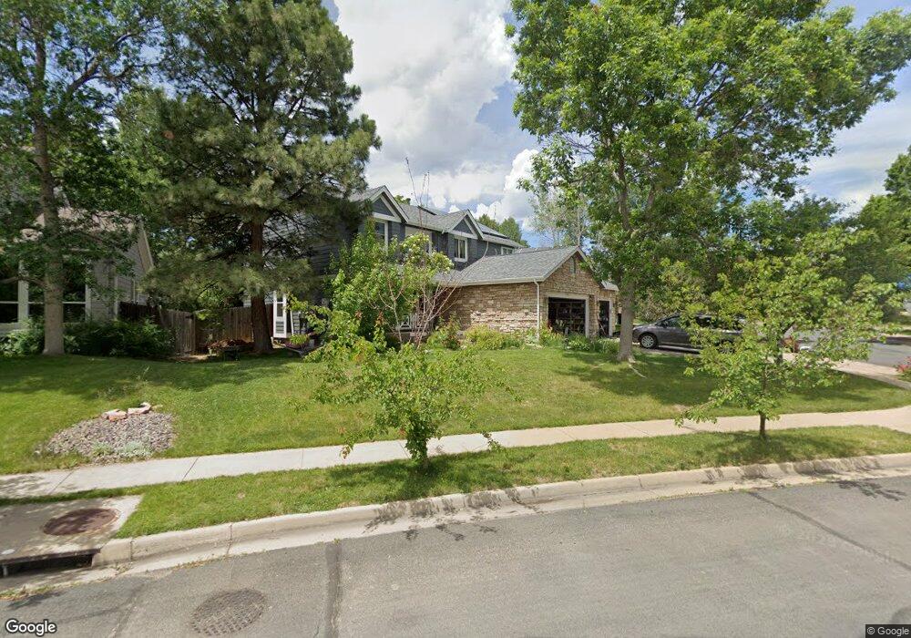
5883 Orchard Creek Ln Boulder, CO 80301
Gunbarrel NeighborhoodEstimated Value: $999,235 - $1,082,000
4
Beds
3
Baths
2,450
Sq Ft
$423/Sq Ft
Est. Value
About This Home
This home is located at 5883 Orchard Creek Ln, Boulder, CO 80301 and is currently estimated at $1,035,309, approximately $422 per square foot. 5883 Orchard Creek Ln is a home located in Boulder County with nearby schools including Crest View Elementary School, Centennial Middle School, and Boulder High School.
Ownership History
Date
Name
Owned For
Owner Type
Purchase Details
Closed on
Aug 29, 2002
Sold by
Barlow Michael Robert Todd and Barlow Michael Lora
Bought by
Feinstein Wendy R
Current Estimated Value
Home Financials for this Owner
Home Financials are based on the most recent Mortgage that was taken out on this home.
Original Mortgage
$292,000
Outstanding Balance
$124,024
Interest Rate
6.47%
Estimated Equity
$911,285
Purchase Details
Closed on
Jun 30, 1995
Sold by
Harris William W
Bought by
Michael Robert Todd
Home Financials for this Owner
Home Financials are based on the most recent Mortgage that was taken out on this home.
Original Mortgage
$203,000
Interest Rate
7.65%
Purchase Details
Closed on
Sep 30, 1994
Sold by
The Ryland Group Inc
Bought by
Harris William W
Purchase Details
Closed on
Nov 25, 1992
Bought by
Feinstein Wendy R
Purchase Details
Closed on
May 4, 1992
Bought by
Feinstein Wendy R
Create a Home Valuation Report for This Property
The Home Valuation Report is an in-depth analysis detailing your home's value as well as a comparison with similar homes in the area
Home Values in the Area
Average Home Value in this Area
Purchase History
| Date | Buyer | Sale Price | Title Company |
|---|---|---|---|
| Feinstein Wendy R | $392,000 | Land Title Guarantee Company | |
| Michael Robert Todd | $257,500 | -- | |
| Harris William W | $252,711 | Land Title | |
| Feinstein Wendy R | -- | -- | |
| Feinstein Wendy R | $36,000 | -- |
Source: Public Records
Mortgage History
| Date | Status | Borrower | Loan Amount |
|---|---|---|---|
| Open | Feinstein Wendy R | $292,000 | |
| Previous Owner | Michael Robert Todd | $203,000 |
Source: Public Records
Tax History Compared to Growth
Tax History
| Year | Tax Paid | Tax Assessment Tax Assessment Total Assessment is a certain percentage of the fair market value that is determined by local assessors to be the total taxable value of land and additions on the property. | Land | Improvement |
|---|---|---|---|---|
| 2025 | $5,417 | $67,426 | $19,388 | $48,038 |
| 2024 | $5,417 | $67,426 | $19,388 | $48,038 |
| 2023 | $5,323 | $68,333 | $21,273 | $50,746 |
| 2022 | $4,391 | $54,238 | $14,477 | $39,761 |
| 2021 | $4,187 | $55,798 | $14,893 | $40,905 |
| 2020 | $3,701 | $49,672 | $10,940 | $38,732 |
| 2019 | $3,645 | $49,672 | $10,940 | $38,732 |
| 2018 | $3,465 | $47,167 | $19,512 | $27,655 |
| 2017 | $3,357 | $52,146 | $21,572 | $30,574 |
| 2016 | $2,929 | $41,790 | $19,661 | $22,129 |
| 2015 | $2,773 | $37,587 | $16,636 | $20,951 |
| 2014 | $2,491 | $37,587 | $16,636 | $20,951 |
Source: Public Records
Map
Nearby Homes
- 5865 N Orchard Creek Cir
- 4650 White Rock Cir Unit 12
- 4658 White Rock Cir Unit 5
- 4767 White Rock Cir Unit D
- 4763 White Rock Cir Unit A
- 4471 Wellington Rd
- 4682 White Rock Cir Unit 5
- 5920 Gunbarrel Ave Unit B
- 4791 White Rock Cir Unit A
- 5922 Gunbarrel Ave Unit F
- 5932 Gunbarrel Ave Unit E
- 5914 Gunbarrel Ave Unit F
- 4839 White Rock Cir Unit D
- 5904 Gunbarrel Ave Unit B
- 4584 Robinson Place
- 5511 Pioneer Rd
- 6201 Willow Ln Unit 6201
- 6239 Willow Ln Unit 6239
- 4458 Driftwood Place
- 6495 Barnacle Ct
- 5883 Orchard Creek Ln
- 5879 Orchard Creek Ln
- 5890 N Orchard Creek Cir
- 4578 Maple Ct
- 4556 Maple Ct
- 5875 Orchard Creek Ln
- 4600 Cloud Ct
- 5884 N Orchard Creek Cir
- 4584 Maple Ct
- 4550 Maple Ct
- 5896 Orchard Creek Ln
- 5800 S Orchard Creek Cir
- 5871 Orchard Creek Ln
- 4610 Cloud Ct
- 5857 Orchard Creek Ln
- 5874 N Orchard Creek Cir
- 4593 Maple Ct
- 5843 Orchard Creek Ln
- 5894 Orchard Creek Ln
- 4619 Cloud Ct