Estimated Value: $225,447 - $381,000
2
Beds
1
Bath
866
Sq Ft
$318/Sq Ft
Est. Value
About This Home
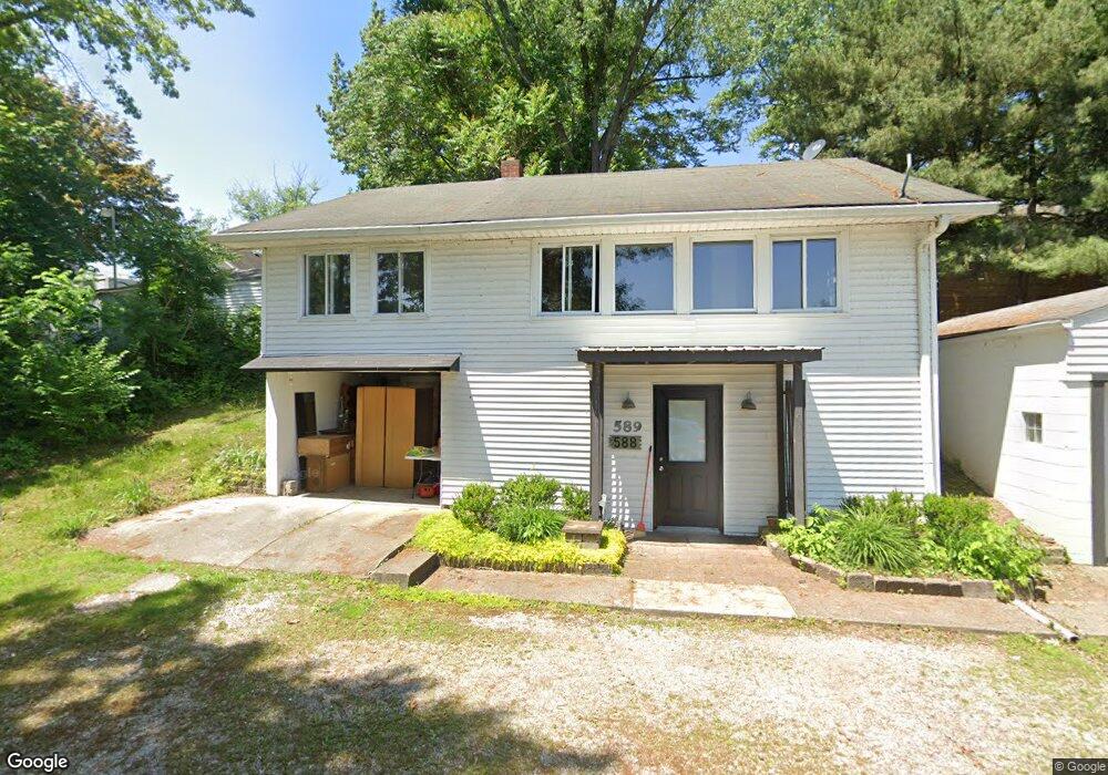
This home is located at 589 Apple Dr, Akron, OH 44319 and is currently estimated at $275,112, approximately $317 per square foot. 589 Apple Dr is a home located in Summit County with nearby schools including Coventry Middle School, Coventry High School, and St. Francis de Sales School.
Ownership History
Date
Name
Owned For
Owner Type
Purchase Details
Closed on
Aug 14, 2023
Sold by
Dodd Anna Louise
Bought by
Dodd Mark W
Current Estimated Value
Purchase Details
Closed on
Oct 16, 2020
Sold by
Lynne Tabet Janet
Bought by
Dodd Anna Louise
Purchase Details
Closed on
Oct 15, 2020
Sold by
Tabet Janet Lynne
Bought by
Dodd Anna Louise
Purchase Details
Closed on
Aug 1, 2006
Sold by
Dodd Darrel and Dodd Anna Louise
Bought by
Dodd Darrel and Dodd Anna Louise
Create a Home Valuation Report for This Property
The Home Valuation Report is an in-depth analysis detailing your home's value as well as a comparison with similar homes in the area
Home Values in the Area
Average Home Value in this Area
Purchase History
| Date | Buyer | Sale Price | Title Company |
|---|---|---|---|
| Dodd Mark W | -- | None Listed On Document | |
| Dodd Anna Louise | $9,000 | American Land Title | |
| Dodd Anna Louise | $9,000 | American Land Title | |
| Dodd Darrel | -- | None Available |
Source: Public Records
Tax History
| Year | Tax Paid | Tax Assessment Tax Assessment Total Assessment is a certain percentage of the fair market value that is determined by local assessors to be the total taxable value of land and additions on the property. | Land | Improvement |
|---|---|---|---|---|
| 2025 | $3,591 | $68,562 | $22,754 | $45,808 |
| 2024 | $3,420 | $68,562 | $22,754 | $45,808 |
| 2023 | $3,591 | $68,562 | $22,754 | $45,808 |
| 2022 | $2,450 | $43,394 | $14,221 | $29,173 |
| 2021 | $2,186 | $42,011 | $12,838 | $29,173 |
| 2020 | $2,181 | $42,960 | $13,790 | $29,170 |
| 2019 | $1,508 | $30,370 | $7,500 | $22,870 |
| 2018 | $1,499 | $30,370 | $7,500 | $22,870 |
| 2017 | $1,351 | $30,370 | $7,500 | $22,870 |
| 2016 | $1,348 | $27,980 | $7,500 | $20,480 |
| 2015 | $1,351 | $27,980 | $7,500 | $20,480 |
| 2014 | $1,314 | $27,980 | $7,500 | $20,480 |
| 2013 | $1,192 | $26,370 | $7,500 | $18,870 |
Source: Public Records
Map
Nearby Homes
- 584 Apple Dr
- 796 Portage Lakes Dr
- 3301 Cormany Rd
- 449 W Long Lake Blvd
- 3462 Dollar Dr
- 428 Canova Dr
- 3613 Manchester Rd
- 900 State Mill Rd
- 231 Portage Lakes Dr
- 206 Olivet Ave
- 3809 Powell Ave
- 196 Olivet Ave
- 3826 Powell Ave
- 855 Fowler Ave
- 202 W Warner Rd
- 0 W Warner Rd
- 72 Weil Ave
- 51 Portage Lakes Dr
- 0 Joyce Ave NW Unit 35 5043152
- 0 Joyce Ave NW Unit 34 5043158
- 588 Apple Dr
- 592 Pear Dr
- 871 Portage Lakes Dr
- 587 Apple Dr
- 594 Pear Dr
- 879 Portage Lakes Dr
- 586 Apple Dr
- 596 Pear Dr
- 856 Portage Lakes Dr
- 593 Pear Dr
- 590 Pear Dr
- 859 Portage Lakes Dr
- 855 Portage Lakes Dr Unit 859
- 595 Pear Dr
- 598 Fruit Dr
- 599 Pear Dr
- 608 Fig Dr
- 606 Fig Dr
- 600 Pear Dr
- 878 Portage Lakes Dr
Your Personal Tour Guide
Ask me questions while you tour the home.