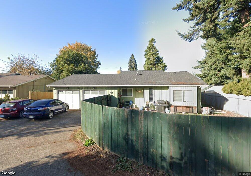
589 Harlow Rd Unit I Springfield, OR 97477
Gateway NeighborhoodEstimated Value: $330,000 - $363,000
2
Beds
1
Bath
882
Sq Ft
$391/Sq Ft
Est. Value
About This Home
This home is located at 589 Harlow Rd Unit I, Springfield, OR 97477 and is currently estimated at $345,027, approximately $391 per square foot. 589 Harlow Rd Unit I is a home located in Lane County with nearby schools including Guy Lee Elementary School, Hamlin Middle School, and Springfield High School.
Ownership History
Date
Name
Owned For
Owner Type
Purchase Details
Closed on
Apr 22, 2004
Sold by
Household Mortgage Funding Corp Iii
Bought by
Hensley Deanna
Current Estimated Value
Home Financials for this Owner
Home Financials are based on the most recent Mortgage that was taken out on this home.
Original Mortgage
$109,000
Outstanding Balance
$50,290
Interest Rate
5.38%
Mortgage Type
FHA
Estimated Equity
$294,737
Purchase Details
Closed on
Jan 9, 2004
Sold by
Alkire Liesel
Bought by
Household Mortgage Funding Corp Iii
Purchase Details
Closed on
Feb 6, 1998
Sold by
Cosci Janet S and Cosci Janet S
Bought by
Alkire Liesel
Home Financials for this Owner
Home Financials are based on the most recent Mortgage that was taken out on this home.
Original Mortgage
$80,000
Interest Rate
10.49%
Create a Home Valuation Report for This Property
The Home Valuation Report is an in-depth analysis detailing your home's value as well as a comparison with similar homes in the area
Home Values in the Area
Average Home Value in this Area
Purchase History
| Date | Buyer | Sale Price | Title Company |
|---|---|---|---|
| Hensley Deanna | $116,000 | Fidelity National Title Insu | |
| Household Mortgage Funding Corp Iii | $106,743 | Evergreen Land Title Co | |
| Alkire Liesel | $85,500 | Evergreen Land Title Co |
Source: Public Records
Mortgage History
| Date | Status | Borrower | Loan Amount |
|---|---|---|---|
| Open | Hensley Deanna | $109,000 | |
| Previous Owner | Alkire Liesel | $80,000 | |
| Closed | Alkire Liesel | $5,500 |
Source: Public Records
Tax History Compared to Growth
Tax History
| Year | Tax Paid | Tax Assessment Tax Assessment Total Assessment is a certain percentage of the fair market value that is determined by local assessors to be the total taxable value of land and additions on the property. | Land | Improvement |
|---|---|---|---|---|
| 2024 | $2,931 | $157,734 | -- | -- |
| 2023 | $2,931 | $153,140 | $0 | $0 |
| 2022 | $2,715 | $148,680 | $0 | $0 |
| 2021 | $2,666 | $144,350 | $0 | $0 |
| 2020 | $2,588 | $140,146 | $0 | $0 |
| 2019 | $2,510 | $136,065 | $0 | $0 |
| 2018 | $2,366 | $128,254 | $0 | $0 |
| 2017 | $2,275 | $128,254 | $0 | $0 |
| 2016 | $2,227 | $124,518 | $0 | $0 |
| 2015 | $2,164 | $120,891 | $0 | $0 |
| 2014 | $2,131 | $117,370 | $0 | $0 |
Source: Public Records
Map
Nearby Homes
- 2386 Clear Vue Ln
- 650 Harlow Rd Unit 209
- 650 Harlow Rd Unit 233
- 650 Harlow Rd Unit 240
- 2567 Game Farm Rd
- 2150 Laura (#57) St Unit 57
- 2150 Laura St Unit 119
- 2150 Laura St Unit 39
- 2150 Laura St Unit 57
- 2150 Laura St Unit 44
- 2165 Laura St
- 328 Scotts Glen Dr
- 2727 Gateway St Unit 24
- 40 Allen Ave
- 114 Hayden Bridge Way
- 1267 Kenray Loop
- 1266 Kenray Loop
- 143 V St
- 3170 Pheasant Blvd
- 663 Swan Ct
- 589 Harlow Rd
- 589 Harlow Rd Unit J
- 589 Harlow Rd Unit H
- 589 Harlow Rd Unit G
- 589 Harlow Rd Unit F
- 589 Harlow Rd Unit E
- 589 Harlow Rd Unit D
- 589 Harlow Rd Unit C
- 589 Harlow Rd Unit B
- 589 Harlow Rd Unit A
- 589 Angel Unit i
- 2455 Clear Vue Ln
- 2451 Clear Vue Ln
- 2463 Clear Vue Ln
- 2429 Clear Vue Ln
- 2475 Clear Vue Ln
- 2448 Clear Vue Ln
- 2489 Clear Vue Ln
- 589 Harlow Rd D
- 609 Harlow Rd