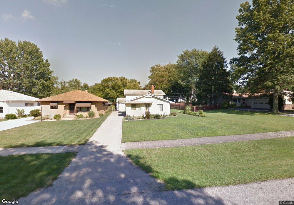
5891 W 224th St Cleveland, OH 44126
Estimated Value: $246,984 - $290,000
2
Beds
1
Bath
1,456
Sq Ft
$182/Sq Ft
Est. Value
About This Home
This home is located at 5891 W 224th St, Cleveland, OH 44126 and is currently estimated at $265,496, approximately $182 per square foot. 5891 W 224th St is a home located in Cuyahoga County with nearby schools including Gilles-Sweet Elementary School, Lewis F Mayer Middle School, and Fairview High School.
Ownership History
Date
Name
Owned For
Owner Type
Purchase Details
Closed on
Sep 27, 2006
Sold by
Kinzel Robert D
Bought by
Gallagher Karen M
Current Estimated Value
Home Financials for this Owner
Home Financials are based on the most recent Mortgage that was taken out on this home.
Original Mortgage
$26,600
Outstanding Balance
$15,899
Interest Rate
6.49%
Mortgage Type
Stand Alone Second
Estimated Equity
$249,597
Purchase Details
Closed on
Dec 14, 1992
Sold by
Kinlel Robert and Kinlel Doris
Bought by
Kinzel Doris
Purchase Details
Closed on
Jan 1, 1992
Bought by
Kinlel Robert and Kinlel Doris
Create a Home Valuation Report for This Property
The Home Valuation Report is an in-depth analysis detailing your home's value as well as a comparison with similar homes in the area
Home Values in the Area
Average Home Value in this Area
Purchase History
| Date | Buyer | Sale Price | Title Company |
|---|---|---|---|
| Gallagher Karen M | $133,000 | Statewide | |
| Kinzel Doris | -- | -- | |
| Kinlel Robert | -- | -- |
Source: Public Records
Mortgage History
| Date | Status | Borrower | Loan Amount |
|---|---|---|---|
| Open | Gallagher Karen M | $26,600 | |
| Open | Gallagher Karen M | $106,400 |
Source: Public Records
Tax History Compared to Growth
Tax History
| Year | Tax Paid | Tax Assessment Tax Assessment Total Assessment is a certain percentage of the fair market value that is determined by local assessors to be the total taxable value of land and additions on the property. | Land | Improvement |
|---|---|---|---|---|
| 2024 | $4,726 | $68,145 | $16,170 | $51,975 |
| 2023 | $4,936 | $61,190 | $11,450 | $49,740 |
| 2022 | $4,814 | $61,180 | $11,450 | $49,740 |
| 2021 | $4,913 | $61,180 | $11,450 | $49,740 |
| 2020 | $4,520 | $49,350 | $9,240 | $40,110 |
| 2019 | $4,020 | $141,000 | $26,400 | $114,600 |
| 2018 | $3,989 | $49,350 | $9,240 | $40,110 |
| 2017 | $4,143 | $47,080 | $11,900 | $35,180 |
| 2016 | $4,116 | $47,080 | $11,900 | $35,180 |
| 2015 | $3,885 | $47,080 | $11,900 | $35,180 |
| 2014 | $3,885 | $44,840 | $11,340 | $33,500 |
Source: Public Records
Map
Nearby Homes
- 22250 Mastick Rd
- 22537 Lenox Dr
- 22640 Lenox Dr
- 22276 Sycamore Dr
- 22636 Mastick Rd
- 22439 Haber Dr
- 22934 Mastick Rd Unit 102
- 5951 Rockport Ln
- 22534 Bard Ave
- 22895 Mastick Rd
- 4530 Clague Rd
- 5300 Sherwood Dr
- 23052 Mastick Rd
- 22503 Sandy Ln
- 4590 Brendan Ln
- 4666 Brendan Cir
- 21877 Seabury Ave
- 4550 Georgette Ave
- 4505 Oak Cir
- 4570 W 228th St
- 5869 W 224th St
- 5915 W 224th St
- 5849 W 224th St
- 5845 W 224th St
- 5935 W 224th St
- 5825 W 224th St
- 5955 W 224th St
- 5870 W 224th St
- 5890 W 224th St
- 5860 W 224th St
- 5940 W 224th St
- 5840 W 224th St
- 5910 W 224th St
- 5838 W 224th St
- 22380 Mastick Rd
- 5960 W 224th St
- 22280 Mastick Rd
- 22390 Mastick Rd
- 22220 Mastick Rd
- 22450 Mastick Rd