Estimated Value: $828,992 - $910,000
4
Beds
4
Baths
1,750
Sq Ft
$502/Sq Ft
Est. Value
About This Home
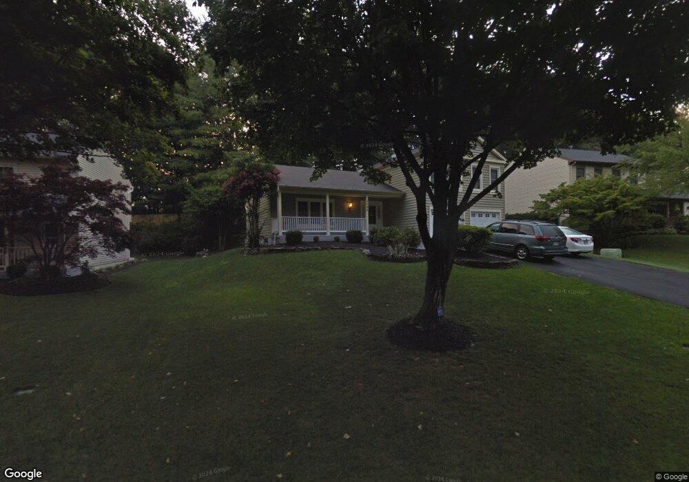
This home is located at 5898 Burnside Landing Dr, Burke, VA 22015 and is currently estimated at $878,248, approximately $501 per square foot. 5898 Burnside Landing Dr is a home located in Fairfax County with nearby schools including Fairview Elementary School, James W Robinson, Jr. Secondary School, and Fairfax Baptist Temple Academy.
Ownership History
Date
Name
Owned For
Owner Type
Purchase Details
Closed on
Oct 31, 2001
Sold by
Carol J Holland Tr
Bought by
Tong Tat L
Current Estimated Value
Home Financials for this Owner
Home Financials are based on the most recent Mortgage that was taken out on this home.
Original Mortgage
$218,800
Outstanding Balance
$85,833
Interest Rate
6.77%
Estimated Equity
$792,415
Create a Home Valuation Report for This Property
The Home Valuation Report is an in-depth analysis detailing your home's value as well as a comparison with similar homes in the area
Home Values in the Area
Average Home Value in this Area
Purchase History
| Date | Buyer | Sale Price | Title Company |
|---|---|---|---|
| Tong Tat L | $388,800 | -- |
Source: Public Records
Mortgage History
| Date | Status | Borrower | Loan Amount |
|---|---|---|---|
| Open | Tong Tat L | $218,800 |
Source: Public Records
Tax History Compared to Growth
Tax History
| Year | Tax Paid | Tax Assessment Tax Assessment Total Assessment is a certain percentage of the fair market value that is determined by local assessors to be the total taxable value of land and additions on the property. | Land | Improvement |
|---|---|---|---|---|
| 2025 | $8,719 | $794,240 | $319,000 | $475,240 |
| 2024 | $8,719 | $752,650 | $309,000 | $443,650 |
| 2023 | $8,553 | $757,920 | $309,000 | $448,920 |
| 2022 | $8,351 | $730,310 | $309,000 | $421,310 |
| 2021 | $7,733 | $658,940 | $254,000 | $404,940 |
| 2020 | $7,280 | $615,090 | $249,000 | $366,090 |
| 2019 | $6,953 | $587,530 | $244,000 | $343,530 |
| 2018 | $6,679 | $580,790 | $244,000 | $336,790 |
| 2017 | $6,414 | $552,460 | $219,000 | $333,460 |
| 2016 | $6,673 | $576,010 | $219,000 | $357,010 |
| 2015 | $6,428 | $576,010 | $219,000 | $357,010 |
| 2014 | $6,169 | $554,010 | $214,000 | $340,010 |
Source: Public Records
Map
Nearby Homes
- 5918 Cove Landing Rd Unit 204
- 5950 Powells Landing Rd
- 5806 Cove Landing Rd Unit 304
- 5819 Cove Landing Rd Unit 303
- 6154 Martins Landing Ct
- 5602 Summer Oak Way
- 5674 Oak Tanager Ct
- 10330 Luria Commons Ct Unit 1B
- 5703 Oak Stake Ct
- 5976 Annaberg Place Unit 168
- 10449 Calumet Grove Dr
- 10848 Burr Oak Way
- 5900 Carters Oak Ct
- 10434 Calumet Grove Dr
- 10205 Quiet Pond Terrace
- 5503 Fireside Ct
- 10412 Pearl St
- 10278 Colony Park Dr
- 5515 Cheshire Meadows Way
- 5453 Cheshire Meadows Way
- 5896 Burnside Landing Dr
- 5902 Burnside Landing Dr
- 5894 Burnside Landing Dr
- 5918 Burnside Landing Dr
- 5920 Burnside Landing Dr
- 5916 Burnside Landing Dr
- 5922 Burnside Landing Dr
- 5904 Burnside Landing Dr
- 5892 Burnside Landing Dr
- 5924 Burnside Landing Dr
- 5914 Burnside Landing Dr
- 5963 Ohara Landing Ct
- 5961 Ohara Landing Ct
- 5906 Burnside Landing Dr
- 5926 Burnside Landing Dr
- 5912 Burnside Landing Dr
- 5959 Ohara Landing Ct
- 5970 Ohara Landing Ct
- 5928 Burnside Landing Dr
- 6499 O'Hara Landing Ct