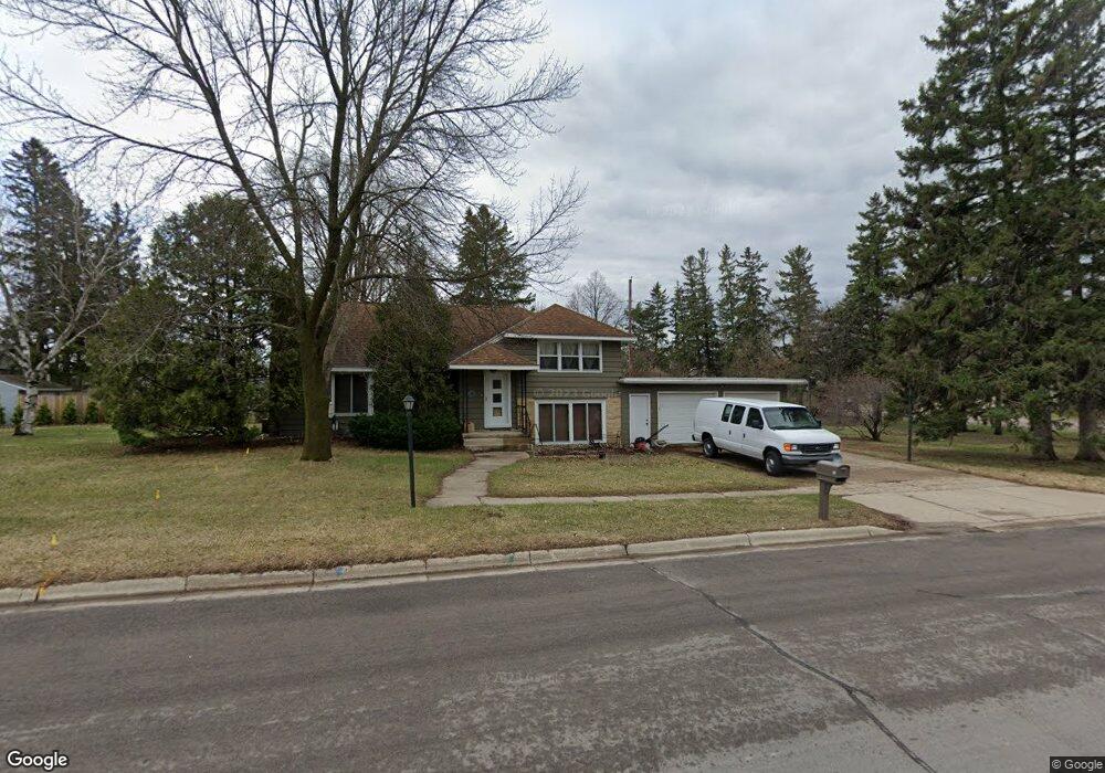
59 1st Ave N Lester Prairie, MN 55354
Estimated Value: $281,000 - $383,000
3
Beds
2
Baths
2,659
Sq Ft
$120/Sq Ft
Est. Value
About This Home
This home is located at 59 1st Ave N, Lester Prairie, MN 55354 and is currently estimated at $317,765, approximately $119 per square foot. 59 1st Ave N is a home located in McLeod County with nearby schools including Lester Prairie Elementary School.
Ownership History
Date
Name
Owned For
Owner Type
Purchase Details
Closed on
Apr 16, 2021
Sold by
Govrik Laszlo and Govrik Mary C
Bought by
Lee Jesse Christopher
Current Estimated Value
Home Financials for this Owner
Home Financials are based on the most recent Mortgage that was taken out on this home.
Original Mortgage
$218,500
Outstanding Balance
$197,437
Interest Rate
3.05%
Mortgage Type
New Conventional
Estimated Equity
$120,328
Create a Home Valuation Report for This Property
The Home Valuation Report is an in-depth analysis detailing your home's value as well as a comparison with similar homes in the area
Home Values in the Area
Average Home Value in this Area
Purchase History
| Date | Buyer | Sale Price | Title Company |
|---|---|---|---|
| Lee Jesse Christopher | $230,000 | Watermark Title | |
| Lee Jesse Jesse | $230,000 | -- |
Source: Public Records
Mortgage History
| Date | Status | Borrower | Loan Amount |
|---|---|---|---|
| Open | Lee Jesse Christopher | $218,500 | |
| Closed | Lee Jesse Jesse | $218,000 |
Source: Public Records
Tax History Compared to Growth
Tax History
| Year | Tax Paid | Tax Assessment Tax Assessment Total Assessment is a certain percentage of the fair market value that is determined by local assessors to be the total taxable value of land and additions on the property. | Land | Improvement |
|---|---|---|---|---|
| 2024 | $3,776 | $254,600 | $65,100 | $189,500 |
| 2023 | $3,968 | $254,600 | $65,100 | $189,500 |
| 2022 | $3,664 | $232,000 | $59,000 | $173,000 |
| 2021 | $3,390 | $200,800 | $53,700 | $147,100 |
| 2020 | $3,218 | $180,800 | $48,800 | $132,000 |
| 2019 | $2,320 | $168,800 | $44,400 | $124,400 |
| 2018 | $2,068 | $0 | $0 | $0 |
| 2017 | $1,996 | $0 | $0 | $0 |
| 2016 | $1,748 | $0 | $0 | $0 |
| 2015 | $1,530 | $0 | $0 | $0 |
| 2014 | -- | $0 | $0 | $0 |
Source: Public Records
Map
Nearby Homes
- 222 Fir St S
- 223 Maple St N
- 600 2nd Ave N
- 216 Juniper St S
- 230 Hi Mae Cir
- 107 Redwood St N
- 3225 180th St
- 19383 Babcock Ave
- 1014 Bluestem Ln
- 18625 62nd St
- 830 Beach Ball Ln
- 823 Beach Ball Ln
- 821 Beach Ball Ln
- 824 Beach Ball Ln
- 819 Beach Ball Ln
- 826 Beach Ball Ln
- 16925 Highway 7
- 17242 Garden Ave
- 815 Mallard Ave
- 151 8th St S
- 59 59 1st-Avenue-n
- 62 Lincoln Ave N
- 62 Lincoln Ave S
- 62 Lincoln Ave S
- 66 Lincoln Ave N
- 65 1st Ave N
- 62 1st Ave N
- 18765 Babcock Ave
- 72 Lincoln Ave N
- 66 1st Ave N
- 66 1st Ave N
- 71 1st Ave N
- 72 1st Ave N
- 18755 Babcock Ave
- 77 1st Ave N
- 86 Lincoln Ave N
- 78 1st Ave N
- 67 Madison Ave
- 73 Madison Ave
- 101 Birch St N
