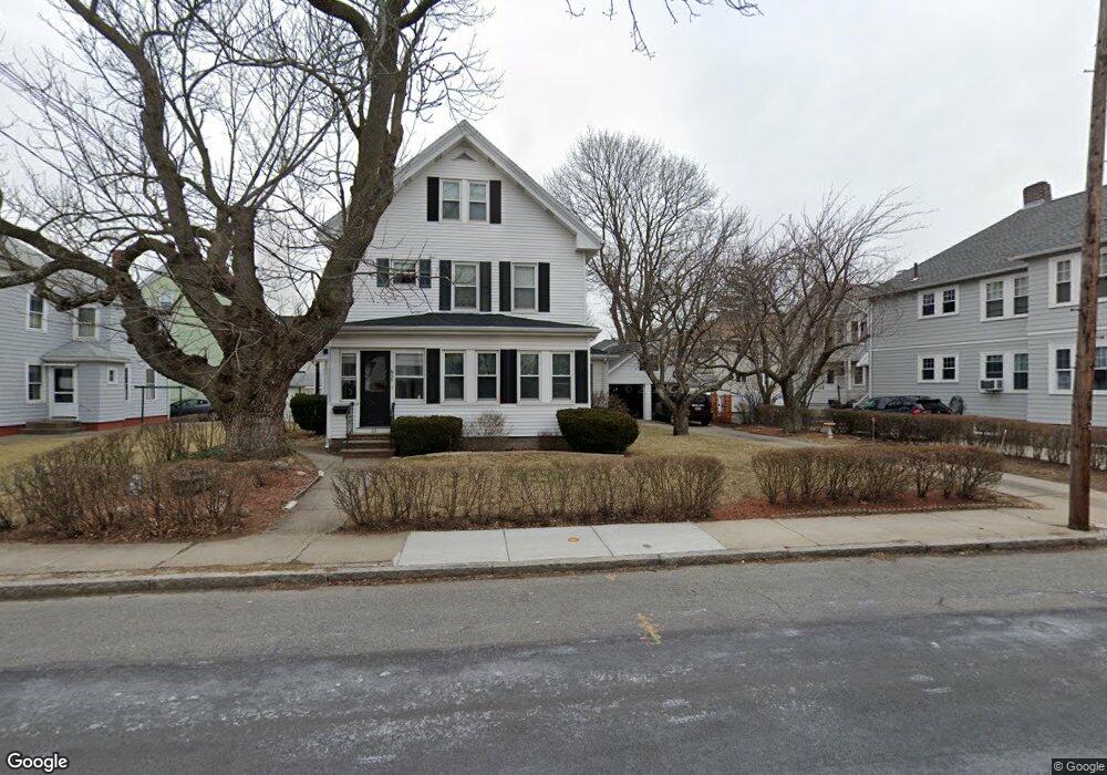
59-61 Warren St Arlington, MA 02474
East Arlington NeighborhoodEstimated Value: $1,237,000 - $1,386,854
6
Beds
2
Baths
2,480
Sq Ft
$520/Sq Ft
Est. Value
About This Home
This home is located at 59-61 Warren St, Arlington, MA 02474 and is currently estimated at $1,288,464, approximately $519 per square foot. 59-61 Warren St is a home located in Middlesex County with nearby schools including Thompson School, Ottoson Middle School, and Arlington High School.
Ownership History
Date
Name
Owned For
Owner Type
Purchase Details
Closed on
Jul 1, 1998
Sold by
15 Many Oaks Cir Rt and Coburn
Bought by
Rusk Patrick D and Rusk Becky L
Current Estimated Value
Create a Home Valuation Report for This Property
The Home Valuation Report is an in-depth analysis detailing your home's value as well as a comparison with similar homes in the area
Home Values in the Area
Average Home Value in this Area
Purchase History
| Date | Buyer | Sale Price | Title Company |
|---|---|---|---|
| Rusk Patrick D | $290,000 | -- |
Source: Public Records
Mortgage History
| Date | Status | Borrower | Loan Amount |
|---|---|---|---|
| Open | Rusk Patrick D | $235,000 | |
| Closed | Rusk Patrick D | $20,000 | |
| Closed | Rusk Patrick D | $30,000 | |
| Closed | Rusk Patrick D | $25,000 |
Source: Public Records
Tax History Compared to Growth
Tax History
| Year | Tax Paid | Tax Assessment Tax Assessment Total Assessment is a certain percentage of the fair market value that is determined by local assessors to be the total taxable value of land and additions on the property. | Land | Improvement |
|---|---|---|---|---|
| 2025 | $12,925 | $1,200,100 | $634,800 | $565,300 |
| 2024 | $11,957 | $1,129,100 | $604,200 | $524,900 |
| 2023 | $11,742 | $1,047,500 | $506,600 | $540,900 |
| 2022 | $11,614 | $1,017,000 | $488,300 | $528,700 |
| 2021 | $11,257 | $992,700 | $488,300 | $504,400 |
| 2020 | $10,979 | $992,700 | $488,300 | $504,400 |
| 2019 | $10,283 | $913,200 | $518,800 | $394,400 |
| 2018 | $9,374 | $772,800 | $378,400 | $394,400 |
| 2017 | $8,795 | $700,200 | $329,600 | $370,600 |
| 2016 | $8,338 | $651,400 | $280,800 | $370,600 |
| 2015 | $7,936 | $585,700 | $274,700 | $311,000 |
Source: Public Records
Map
Nearby Homes
- 42-44 Warren St Unit 42
- 41 Palmer St Unit 43
- 29 Dartmouth St Unit 29
- 94 Rawson Rd Unit 94
- 25-27 Adams St
- 132 Rawson Rd Unit 132
- 23 Yale Rd
- 18 Belknap St Unit 2
- 18 Belknap St Unit 1
- 167 Franklin St Unit 167
- 69 Arlington St
- 34 Hamilton Rd Unit 302
- 230 Massachusetts Ave Unit 6
- 6 Gordon Rd
- 215 Massachusetts Ave Unit 19 (34)
- 22 Hamilton Rd Unit 206
- 166 Arlington St
- 12 Arizona Terrace Unit 2
- 31 Sharon St
- 111 Sharon St Unit 1
- 59 Warren St Unit 61
- 57 Warren St
- 57 Warren St Unit 1
- 57 Warren St Unit 2
- 63 Warren St
- 53 Warren St
- 53 Warren St Unit 2
- 51 Warren St Unit 51
- 28 Rawson Rd Unit 30
- 28 Rawson Rd
- 28 Rawson Rd Unit 28
- 28 Rawson Rd Unit 1
- 32 Rawson Rd Unit 34
- 32-34 Rawson Rd Unit 1
- 58 Warren St
- 54 Warren St Unit 56
- 60 Warren St
- 69 Warren St Unit 71
- 69 Warren St Unit 1
- 52 Warren St