Estimated Value: $586,000 - $707,000
3
Beds
3
Baths
1,700
Sq Ft
$366/Sq Ft
Est. Value
About This Home
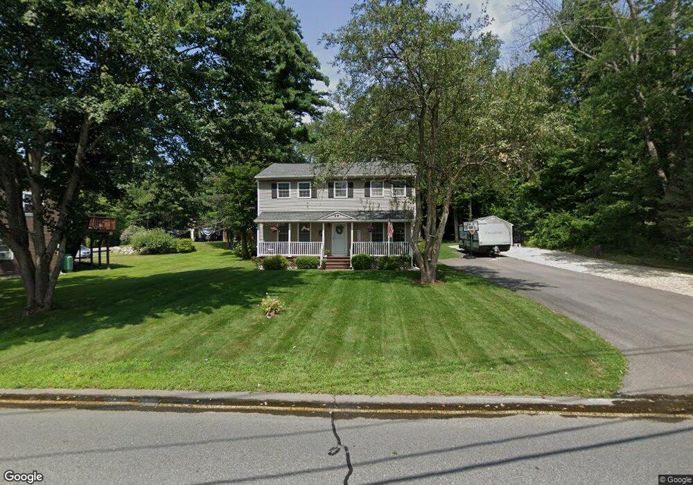
This home is located at 59 Bridge St, Salem, NH 03079 and is currently estimated at $621,429, approximately $365 per square foot. 59 Bridge St is a home located in Rockingham County with nearby schools including William T. Barron Elementary School, Woodbury School, and Salem High School.
Ownership History
Date
Name
Owned For
Owner Type
Purchase Details
Closed on
May 15, 2009
Sold by
Ohare Jeffrey K and Ohare Cheryl
Bought by
Gallagher Michael and Censullo Lisa
Current Estimated Value
Home Financials for this Owner
Home Financials are based on the most recent Mortgage that was taken out on this home.
Original Mortgage
$234,000
Interest Rate
4.85%
Mortgage Type
Purchase Money Mortgage
Purchase Details
Closed on
Oct 26, 2007
Sold by
Starta Paul Est
Bought by
Ohare Jeffrey K and Ohare Cheryl
Home Financials for this Owner
Home Financials are based on the most recent Mortgage that was taken out on this home.
Original Mortgage
$121,500
Interest Rate
6.39%
Mortgage Type
Purchase Money Mortgage
Create a Home Valuation Report for This Property
The Home Valuation Report is an in-depth analysis detailing your home's value as well as a comparison with similar homes in the area
Purchase History
| Date | Buyer | Sale Price | Title Company |
|---|---|---|---|
| Gallagher Michael | $300,000 | -- | |
| Ohare Jeffrey K | $135,000 | -- |
Source: Public Records
Mortgage History
| Date | Status | Borrower | Loan Amount |
|---|---|---|---|
| Open | Ohare Jeffrey K | $218,000 | |
| Closed | Ohare Jeffrey K | $234,000 | |
| Previous Owner | Ohare Jeffrey K | $205,500 | |
| Previous Owner | Ohare Jeffrey K | $121,500 |
Source: Public Records
Tax History
| Year | Tax Paid | Tax Assessment Tax Assessment Total Assessment is a certain percentage of the fair market value that is determined by local assessors to be the total taxable value of land and additions on the property. | Land | Improvement |
|---|---|---|---|---|
| 2024 | $7,513 | $426,900 | $162,600 | $264,300 |
| 2023 | $7,240 | $426,900 | $162,600 | $264,300 |
| 2022 | $6,852 | $426,900 | $162,600 | $264,300 |
| 2021 | $6,822 | $426,900 | $162,600 | $264,300 |
| 2020 | $6,602 | $299,800 | $116,200 | $183,600 |
| 2019 | $6,590 | $299,800 | $116,200 | $183,600 |
| 2018 | $6,479 | $299,800 | $116,200 | $183,600 |
| 2017 | $6,248 | $299,800 | $116,200 | $183,600 |
| 2016 | $6,125 | $299,800 | $116,200 | $183,600 |
| 2015 | $5,827 | $272,400 | $115,400 | $157,000 |
| 2014 | $5,663 | $272,400 | $115,400 | $157,000 |
| 2013 | $5,573 | $272,400 | $115,400 | $157,000 |
Source: Public Records
Map
Nearby Homes
- 40 Stanwood Rd Unit 9
- 139 North St
- 384 Main St Unit 203
- 384 Main St Unit 102
- 17 Canterbury Ct
- 9 Clydesdale Rd
- 5 Highland Ave
- 5 Sally Sweets Way Unit 110
- 5 Sally Sweets Way Unit 128
- 20 Williams St
- 74 Ayers Village Rd
- 1513 Broadway
- 11 Brookside Ct
- 117 Lawrence Rd
- 9 Falcon Ln
- 8 Alta Ave
- 15 Briar Ave
- 10 Braemoor Woods Rd Unit 401
- 10 Braemoor Woods Rd Unit 300
- 47 Bailey Ct
Your Personal Tour Guide
Ask me questions while you tour the home.