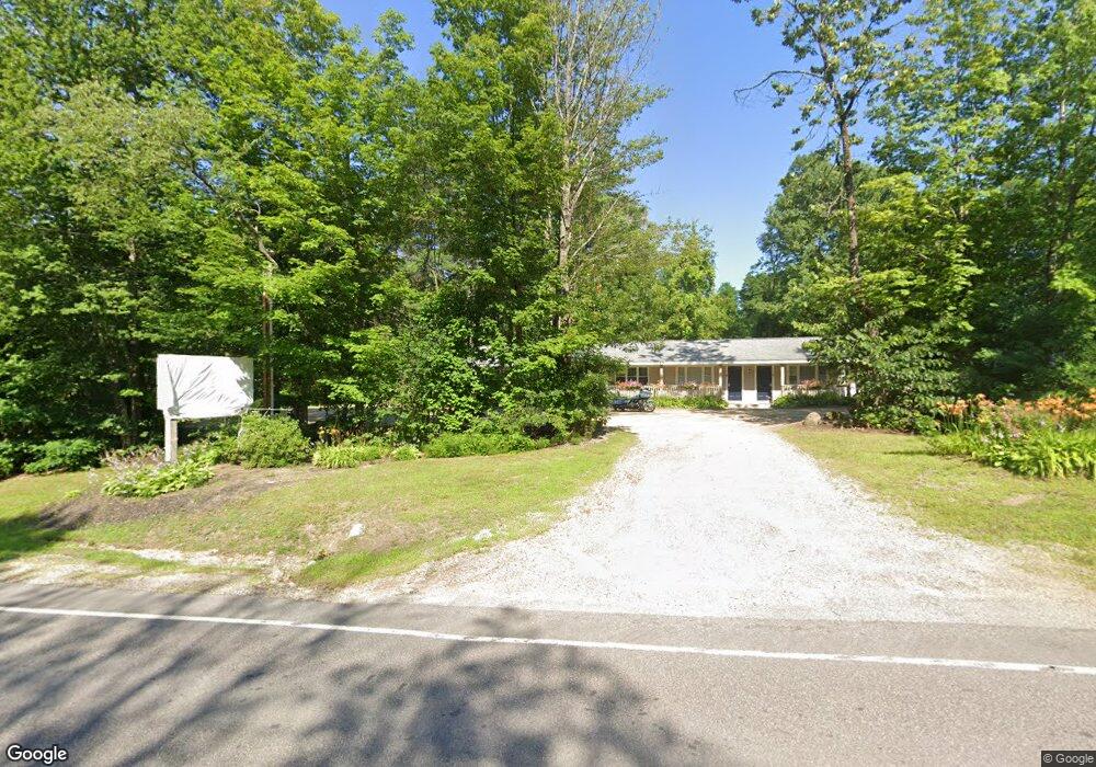
59 Daniel Webster Hwy Meredith, NH 03253
Estimated Value: $506,351
Studio
--
Bath
1,736
Sq Ft
$292/Sq Ft
Est. Value
About This Home
This home is located at 59 Daniel Webster Hwy, Meredith, NH 03253 and is currently estimated at $506,351, approximately $291 per square foot. 59 Daniel Webster Hwy is a home located in Belknap County with nearby schools including Inter-Lakes Elementary School, Sandwich Central School, and Inter-Lakes Middle High School.
Ownership History
Date
Name
Owned For
Owner Type
Purchase Details
Closed on
Feb 16, 2021
Sold by
Schuster Leslie R and Schuster Linda A
Bought by
Winnipesaukee Clearning
Current Estimated Value
Home Financials for this Owner
Home Financials are based on the most recent Mortgage that was taken out on this home.
Original Mortgage
$270,000
Outstanding Balance
$239,948
Interest Rate
2.6%
Mortgage Type
Commercial
Estimated Equity
$266,403
Purchase Details
Closed on
Nov 22, 2002
Sold by
Pearson Craig W
Bought by
Schuster Leslie R and Schuster Linda A
Home Financials for this Owner
Home Financials are based on the most recent Mortgage that was taken out on this home.
Original Mortgage
$85,500
Interest Rate
6.07%
Mortgage Type
Commercial
Create a Home Valuation Report for This Property
The Home Valuation Report is an in-depth analysis detailing your home's value as well as a comparison with similar homes in the area
Home Values in the Area
Average Home Value in this Area
Purchase History
| Date | Buyer | Sale Price | Title Company |
|---|---|---|---|
| Winnipesaukee Clearning | $337,533 | None Available | |
| Winnipesaukee Clearning | $337,533 | None Available | |
| Schuster Leslie R | $109,000 | -- |
Source: Public Records
Mortgage History
| Date | Status | Borrower | Loan Amount |
|---|---|---|---|
| Open | Winnipesaukee Clearning | $270,000 | |
| Closed | Winnipesaukee Clearning | $270,000 | |
| Previous Owner | Schuster Leslie R | $85,500 |
Source: Public Records
Tax History
| Year | Tax Paid | Tax Assessment Tax Assessment Total Assessment is a certain percentage of the fair market value that is determined by local assessors to be the total taxable value of land and additions on the property. | Land | Improvement |
|---|---|---|---|---|
| 2024 | $3,947 | $384,700 | $215,300 | $169,400 |
| 2023 | $3,805 | $384,700 | $215,300 | $169,400 |
| 2022 | $4,062 | $290,800 | $141,400 | $149,400 |
| 2021 | $3,905 | $290,800 | $141,400 | $149,400 |
| 2020 | $4,077 | $290,800 | $141,400 | $149,400 |
| 2019 | $4,419 | $278,100 | $138,800 | $139,300 |
| 2018 | $4,344 | $278,100 | $138,800 | $139,300 |
| 2016 | $3,802 | $243,900 | $143,700 | $100,200 |
| 2015 | $3,707 | $243,900 | $143,700 | $100,200 |
| 2014 | $3,617 | $243,900 | $143,700 | $100,200 |
| 2013 | $3,513 | $243,800 | $143,700 | $100,100 |
Source: Public Records
Map
Nearby Homes
- 9 Westbury Rd
- UNIT 41 Stonewall Corners Way Unit 41
- 12 Needle Eye Rd
- Lot 12-5 Needle Eye Rd
- 17 Granite Ridge
- 64 Granite Ridge
- 74 Granite Ridge
- 78 Granite Ridge
- 75 Neal Shore Rd
- 00 Tracy Way Unit 63
- 29 S Watch Rd
- UNIT 48 Stonewall Corners Way Unit 48
- 45 Stern Castle Place Unit 32
- 44 Stonewall Corners Way Unit 44
- 38 Stern Castle Place Unit 30
- 37
- 42 Stonewall Corners Way Unit 42
- UNIT 46 Stonewall Corners Way Unit 46
- 18 Bay Ridge Dr
- 34 Deadreckoning Point
- 55 Daniel Webster Hwy Unit C
- 55 Daniel Webster Hwy Unit 2-2
- 50 Daniel Webster Hwy
- 18 Latchkey Ln
- S-19/Lot 12 Daniel Webster Hwy
- 00 Daniel Webster Hwy
- Lot - 2 Daniel Webster Hwy
- 45 Daniel Webster Hwy
- 1 Neal Shore Rd
- 12 Latchkey Ln
- 6 Latchkey Ln
- 17 Latchkey Ln
- 6 Neal Shore Rd
- 8 Neal Shore Rd
- 15 Latchkey Ln
- 3 Westbury Rd
- 12 Neal Shore Rd
- 45 Brook Hill
- Unit 8 Brook Hill
- 10 Brook Hill Unit 10
Your Personal Tour Guide
Ask me questions while you tour the home.