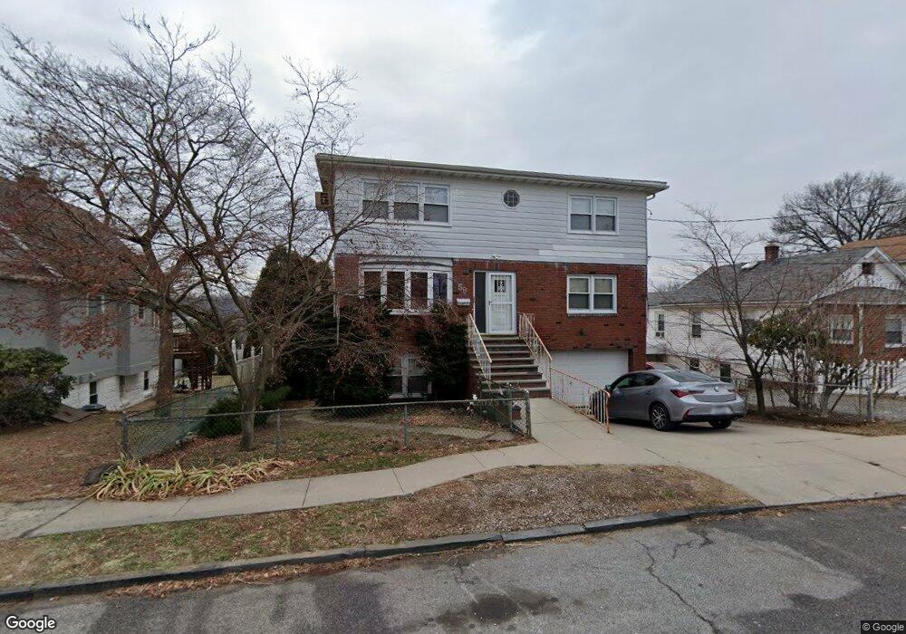
59 Dunston Ave Yonkers, NY 10701
Dunwoodie NeighborhoodEstimated Value: $996,000 - $1,118,000
6
Beds
5
Baths
2,940
Sq Ft
$362/Sq Ft
Est. Value
About This Home
This home is located at 59 Dunston Ave, Yonkers, NY 10701 and is currently estimated at $1,063,639, approximately $361 per square foot. 59 Dunston Ave is a home located in Westchester County with nearby schools including St. John the Baptist Catholic Church and Andalusia School.
Ownership History
Date
Name
Owned For
Owner Type
Purchase Details
Closed on
Feb 3, 2011
Sold by
Mcguire Lucy
Bought by
Iula Irene
Current Estimated Value
Purchase Details
Closed on
Jul 9, 2003
Sold by
Mcguire Lucy
Bought by
Mcguire Lucy
Purchase Details
Closed on
Mar 26, 1998
Sold by
Szkamarda Paula and Mcguire Lucy
Bought by
Mcguire Lucy and Iula Irene
Create a Home Valuation Report for This Property
The Home Valuation Report is an in-depth analysis detailing your home's value as well as a comparison with similar homes in the area
Home Values in the Area
Average Home Value in this Area
Purchase History
| Date | Buyer | Sale Price | Title Company |
|---|---|---|---|
| Iula Irene | -- | None Available | |
| Mcguire Lucy | $224,000 | -- | |
| Mcguire Lucy | -- | Commonwealth Land Title Ins |
Source: Public Records
Tax History Compared to Growth
Tax History
| Year | Tax Paid | Tax Assessment Tax Assessment Total Assessment is a certain percentage of the fair market value that is determined by local assessors to be the total taxable value of land and additions on the property. | Land | Improvement |
|---|---|---|---|---|
| 2024 | $2,874 | $16,128 | $3,500 | $12,628 |
| 2023 | $2,859 | $16,128 | $3,500 | $12,628 |
| 2022 | $2,840 | $16,128 | $3,500 | $12,628 |
| 2021 | $12,840 | $16,128 | $3,500 | $12,628 |
| 2020 | $13,498 | $16,128 | $3,500 | $12,628 |
| 2019 | $15,196 | $16,128 | $3,500 | $12,628 |
| 2018 | $12,448 | $16,128 | $3,500 | $12,628 |
| 2017 | -- | $16,128 | $3,500 | $12,628 |
| 2016 | $13,421 | $16,128 | $3,500 | $12,628 |
| 2015 | -- | $16,128 | $3,500 | $12,628 |
| 2014 | -- | $16,128 | $3,500 | $12,628 |
| 2013 | -- | $16,128 | $3,500 | $12,628 |
Source: Public Records
Map
Nearby Homes
- 43 Dunston Ave
- 39 Dunston Ave
- 47 Brewster Ave
- 20 Ashford Place
- 9 Brynwood Rd
- 70 Cook Ave
- 30 College Place
- 7 Elaine Terrace
- 900 Midland Ave Unit 2E
- 41 Cowdrey St
- 98 University Ave
- 90 University Ave
- 86 University Ave
- 194 Valentine St
- 174 Valentine St
- 191 Dunwoodie St
- 419 Palmer Rd
- 140 Ramsey Ave
- 466 Palmer Rd
- 130 Staunton St
- 63 Dunston Ave
- 63 AKA 65 Dunston Ave
- 55 Dunston Ave
- 65 Dunston Ave Unit 1
- 65 Dunston Ave
- 65 Dunston Ave Unit 2
- 67 Dunston Ave
- 51 Dunston Ave
- 166 Bennett Ave
- 170 Bennett Ave
- 71 Dunston Ave
- 174 Bennett Ave
- 176 Bennett Ave
- 156 Bennett Ave
- 47 Dunston Ave
- 180 Bennett Ave
- 152 Bennett Ave Unit 2
- 152 Bennett Ave
- 1 Ambrose Place
- 50 Dunston Ave