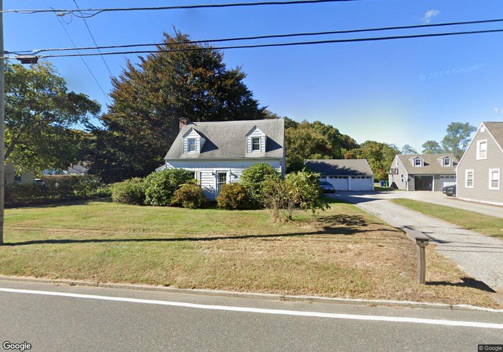
59 Fog Plain Rd Waterford, CT 06385
Estimated Value: $248,000 - $403,000
3
Beds
2
Baths
1,465
Sq Ft
$240/Sq Ft
Est. Value
About This Home
This home is located at 59 Fog Plain Rd, Waterford, CT 06385 and is currently estimated at $352,015, approximately $240 per square foot. 59 Fog Plain Rd is a home located in New London County with nearby schools including Clark Lane Middle School, Waterford High School, and New London High School Multi-Magnet Campus.
Ownership History
Date
Name
Owned For
Owner Type
Purchase Details
Closed on
Sep 10, 2025
Sold by
Michalik Anthony J and Wilmington Svgs Fund Soc
Bought by
Hempstead Frank W
Current Estimated Value
Home Financials for this Owner
Home Financials are based on the most recent Mortgage that was taken out on this home.
Original Mortgage
$225,000
Outstanding Balance
$225,000
Interest Rate
6.58%
Mortgage Type
New Conventional
Estimated Equity
$127,015
Purchase Details
Closed on
Nov 16, 1998
Sold by
Novicki Delberta L
Bought by
Michalik Anthony J
Home Financials for this Owner
Home Financials are based on the most recent Mortgage that was taken out on this home.
Original Mortgage
$40,000
Interest Rate
7%
Mortgage Type
Purchase Money Mortgage
Create a Home Valuation Report for This Property
The Home Valuation Report is an in-depth analysis detailing your home's value as well as a comparison with similar homes in the area
Home Values in the Area
Average Home Value in this Area
Purchase History
| Date | Buyer | Sale Price | Title Company |
|---|---|---|---|
| Hempstead Frank W | $235,000 | -- | |
| Hempstead Frank W | $235,000 | -- | |
| Michalik Anthony J | $115,000 | -- | |
| Michalik Anthony J | $115,000 | -- |
Source: Public Records
Mortgage History
| Date | Status | Borrower | Loan Amount |
|---|---|---|---|
| Open | Hempstead Frank W | $225,000 | |
| Closed | Hempstead Frank W | $225,000 | |
| Previous Owner | Michalik Anthony J | $330,000 | |
| Previous Owner | Michalik Anthony J | $40,000 |
Source: Public Records
Tax History Compared to Growth
Tax History
| Year | Tax Paid | Tax Assessment Tax Assessment Total Assessment is a certain percentage of the fair market value that is determined by local assessors to be the total taxable value of land and additions on the property. | Land | Improvement |
|---|---|---|---|---|
| 2025 | $3,933 | $168,380 | $71,250 | $97,130 |
| 2024 | $3,755 | $168,380 | $71,250 | $97,130 |
| 2023 | $3,570 | $168,380 | $71,250 | $97,130 |
| 2022 | $3,540 | $128,450 | $52,740 | $75,710 |
| 2021 | $3,550 | $128,450 | $52,740 | $75,710 |
| 2020 | $3,580 | $128,450 | $52,740 | $75,710 |
| 2019 | $3,594 | $128,450 | $52,740 | $75,710 |
| 2018 | $3,522 | $128,450 | $52,740 | $75,710 |
| 2017 | $3,556 | $131,560 | $55,850 | $75,710 |
| 2016 | $3,523 | $131,560 | $55,850 | $75,710 |
| 2015 | $3,398 | $131,560 | $55,850 | $75,710 |
| 2014 | $2,587 | $131,560 | $55,850 | $75,710 |
Source: Public Records
Map
Nearby Homes
- 267 Boston Post Rd
- 213 Boston Post Rd
- 270 Boston Post Rd Unit 22
- 140 Waterford Pkwy S
- 27 Mullen Hill Rd
- 310 Boston Post Rd Unit 86
- 54 Rope Ferry Rd Unit H133
- 164 Stoneheights Dr Unit 164
- 16 Beechwood Dr
- 24 Stoneheights Dr
- 32 Stoneheights Dr Unit 32
- 41 5th Ave
- 9 Rock Ridge Rd
- 14 N Phillips St
- 47 Phillips St
- 168 Waterford Pkwy S Unit B25
- 172 Ashcraft Rd
- 226 Colman St
- 430 Vauxhall St
- 70 Morgan St
- 63 Fog Plain Rd
- 57 Fog Plain Rd
- 55 Fog Plain Rd
- 55R Fog Plain Rd
- 65 Fog Plain Rd
- 1 Mackenzie Rd
- 67 Fog Plain Rd
- 53 Fog Plain Rd
- 10 Devonshire Dr
- 3 Mackenzie Rd
- 56 Fog Plain Rd
- 8 Devonshire Dr
- 64 Fog Plain Rd
- 6 Devonshire Dr
- 12 Devonshire Dr
- 54 Fog Plain Rd
- 71 Fog Plain Rd
- 4 Devonshire Dr
- 5 Mackenzie Rd
- 4 Mackenzie Rd