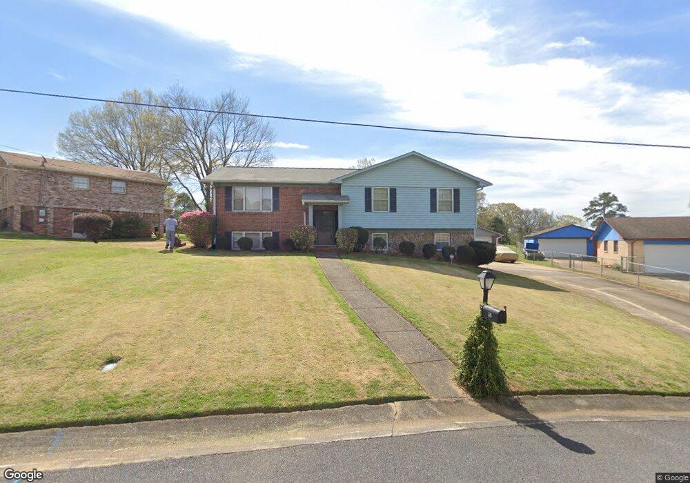
59 Greenleaf Cir W Birmingham, AL 35214
Estimated Value: $140,000 - $233,000
3
Beds
2
Baths
1,650
Sq Ft
$122/Sq Ft
Est. Value
About This Home
This home is located at 59 Greenleaf Cir W, Birmingham, AL 35214 and is currently estimated at $201,134, approximately $121 per square foot. 59 Greenleaf Cir W is a home located in Jefferson County with nearby schools including Minor Middle School, Minor High School, and Gloryland Christian Academy.
Ownership History
Date
Name
Owned For
Owner Type
Purchase Details
Closed on
Mar 11, 2022
Sold by
Blanks Terri Mcclain Estate
Bought by
Blanks Johnny
Current Estimated Value
Purchase Details
Closed on
Feb 17, 2022
Sold by
Blanks Johnny
Bought by
Blanks Johnny
Purchase Details
Closed on
Nov 21, 2019
Sold by
Blanks Teri
Bought by
Blanks Kelvin
Purchase Details
Closed on
Apr 30, 1998
Sold by
Johnson James A and Johnson Sandra L
Bought by
Blanks Teri G
Home Financials for this Owner
Home Financials are based on the most recent Mortgage that was taken out on this home.
Original Mortgage
$98,262
Interest Rate
7.11%
Mortgage Type
FHA
Create a Home Valuation Report for This Property
The Home Valuation Report is an in-depth analysis detailing your home's value as well as a comparison with similar homes in the area
Home Values in the Area
Average Home Value in this Area
Purchase History
| Date | Buyer | Sale Price | Title Company |
|---|---|---|---|
| Blanks Johnny | -- | -- | |
| Blanks Johnny | $148,500 | None Listed On Document | |
| Blanks Kelvin | $159,000 | -- | |
| Blanks Teri G | $98,000 | -- |
Source: Public Records
Mortgage History
| Date | Status | Borrower | Loan Amount |
|---|---|---|---|
| Previous Owner | Blanks Teri G | $98,262 |
Source: Public Records
Tax History Compared to Growth
Tax History
| Year | Tax Paid | Tax Assessment Tax Assessment Total Assessment is a certain percentage of the fair market value that is determined by local assessors to be the total taxable value of land and additions on the property. | Land | Improvement |
|---|---|---|---|---|
| 2024 | -- | $19,620 | -- | -- |
| 2023 | $316 | $19,620 | $2,501 | $17,119 |
| 2022 | $316 | $19,670 | $2,500 | $17,170 |
| 2021 | $1,488 | $14,850 | $2,500 | $12,350 |
| 2020 | $691 | $14,850 | $2,500 | $12,350 |
| 2019 | $691 | $14,860 | $0 | $0 |
| 2018 | $617 | $13,380 | $0 | $0 |
| 2017 | $617 | $13,380 | $0 | $0 |
| 2016 | $614 | $13,320 | $0 | $0 |
| 2015 | $614 | $13,320 | $0 | $0 |
| 2014 | $657 | $12,140 | $0 | $0 |
| 2013 | $657 | $12,140 | $0 | $0 |
Source: Public Records
Map
Nearby Homes
- 50 W Carriage Dr
- 2151 Veterans Memorial Dr
- 2349 Pershing Rd
- 2150 & 2140 Veterans Memorial Dr
- 2215 Arcadia Rd
- 2116 Arcadia Rd
- 2108 Maywood Dr
- 2352 Pershing Place Loop
- 2361 Pershing Place Loop
- 405 Blackmon Cir
- 3636 Forestdale Bend Rd
- 2012 Arcadia Rd
- 517 Tamrandon Ln
- 71 Swindle Dr
- 3013 Crestlane Dr
- 228 Gober Dr
- 2036 Pershing Rd
- 2300 Roberta Rd
- 549 Collette St
- 510 Roosevelt Ave Unit 17-22
- 55 Greenleaf Cir W
- 63 W Greenleaf Dr
- 2428 Crossbow Dr
- 2432 Crossbow Dr
- 60 Greenleaf Cir W
- 2501 Lancelot Dr
- 51 Greenleaf Cir W
- 2424 Crossbow Dr
- 52 Greenleaf Cir W
- 56 Greenleaf Cir W
- 2500 Crossbow Dr
- 2420 Crossbow Dr
- 2504 Lancelot Dr
- 2505 Lancelot Dr
- 94 Tarrywood Ln
- 2429 Crossbow Dr
- 2429 Crossbow Dr Unit 1
- 2433 Crossbow Dr
- 55 Lodengreen Dr
- 2504 Crossbow Dr