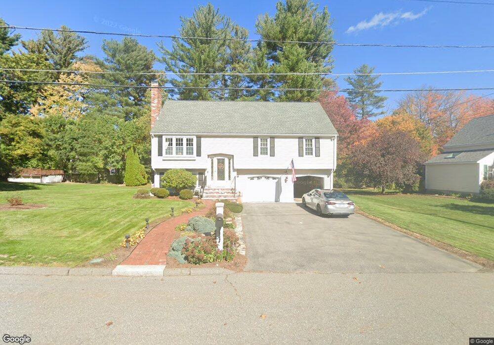
59 Lantern Ln Leominster, MA 01453
Estimated Value: $559,462 - $583,000
3
Beds
3
Baths
1,345
Sq Ft
$425/Sq Ft
Est. Value
About This Home
This home is located at 59 Lantern Ln, Leominster, MA 01453 and is currently estimated at $571,116, approximately $424 per square foot. 59 Lantern Ln is a home located in Worcester County with nearby schools including Leominster High School, St. Anna Catholic School, and St. Leo School.
Ownership History
Date
Name
Owned For
Owner Type
Purchase Details
Closed on
Oct 1, 2003
Sold by
Race Candace A
Bought by
Coleman Kevin J and Coleman Sandra C
Current Estimated Value
Home Financials for this Owner
Home Financials are based on the most recent Mortgage that was taken out on this home.
Original Mortgage
$50,000
Outstanding Balance
$23,397
Interest Rate
6.25%
Mortgage Type
Purchase Money Mortgage
Estimated Equity
$547,719
Create a Home Valuation Report for This Property
The Home Valuation Report is an in-depth analysis detailing your home's value as well as a comparison with similar homes in the area
Home Values in the Area
Average Home Value in this Area
Purchase History
| Date | Buyer | Sale Price | Title Company |
|---|---|---|---|
| Coleman Kevin J | $279,000 | -- |
Source: Public Records
Mortgage History
| Date | Status | Borrower | Loan Amount |
|---|---|---|---|
| Open | Coleman Kevin J | $50,000 |
Source: Public Records
Tax History Compared to Growth
Tax History
| Year | Tax Paid | Tax Assessment Tax Assessment Total Assessment is a certain percentage of the fair market value that is determined by local assessors to be the total taxable value of land and additions on the property. | Land | Improvement |
|---|---|---|---|---|
| 2025 | $6,892 | $491,200 | $144,700 | $346,500 |
| 2024 | $6,699 | $461,700 | $137,900 | $323,800 |
| 2023 | $6,522 | $419,700 | $119,900 | $299,800 |
| 2022 | $6,228 | $376,100 | $104,200 | $271,900 |
| 2021 | $6,012 | $331,600 | $81,200 | $250,400 |
| 2020 | $5,831 | $324,300 | $81,200 | $243,100 |
| 2019 | $5,584 | $301,200 | $77,300 | $223,900 |
| 2018 | $5,656 | $292,600 | $75,100 | $217,500 |
| 2017 | $5,128 | $259,900 | $70,100 | $189,800 |
| 2016 | $4,838 | $247,100 | $70,100 | $177,000 |
| 2015 | $4,677 | $240,600 | $70,100 | $170,500 |
| 2014 | $4,500 | $238,200 | $76,900 | $161,300 |
Source: Public Records
Map
Nearby Homes
- 109 Weathervane Dr
- 76 Jamestown Rd
- 6 Argentine St
- 112 Overlook Dr
- 482 Grant St
- 1237 Central St Unit 2
- 1237 Central St Unit 15
- 675 Willard St
- 3 Leo Gagnon Way Unit 3
- 597 Willard St
- 26 Belview Dr
- 2 Katie Ln
- 24 Starling Way
- 197 Chapman Place Unit 197
- 102 Chapman Place Unit 102
- 740 Central St Unit R24
- 25 Crimson Ct
- 30 Abbey Rd Unit 207
- 10 Abbey Rd Unit 205
- 30 Abbey Rd Unit 104
- 53 Lantern Ln
- 65 Lantern Ln
- 118 Weathervane Dr
- 124 Weathervane Dr
- 58 Lantern Ln
- 52 Lantern Ln
- 112 Weathervane Dr
- 47 Lantern Ln
- 103 Jamestown Rd
- 115 Jamestown Rd
- 66 Lantern Ln
- 46 Lantern Ln
- 79 Jamestown Rd
- 41 Lantern Ln
- 69 Jamestown Rd
- 106 Weathervane Dr
- 85 Jamestown Rd
- 115 Weathervane Dr
- 40 Lantern Ln
- 125 Weathervane Dr