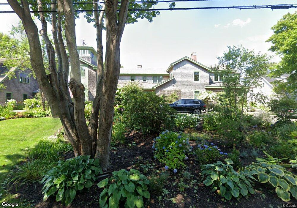
59 Lester B Orcutt Blvd Biddeford, ME 04005
Fortunes Rocks NeighborhoodEstimated Value: $1,462,000 - $3,667,388
6
Beds
5
Baths
5,916
Sq Ft
$434/Sq Ft
Est. Value
About This Home
This home is located at 59 Lester B Orcutt Blvd, Biddeford, ME 04005 and is currently estimated at $2,564,694, approximately $433 per square foot. 59 Lester B Orcutt Blvd is a home with nearby schools including John F Kennedy Memorial School, Biddeford Primary School, and Biddeford Intermediate School.
Ownership History
Date
Name
Owned For
Owner Type
Purchase Details
Closed on
Jan 7, 2008
Sold by
Bowman Phoebe E
Bought by
Bowman Christopher S
Current Estimated Value
Create a Home Valuation Report for This Property
The Home Valuation Report is an in-depth analysis detailing your home's value as well as a comparison with similar homes in the area
Home Values in the Area
Average Home Value in this Area
Purchase History
| Date | Buyer | Sale Price | Title Company |
|---|---|---|---|
| Bowman Christopher S | -- | -- | |
| Bowman Christopher S | -- | -- |
Source: Public Records
Tax History Compared to Growth
Tax History
| Year | Tax Paid | Tax Assessment Tax Assessment Total Assessment is a certain percentage of the fair market value that is determined by local assessors to be the total taxable value of land and additions on the property. | Land | Improvement |
|---|---|---|---|---|
| 2024 | $38,502 | $2,707,600 | $1,599,800 | $1,107,800 |
| 2023 | $35,465 | $2,703,100 | $1,595,300 | $1,107,800 |
| 2022 | $30,634 | $1,866,800 | $963,000 | $903,800 |
| 2021 | $28,805 | $1,580,100 | $822,100 | $758,000 |
| 2020 | $29,796 | $1,486,100 | $792,800 | $693,300 |
| 2019 | $29,105 | $1,456,700 | $834,700 | $622,000 |
| 2018 | $28,697 | $1,456,700 | $834,700 | $622,000 |
| 2017 | $28,814 | $1,435,700 | $834,700 | $601,000 |
| 2016 | $28,513 | $1,435,700 | $834,700 | $601,000 |
| 2015 | $27,953 | $1,435,700 | $834,700 | $601,000 |
| 2014 | $26,875 | $1,415,200 | $834,700 | $580,500 |
| 2013 | -- | $1,002,800 | $550,400 | $452,400 |
Source: Public Records
Map
Nearby Homes
- 52 Lester B Orcutt Blvd
- 111 Mile Stretch Rd
- 3 Fortunes Rocks Rd
- 6 Days Landing
- 88-90 Old Pool Rd
- 66 Old Pool Rd
- 2 Maddox Pond Rd
- Lot 1 Longboard Ln
- Lot 2 Longboard Ln
- Lot 3 Longboard Ln
- 1 Willow Ridge
- 26 Reserved Ln
- Lot 7 Longboard Ln
- Lot 4 Longboard Ln
- Lot 6 Longboard Ln
- 700 Pool St
- 96 Fortunes Rocks Rd
- 23 North Ave
- 9 Riverside Ave
- 12 Lower Beach Rd
- 60 Lester B Orcutt Blvd
- 66 Lester B Orcutt Blvd
- 55 Lester B Orcutt Blvd
- 27 First St
- 23 First St
- 20 Lester Orcutt Blvd Unit 2
- 13 First St
- 1 St Martins Ln
- 54 Lester B Orcutt Blvd
- 67 Lester B Orcutt Blvd
- 31 1st St
- 72 Lester B Orcutt Blvd
- 10 Eighth St
- 1 Third St
- Lot 3 3 5ac Ridgewood Dr
- 33-35 1st St
- 7 3rd St
- 11 Third
- 69 Lester B Orcutt Blvd