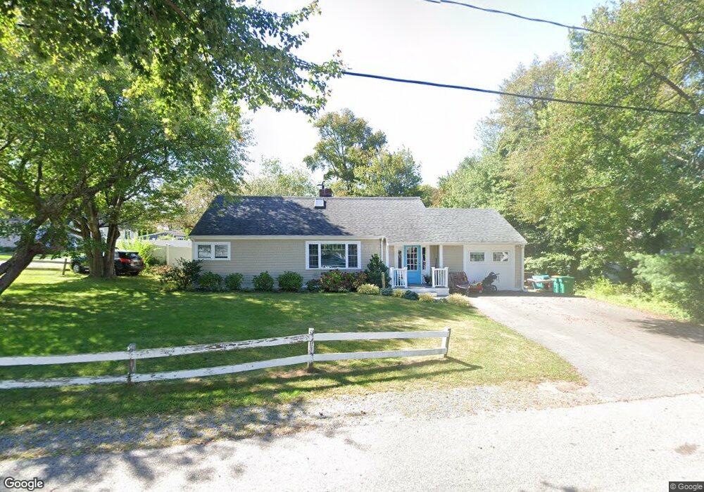
59 Norwell Ave Scituate, MA 02066
Estimated Value: $826,000 - $947,000
3
Beds
2
Baths
1,743
Sq Ft
$509/Sq Ft
Est. Value
About This Home
This home is located at 59 Norwell Ave, Scituate, MA 02066 and is currently estimated at $887,393, approximately $509 per square foot. 59 Norwell Ave is a home located in Plymouth County with nearby schools including Wampatuck Elementary School, Lester J. Gates Middle School, and Scituate High School.
Ownership History
Date
Name
Owned For
Owner Type
Purchase Details
Closed on
Jul 24, 1997
Sold by
Hennessey Raymond F and Hennessey Christine M
Bought by
Rooney Thomas and Rooney Jennifer A
Current Estimated Value
Purchase Details
Closed on
Aug 24, 1990
Sold by
Dickinson Jeremiah
Bought by
Hennessey Raymond F
Create a Home Valuation Report for This Property
The Home Valuation Report is an in-depth analysis detailing your home's value as well as a comparison with similar homes in the area
Home Values in the Area
Average Home Value in this Area
Purchase History
| Date | Buyer | Sale Price | Title Company |
|---|---|---|---|
| Rooney Thomas | $147,000 | -- | |
| Hennessey Raymond F | $145,000 | -- |
Source: Public Records
Mortgage History
| Date | Status | Borrower | Loan Amount |
|---|---|---|---|
| Open | Hennessey Raymond F | $192,000 | |
| Closed | Hennessey Raymond F | $188,000 |
Source: Public Records
Tax History Compared to Growth
Tax History
| Year | Tax Paid | Tax Assessment Tax Assessment Total Assessment is a certain percentage of the fair market value that is determined by local assessors to be the total taxable value of land and additions on the property. | Land | Improvement |
|---|---|---|---|---|
| 2025 | $6,927 | $693,400 | $407,600 | $285,800 |
| 2024 | $6,785 | $654,900 | $370,500 | $284,400 |
| 2023 | $6,334 | $593,500 | $336,900 | $256,600 |
| 2022 | $6,334 | $501,900 | $286,600 | $215,300 |
| 2021 | $5,920 | $444,100 | $259,300 | $184,800 |
| 2020 | $5,744 | $425,500 | $249,300 | $176,200 |
| 2019 | $5,675 | $413,000 | $244,400 | $168,600 |
| 2018 | $5,812 | $416,600 | $258,700 | $157,900 |
| 2017 | $5,718 | $405,800 | $247,900 | $157,900 |
| 2016 | $5,433 | $384,200 | $226,300 | $157,900 |
| 2015 | $4,893 | $373,500 | $215,600 | $157,900 |
Source: Public Records
Map
Nearby Homes
- 30 Irving Rd
- 209 Hatherly Rd
- 378 Tilden Rd
- 17 Bradford Ave
- 10 Benjamin Ln Unit 10
- 2 Windward Ln
- 22 Kings Way
- 54 Woodland Rd
- 23 Oceanside Dr
- 59 Captain Peirce Rd
- 105 Turner Rd
- 32 Barker Rd Unit 3
- 74 Tilden Rd
- 14 Aberdeen Dr
- 3 Grace Way Unit 3
- 1 Grace Way Unit 1
- 32 Fairview Ave
- 111 Elm St
- 112 Hollett St
- 115 Elm St