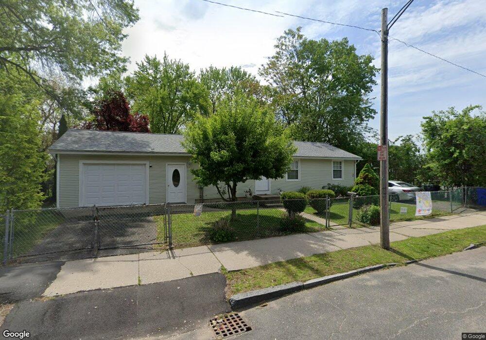
59 Osgood St Springfield, MA 01107
Memorial Square NeighborhoodEstimated Value: $255,000 - $276,669
3
Beds
2
Baths
960
Sq Ft
$275/Sq Ft
Est. Value
About This Home
This home is located at 59 Osgood St, Springfield, MA 01107 and is currently estimated at $263,667, approximately $274 per square foot. 59 Osgood St is a home located in Hampden County with nearby schools including German Gerena Community School, High School Of Commerce, and Springfield High School of Science and Technology.
Ownership History
Date
Name
Owned For
Owner Type
Purchase Details
Closed on
Oct 16, 2003
Sold by
Nieves Mildred
Bought by
Rodriguez Aida L
Current Estimated Value
Home Financials for this Owner
Home Financials are based on the most recent Mortgage that was taken out on this home.
Original Mortgage
$45,500
Outstanding Balance
$21,383
Interest Rate
6.43%
Mortgage Type
Purchase Money Mortgage
Estimated Equity
$242,284
Purchase Details
Closed on
Sep 16, 1994
Sold by
Roldan Pedro
Bought by
Nieves Mildred
Home Financials for this Owner
Home Financials are based on the most recent Mortgage that was taken out on this home.
Original Mortgage
$37,647
Interest Rate
8.38%
Mortgage Type
Purchase Money Mortgage
Create a Home Valuation Report for This Property
The Home Valuation Report is an in-depth analysis detailing your home's value as well as a comparison with similar homes in the area
Home Values in the Area
Average Home Value in this Area
Purchase History
| Date | Buyer | Sale Price | Title Company |
|---|---|---|---|
| Rodriguez Aida L | $65,000 | -- | |
| Nieves Mildred | $37,647 | -- |
Source: Public Records
Mortgage History
| Date | Status | Borrower | Loan Amount |
|---|---|---|---|
| Open | Rodriguez Aida L | $45,500 | |
| Previous Owner | Nieves Mildred | $2,500 | |
| Previous Owner | Nieves Mildred | $37,647 | |
| Previous Owner | Nieves Mildred | $49,000 |
Source: Public Records
Tax History
| Year | Tax Paid | Tax Assessment Tax Assessment Total Assessment is a certain percentage of the fair market value that is determined by local assessors to be the total taxable value of land and additions on the property. | Land | Improvement |
|---|---|---|---|---|
| 2025 | $3,069 | $195,700 | $32,500 | $163,200 |
| 2024 | $3,085 | $192,100 | $32,500 | $159,600 |
| 2023 | $2,895 | $169,800 | $23,700 | $146,100 |
| 2022 | $2,044 | $108,600 | $21,600 | $87,000 |
| 2021 | $2,223 | $117,600 | $19,600 | $98,000 |
| 2020 | $1,967 | $100,700 | $19,600 | $81,100 |
| 2019 | $1,793 | $91,100 | $19,600 | $71,500 |
| 2018 | $1,734 | $88,100 | $19,600 | $68,500 |
| 2017 | $1,956 | $99,500 | $18,800 | $80,700 |
| 2016 | $1,911 | $97,200 | $18,800 | $78,400 |
| 2015 | $1,725 | $87,700 | $18,800 | $68,900 |
Source: Public Records
Map
Nearby Homes
- 42 Ringgold St
- 35-37 Narragansett St
- 85 Narragansett St
- 78 Mayfair Ave
- 14 Crane St
- 127 Melha Ave
- 68 Mooreland St Unit 70
- 37 Elmdale St
- 140 Chestnut St Unit 619
- 35 Shefford St
- 65 Hyde Ave
- 521 Liberty St
- 20 Sprague St
- 24 Morrell St
- 14-16 Wolcott St
- 849 Worthington St
- 78 Governor St
- 38 Byers St
- 127 Governor St
- 334 Elm St
- 1218 Dwight St
- 69 Osgood St
- 54 Osgood St
- 52 Osgood St Unit 1
- 52 Osgood St Unit 2
- 1200 Dwight St
- 48 Osgood St
- 64 Osgood St
- 64 Osgood St
- 64-68 Osgood St
- 1180 Dwight St
- 44 Osgood St
- 38 Osgood St
- 10 Brookline Ave
- 1267 Dwight St
- 0 Brookline Ave (Ns) L: Unit 71157289
- 0 Brookline Ave
- 9 Brookline Ave
- 32 Osgood St Unit 34
- 20 Hebron St
Your Personal Tour Guide
Ask me questions while you tour the home.