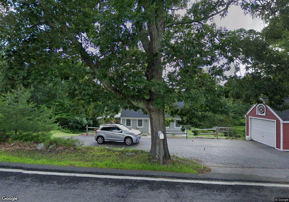
59 Perkins Rd Londonderry, NH 03053
Estimated Value: $488,000 - $588,000
3
Beds
2
Baths
1,428
Sq Ft
$384/Sq Ft
Est. Value
About This Home
This home is located at 59 Perkins Rd, Londonderry, NH 03053 and is currently estimated at $547,908, approximately $383 per square foot. 59 Perkins Rd is a home located in Rockingham County with nearby schools including North Londonderry Elementary School, Londonderry Middle School, and Londonderry Senior High School.
Ownership History
Date
Name
Owned For
Owner Type
Purchase Details
Closed on
Nov 22, 2011
Sold by
Lenny Santosuosso Ret and Santosuosso Lenny
Bought by
Micciche Brian C
Current Estimated Value
Home Financials for this Owner
Home Financials are based on the most recent Mortgage that was taken out on this home.
Original Mortgage
$202,000
Outstanding Balance
$136,061
Interest Rate
3.92%
Estimated Equity
$411,847
Purchase Details
Closed on
Jul 22, 2010
Sold by
Carter 3Rd James G and Fnma
Bought by
Fnma
Purchase Details
Closed on
Jun 30, 2000
Sold by
Miller James D and Miller Marianne M
Bought by
Carter James G
Home Financials for this Owner
Home Financials are based on the most recent Mortgage that was taken out on this home.
Original Mortgage
$144,840
Interest Rate
8.59%
Purchase Details
Closed on
Jun 26, 1998
Sold by
Wings Rlty Inc
Bought by
Miller James D and Miller Marianne M
Home Financials for this Owner
Home Financials are based on the most recent Mortgage that was taken out on this home.
Original Mortgage
$52,000
Interest Rate
7.09%
Create a Home Valuation Report for This Property
The Home Valuation Report is an in-depth analysis detailing your home's value as well as a comparison with similar homes in the area
Home Values in the Area
Average Home Value in this Area
Purchase History
| Date | Buyer | Sale Price | Title Company |
|---|---|---|---|
| Micciche Brian C | $203,000 | -- | |
| Fnma | $259,400 | -- | |
| Carter James G | $142,000 | -- | |
| Miller James D | $102,000 | -- | |
| Wings Rlty Inc | $88,000 | -- |
Source: Public Records
Mortgage History
| Date | Status | Borrower | Loan Amount |
|---|---|---|---|
| Open | Wings Rlty Inc | $202,000 | |
| Previous Owner | Wings Rlty Inc | $144,840 | |
| Previous Owner | Wings Rlty Inc | $52,000 |
Source: Public Records
Tax History Compared to Growth
Tax History
| Year | Tax Paid | Tax Assessment Tax Assessment Total Assessment is a certain percentage of the fair market value that is determined by local assessors to be the total taxable value of land and additions on the property. | Land | Improvement |
|---|---|---|---|---|
| 2024 | $6,811 | $422,000 | $200,900 | $221,100 |
| 2023 | $6,604 | $422,000 | $200,900 | $221,100 |
| 2022 | $6,568 | $355,400 | $150,600 | $204,800 |
| 2021 | $6,532 | $355,400 | $150,600 | $204,800 |
| 2020 | $6,146 | $305,600 | $112,900 | $192,700 |
| 2019 | $5,926 | $305,600 | $112,900 | $192,700 |
| 2018 | $3,031 | $255,200 | $94,200 | $161,000 |
| 2017 | $5,515 | $255,200 | $94,200 | $161,000 |
| 2016 | $5,487 | $255,200 | $94,200 | $161,000 |
| 2015 | $5,364 | $255,200 | $94,200 | $161,000 |
| 2014 | $5,382 | $255,200 | $94,200 | $161,000 |
| 2011 | -- | $261,400 | $94,200 | $167,200 |
Source: Public Records
Map
Nearby Homes
- 4 Crestview Cir Unit 119
- 36 Perkins Rd
- 32 Noyes Rd
- 103 Rockingham Rd Unit 1
- 103 Rockingham Rd Unit 2
- 10 Auburn Rd
- 50 Bartley Hill Rd
- 19 Auburn Rd
- 38 Bartley Hill Rd
- 17 Welch Rd
- 75 Rockingham Rd
- 28 Barksdale Ave
- 8 Barksdale Ave
- 27 Buckingham Dr
- 10 Judy Dr
- 118 Fieldstone Dr Unit 118
- 57 Hardy Rd
- 193 Fieldstone Dr
- 193 Fieldstone Dr Unit 193
- 20 Wedgewood Dr
- 61 Perkins Rd
- 57 Perkins Rd
- 63 Perkins Rd
- 55 Perkins Rd
- 62 Perkins Rd
- 4 Bridle Path
- 65 Perkins Rd
- 53 Perkins Rd
- 52 Perkins Rd
- 18 Crestview Cir Unit 213
- 18 Crestview Cir Unit 196
- 18 Crestview Cir Unit 207
- 18 Crestview Cir Unit 197
- 18 Crestview Cir Unit 198
- 18 Crestview Cir Unit 216
- 18 Crestview Cir Unit 200
- 18 Crestview Cir Unit 202
- 18 Crestview Cir Unit 203
- 18 Crestview Cir Unit 195
- 18 Crestview Cir Unit 211