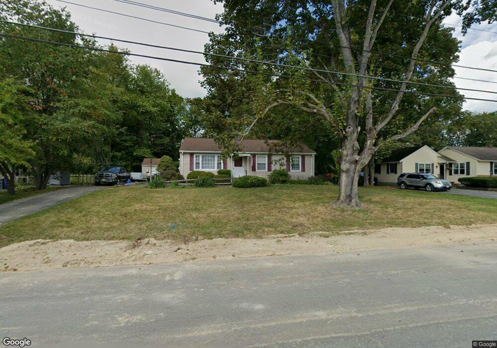
59 Rolling Acres Rd Lunenburg, MA 01462
Estimated Value: $449,028 - $529,000
3
Beds
1
Bath
1,240
Sq Ft
$384/Sq Ft
Est. Value
About This Home
This home is located at 59 Rolling Acres Rd, Lunenburg, MA 01462 and is currently estimated at $476,507, approximately $384 per square foot. 59 Rolling Acres Rd is a home located in Worcester County with nearby schools including Lunenburg Primary School, Lunenburg High School, and St Bernards Elementary School.
Ownership History
Date
Name
Owned For
Owner Type
Purchase Details
Closed on
Jun 16, 2016
Sold by
Montuori Todd
Bought by
Montuori Sandra L
Current Estimated Value
Purchase Details
Closed on
Jan 6, 1994
Sold by
Mccarron Peter J and Mccarron Kathleen
Bought by
Montuori Todd and Montuori Sandra
Create a Home Valuation Report for This Property
The Home Valuation Report is an in-depth analysis detailing your home's value as well as a comparison with similar homes in the area
Home Values in the Area
Average Home Value in this Area
Purchase History
| Date | Buyer | Sale Price | Title Company |
|---|---|---|---|
| Montuori Sandra L | -- | -- | |
| Montuori Todd | $110,000 | -- |
Source: Public Records
Mortgage History
| Date | Status | Borrower | Loan Amount |
|---|---|---|---|
| Previous Owner | Montuori Todd | $58,400 | |
| Previous Owner | Montuori Todd | $75,000 |
Source: Public Records
Tax History Compared to Growth
Tax History
| Year | Tax Paid | Tax Assessment Tax Assessment Total Assessment is a certain percentage of the fair market value that is determined by local assessors to be the total taxable value of land and additions on the property. | Land | Improvement |
|---|---|---|---|---|
| 2025 | $5,519 | $384,300 | $121,900 | $262,400 |
| 2024 | $5,151 | $365,300 | $114,900 | $250,400 |
| 2023 | $5,061 | $346,200 | $104,600 | $241,600 |
| 2022 | $4,593 | $267,200 | $87,200 | $180,000 |
| 2020 | $4,583 | $252,900 | $87,100 | $165,800 |
| 2019 | $4,345 | $232,600 | $82,000 | $150,600 |
| 2018 | $3,954 | $200,700 | $82,000 | $118,700 |
| 2017 | $3,838 | $192,100 | $74,700 | $117,400 |
| 2016 | $3,655 | $186,400 | $71,100 | $115,300 |
| 2015 | $3,298 | $180,000 | $67,400 | $112,600 |
Source: Public Records
Map
Nearby Homes
- 35 Leominster Rd
- 31 School St
- 9 Fairview Rd
- 29 West St
- 6 Riley Rd Unit 6
- 63 Holman St
- 711 Massachusetts Ave Unit 2
- 319 Highland St
- 44 Hemlock Dr
- 185 Hemlock Dr
- 330 Arbor St
- 200-365 Hollis Rd
- 130 Gilchrest St
- 452 Hollis Rd
- 110 Burrage St
- 91 Valley Rd
- 372 Townsend Harbor Rd
- 29 Lakeview Ave
- 70 Kilburn St
- 77 Upland Ave
- 65 Rolling Acres Rd
- 55 Rolling Acres Rd
- 73 Rolling Acres Rd
- 46 Rolling Acres Rd
- 66 Rolling Acres Rd
- 79 Rolling Acres Rd
- 72 Rolling Acres Rd
- 40 Rolling Acres Rd
- 80 Rolling Acres Rd
- 125 Lancaster Ave
- 85 Rolling Acres Rd
- 90 Rolling Acres Rd
- 93 Rolling Acres Rd
- 93 Rolling Acres Rd Unit 1
- 99 Lancaster Ave
- 12 Meadow Ln
- 91 Lancaster Ave
- 32 Rolling Acres Rd
- 32 Rolling Acres Rd Unit 1
- 83 Lancaster Ave