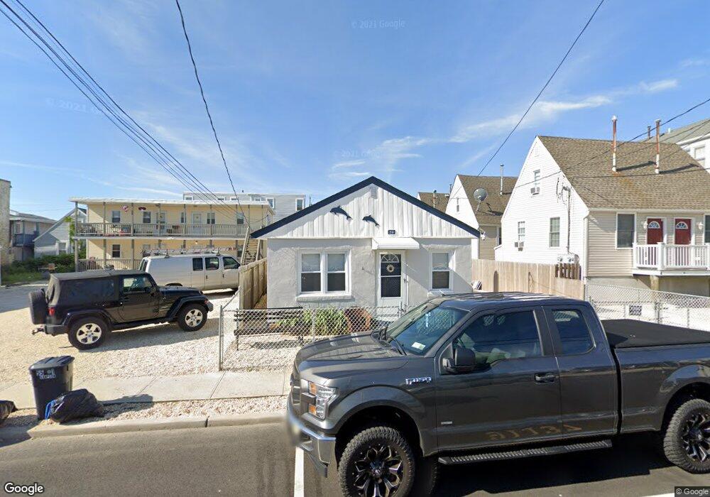
59 Sampson Ave Seaside Heights, NJ 08751
Estimated Value: $538,330 - $851,000
3
Beds
1
Bath
882
Sq Ft
$758/Sq Ft
Est. Value
About This Home
This home is located at 59 Sampson Ave, Seaside Heights, NJ 08751 and is currently estimated at $668,333, approximately $757 per square foot. 59 Sampson Ave is a home located in Ocean County with nearby schools including Hugh J. Boyd Jr. Elementary School, Central Regional Middle School, and Central Regional High School.
Ownership History
Date
Name
Owned For
Owner Type
Purchase Details
Closed on
Mar 2, 2011
Sold by
Estate Of Shirley Conolley and Armstrong Patricia L
Bought by
Scanlon John and Carnegie Elayne
Current Estimated Value
Home Financials for this Owner
Home Financials are based on the most recent Mortgage that was taken out on this home.
Original Mortgage
$202,500
Outstanding Balance
$139,791
Interest Rate
4.89%
Mortgage Type
New Conventional
Estimated Equity
$528,542
Purchase Details
Closed on
Jun 17, 1997
Sold by
Lorenzo Dominic
Bought by
Damiano Anthony and Damiano Regina
Home Financials for this Owner
Home Financials are based on the most recent Mortgage that was taken out on this home.
Original Mortgage
$83,000
Interest Rate
7.81%
Create a Home Valuation Report for This Property
The Home Valuation Report is an in-depth analysis detailing your home's value as well as a comparison with similar homes in the area
Home Values in the Area
Average Home Value in this Area
Purchase History
| Date | Buyer | Sale Price | Title Company |
|---|---|---|---|
| Scanlon John | $270,000 | Westcor Land Title Ins Co | |
| Damiano Anthony | $97,000 | -- |
Source: Public Records
Mortgage History
| Date | Status | Borrower | Loan Amount |
|---|---|---|---|
| Open | Scanlon John | $202,500 | |
| Previous Owner | Damiano Anthony | $83,000 |
Source: Public Records
Tax History Compared to Growth
Tax History
| Year | Tax Paid | Tax Assessment Tax Assessment Total Assessment is a certain percentage of the fair market value that is determined by local assessors to be the total taxable value of land and additions on the property. | Land | Improvement |
|---|---|---|---|---|
| 2025 | $8,097 | $816,200 | $600,000 | $216,200 |
| 2024 | $7,514 | $285,700 | $180,000 | $105,700 |
| 2023 | $7,145 | $285,700 | $180,000 | $105,700 |
| 2022 | $7,145 | $285,700 | $180,000 | $105,700 |
| 2021 | $6,914 | $285,700 | $180,000 | $105,700 |
| 2020 | $6,937 | $285,700 | $180,000 | $105,700 |
| 2019 | $6,728 | $285,700 | $180,000 | $105,700 |
| 2018 | $6,551 | $285,700 | $180,000 | $105,700 |
| 2017 | $6,428 | $285,700 | $180,000 | $105,700 |
| 2016 | $6,320 | $285,700 | $180,000 | $105,700 |
| 2015 | $6,100 | $285,700 | $180,000 | $105,700 |
| 2014 | $4,862 | $248,700 | $180,000 | $68,700 |
Source: Public Records
Map
Nearby Homes
- 51 Sampson Ave
- 45 Sampson Ave Unit 11
- 55 Sampson Ave
- 1515 Boulevard Unit 13
- 61 Hiering Ave
- 118 Sampson Ave
- 52 Kearney Ave
- 1601 Boulevard Unit B7
- 112 Kearney Ave
- 36 Kearney Ave
- 1215 Boulevard
- 132 Sampson Ave Unit 2
- 51 Hiering Ave Unit D-4
- 1201 Ocean Blvd
- 1501 Central
- 1501 Ocean Terrace Unit H
- 122 Fremont Ave
- 1120 Boulevard
- 1300 Ocean Terrace
- 500 Ocean Terrace Unit 6
- 65 Sampson Ave Unit 5
- 65 Sampson Ave Unit 4
- 65 Sampson Ave Unit 1
- 65 Sampson Ave Unit 2
- 65 Sampson Ave Unit 6
- 51 Sampson Ave
- 1418 Boulevard Unit 5
- 1418 Boulevard
- 1418 Boulevard
- 1418 Boulevard
- 1418 Boulevard
- 1418 Boulevard
- 1418 Boulevard
- 1418 Boulevard
- 1418 Boulevard
- 1418 Boulevard
- 1418 Boulevard
- 1418 Boulevard Unit 9
- 1418 Boulevard Unit A1
- 64 Carteret Ave