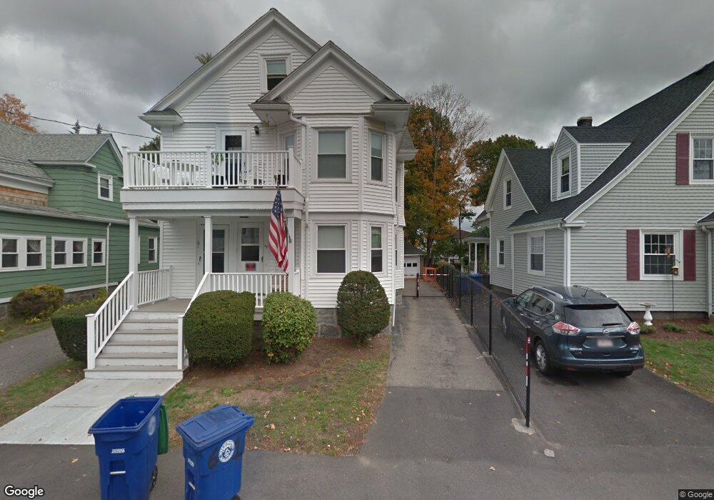
59 Tremont St Unit 61 Braintree, MA 02184
South Braintree NeighborhoodEstimated Value: $957,000 - $1,120,000
10
Beds
2
Baths
3,194
Sq Ft
$327/Sq Ft
Est. Value
About This Home
This home is located at 59 Tremont St Unit 61, Braintree, MA 02184 and is currently estimated at $1,044,250, approximately $326 per square foot. 59 Tremont St Unit 61 is a home located in Norfolk County with nearby schools including Braintree High School, Meeting House Montessori School, and Thayer Academy.
Ownership History
Date
Name
Owned For
Owner Type
Purchase Details
Closed on
Mar 16, 2022
Sold by
Cawley Thomas P and Cawley Maureen I
Bought by
T P Jr & M I Cawley Ret
Current Estimated Value
Purchase Details
Closed on
Mar 16, 1983
Bought by
Cawley Thomas P and Cawley Maureen I
Create a Home Valuation Report for This Property
The Home Valuation Report is an in-depth analysis detailing your home's value as well as a comparison with similar homes in the area
Home Values in the Area
Average Home Value in this Area
Purchase History
| Date | Buyer | Sale Price | Title Company |
|---|---|---|---|
| T P Jr & M I Cawley Ret | -- | None Available | |
| Cawley Thomas P | -- | -- |
Source: Public Records
Mortgage History
| Date | Status | Borrower | Loan Amount |
|---|---|---|---|
| Previous Owner | Cawley Thomas P | $145,000 |
Source: Public Records
Tax History Compared to Growth
Tax History
| Year | Tax Paid | Tax Assessment Tax Assessment Total Assessment is a certain percentage of the fair market value that is determined by local assessors to be the total taxable value of land and additions on the property. | Land | Improvement |
|---|---|---|---|---|
| 2025 | $8,787 | $880,500 | $332,500 | $548,000 |
| 2024 | $7,603 | $802,000 | $310,000 | $492,000 |
| 2023 | $7,166 | $734,200 | $278,600 | $455,600 |
| 2022 | $7,037 | $707,200 | $251,600 | $455,600 |
| 2021 | $6,312 | $634,400 | $227,300 | $407,100 |
| 2020 | $6,004 | $608,900 | $206,700 | $402,200 |
| 2019 | $5,788 | $573,600 | $197,700 | $375,900 |
| 2018 | $5,678 | $538,700 | $179,700 | $359,000 |
| 2017 | $5,689 | $529,700 | $170,700 | $359,000 |
| 2016 | $4,855 | $442,200 | $143,800 | $298,400 |
| 2015 | $4,875 | $440,400 | $142,000 | $298,400 |
| 2014 | $4,441 | $388,900 | $129,400 | $259,500 |
Source: Public Records
Map
Nearby Homes
- 59-61 Tremont St
- 6 Franklin St
- 1 Meadowbrook Rd
- 145 Hancock St Unit 214
- 17 Royal Lake Dr Unit 4
- 26 Sherman Rd
- 56 Plain St
- 7 Carter Rd
- 414 John Mahar Hwy Unit 312
- 418 John Mahar Hwy Unit 408
- 131 Jefferson St
- 420 John Mahar Hwy Unit 202
- 57 Graziano Dr
- 422 John Mahar Hwy Unit 108
- 422 John Mahar Hwy Unit 305
- 426 John Mahar Hwy Unit 311
- 428 John Mahar Hwy Unit 301
- 86 E Boscobel St
- 175 West St
- 15 Highland Ave
- 61 Tremont St
- 47 Tremont St Unit 2nd
- 65 Tremont St
- 57 Tremont St Unit 57
- 55 Tremont St Unit 57
- 64 Tremont St
- 69 Tremont St Unit 71
- 71 Tremont St
- 56 Tremont St
- 39 Summer St
- 70 Tremont St Unit 2L
- 70 Tremont St Unit 2R
- 70 Tremont St Unit 4
- 31 Summer St Unit 33
- 50 Tremont St
- 75 Tremont St
- 75 Tremont St
- 65 Franklin St
- 50 Taylor St
- 50 Taylor St Unit 50