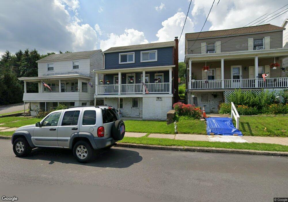
59 W Columbus Ave Nesquehoning, PA 18240
Estimated Value: $140,729 - $162,000
3
Beds
1
Bath
1,440
Sq Ft
$105/Sq Ft
Est. Value
About This Home
This home is located at 59 W Columbus Ave, Nesquehoning, PA 18240 and is currently estimated at $150,932, approximately $104 per square foot. 59 W Columbus Ave is a home located in Carbon County with nearby schools including Panther Valley Elementary School, Panther Valley Intermediate School, and Panther Valley Junior/Senior High School.
Ownership History
Date
Name
Owned For
Owner Type
Purchase Details
Closed on
Apr 22, 2005
Sold by
Dolinsky David
Bought by
Glass Arlene M
Current Estimated Value
Home Financials for this Owner
Home Financials are based on the most recent Mortgage that was taken out on this home.
Original Mortgage
$53,000
Outstanding Balance
$27,651
Interest Rate
5.95%
Mortgage Type
New Conventional
Estimated Equity
$123,281
Purchase Details
Closed on
Dec 30, 2004
Sold by
Bentley David and Dolinsky David
Bought by
Dolinsky David
Create a Home Valuation Report for This Property
The Home Valuation Report is an in-depth analysis detailing your home's value as well as a comparison with similar homes in the area
Home Values in the Area
Average Home Value in this Area
Purchase History
| Date | Buyer | Sale Price | Title Company |
|---|---|---|---|
| Glass Arlene M | $53,000 | None Available | |
| Dolinsky David | -- | None Available |
Source: Public Records
Mortgage History
| Date | Status | Borrower | Loan Amount |
|---|---|---|---|
| Open | Glass Arlene M | $53,000 |
Source: Public Records
Tax History Compared to Growth
Tax History
| Year | Tax Paid | Tax Assessment Tax Assessment Total Assessment is a certain percentage of the fair market value that is determined by local assessors to be the total taxable value of land and additions on the property. | Land | Improvement |
|---|---|---|---|---|
| 2025 | $1,980 | $20,952 | $3,254 | $17,698 |
| 2024 | $2,061 | $20,952 | $3,254 | $17,698 |
| 2023 | $2,019 | $20,952 | $3,254 | $17,698 |
| 2022 | $2,032 | $20,952 | $3,254 | $17,698 |
| 2021 | $2,032 | $20,952 | $3,254 | $17,698 |
| 2020 | $2,001 | $20,952 | $3,254 | $17,698 |
| 2019 | $1,885 | $20,952 | $3,254 | $17,698 |
| 2018 | $1,865 | $20,952 | $3,254 | $17,698 |
| 2017 | $1,865 | $20,952 | $3,254 | $17,698 |
| 2016 | -- | $20,952 | $3,254 | $17,698 |
| 2015 | -- | $20,952 | $3,254 | $17,698 |
| 2014 | -- | $20,952 | $3,254 | $17,698 |
Source: Public Records
Map
Nearby Homes
- 24 W Garibaldi Ave
- 58 W Columbus Ave
- 105 E Columbus Ave
- 61 Rhume St
- 34 Coal St
- 117 E Garibaldi Ave
- 2 W Catawissa St
- 134 W Railroad St Unit 136
- 153 W High St
- 68 E Railroad St
- 1 W High St
- 129 Lentz Trail
- 0 11th Ave Unit PM-131093
- 419 E White Bear Dr
- 16 Andrewsville St
- A591 Apple Lane & Stony Mountain
- 622 Center Ave
- 0 N Dr Unit PM-116531
- 131 W Broadway
- 333 E Hazard St
- 63 W Columbus Ave
- 55 W Columbus Ave
- 51 W Columbus Ave
- 47 W Columbus Ave
- 43 W Columbus Ave
- 101 W Columbus Ave
- 58 W Garibaldi Ave
- 50 W Garibaldi Ave
- 52 W Columbus Ave
- 62 W Columbus Ave
- 43 W Marconi Ave
- 48 W Garibaldi Ave
- 54 W Columbus Ave
- 35 W Columbus Ave
- 100 Genoa Ave
- 42 W Garibaldi Ave
- 44 W Columbus Ave Unit 46
- W Garibaldi Ave
- 121 W Columbus Ave
- 65 W Mussmano Ave