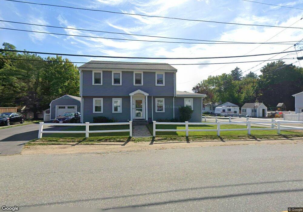
59 Wheeler St Gloucester, MA 01930
Riverview NeighborhoodEstimated Value: $816,627 - $1,003,000
3
Beds
2
Baths
2,366
Sq Ft
$386/Sq Ft
Est. Value
About This Home
This home is located at 59 Wheeler St, Gloucester, MA 01930 and is currently estimated at $912,657, approximately $385 per square foot. 59 Wheeler St is a home located in Essex County with nearby schools including Beeman Memorial, Ralph B O'maley Middle School, and Gloucester High School.
Ownership History
Date
Name
Owned For
Owner Type
Purchase Details
Closed on
Dec 4, 2024
Sold by
Souza David T and Souza Diane F
Bought by
Souza Ft and Souza
Current Estimated Value
Purchase Details
Closed on
Jun 16, 1992
Sold by
Silveira Russell J and Silveira Gertrude C
Bought by
Souza David T and Souza Diane F
Create a Home Valuation Report for This Property
The Home Valuation Report is an in-depth analysis detailing your home's value as well as a comparison with similar homes in the area
Home Values in the Area
Average Home Value in this Area
Purchase History
| Date | Buyer | Sale Price | Title Company |
|---|---|---|---|
| Souza Ft | -- | None Available | |
| Souza Ft | -- | None Available | |
| Souza David T | $75,000 | -- | |
| Souza David T | $75,000 | -- |
Source: Public Records
Mortgage History
| Date | Status | Borrower | Loan Amount |
|---|---|---|---|
| Previous Owner | Souza David T | $110,000 | |
| Previous Owner | Souza David T | $110,000 | |
| Previous Owner | Souza David T | $80,000 |
Source: Public Records
Tax History
| Year | Tax Paid | Tax Assessment Tax Assessment Total Assessment is a certain percentage of the fair market value that is determined by local assessors to be the total taxable value of land and additions on the property. | Land | Improvement |
|---|---|---|---|---|
| 2025 | $7,152 | $735,800 | $222,100 | $513,700 |
| 2024 | $7,056 | $725,200 | $211,500 | $513,700 |
| 2023 | $6,774 | $639,700 | $188,800 | $450,900 |
| 2022 | $6,507 | $554,700 | $160,500 | $394,200 |
| 2021 | $6,295 | $506,000 | $146,000 | $360,000 |
| 2020 | $6,280 | $509,300 | $146,000 | $363,300 |
| 2019 | $6,044 | $476,300 | $146,000 | $330,300 |
| 2018 | $5,657 | $437,500 | $146,000 | $291,500 |
| 2017 | $5,437 | $412,200 | $139,000 | $273,200 |
| 2016 | $5,391 | $396,100 | $139,500 | $256,600 |
| 2015 | $5,135 | $376,200 | $139,500 | $236,700 |
Source: Public Records
Map
Nearby Homes
- 13 Honeysuckle Rd
- 3 Deacon Farm Ln
- 31 Echo Ave
- 2 Breezy Point Rd
- 13 Mystic Ave
- 8 Mystic Ave
- 6 Monroe Ct
- 98 Maplewood Ave
- 167 Atlantic St
- 672 Washington St
- 178 Atlantic St
- 9 Cleveland Place
- 12 Arthur St
- 15 Harvard St
- 40 Sargent St
- 145 Essex Ave Unit 402
- 226 Atlantic St
- 5 Samoset Rd Unit B
- 24 Cobblestone Ln Unit 603
- 33 Maplewood Ave Unit 310
Your Personal Tour Guide
Ask me questions while you tour the home.