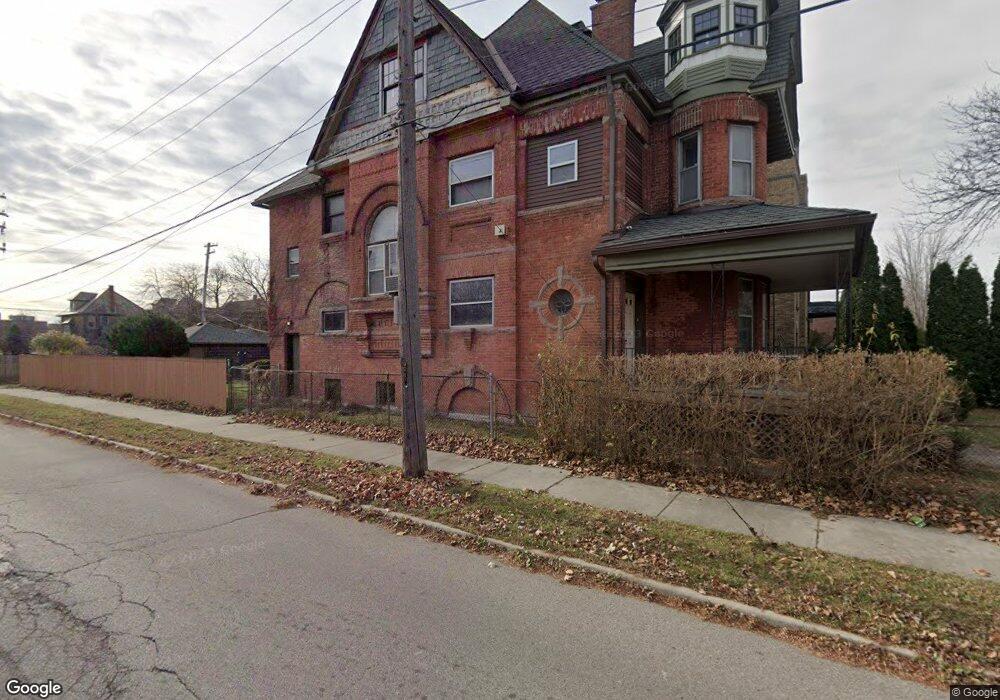
590 E Ferry St Detroit, MI 48202
Cultural Center NeighborhoodEstimated Value: $204,075 - $540,000
--
Bed
5
Baths
4,512
Sq Ft
$70/Sq Ft
Est. Value
About This Home
This home is located at 590 E Ferry St, Detroit, MI 48202 and is currently estimated at $317,019, approximately $70 per square foot. 590 E Ferry St is a home located in Wayne County with nearby schools including Golightly Education Center, Charles L. Spain Elementary-Middle School, and Edward 'Duke' Ellington Conservatory of Music and Art.
Ownership History
Date
Name
Owned For
Owner Type
Purchase Details
Closed on
Sep 13, 2022
Sold by
Wayne Jessica Lindsay
Bought by
Johns Robert Scott
Current Estimated Value
Purchase Details
Closed on
Apr 21, 2016
Sold by
Johns Robert Scott
Bought by
Lindsay Johns Robert Scott and Lindsay Wayne Jessica
Purchase Details
Closed on
Jul 24, 2015
Sold by
Townsend Jessica J and Myers Joseph E
Bought by
Johns Robert S
Create a Home Valuation Report for This Property
The Home Valuation Report is an in-depth analysis detailing your home's value as well as a comparison with similar homes in the area
Home Values in the Area
Average Home Value in this Area
Purchase History
| Date | Buyer | Sale Price | Title Company |
|---|---|---|---|
| Johns Robert Scott | -- | Premier Title | |
| Johns Robert Scott | -- | Premier Title | |
| Lindsay Johns Robert Scott | -- | None Available | |
| Johns Robert S | $110,000 | Title One Inc |
Source: Public Records
Tax History Compared to Growth
Tax History
| Year | Tax Paid | Tax Assessment Tax Assessment Total Assessment is a certain percentage of the fair market value that is determined by local assessors to be the total taxable value of land and additions on the property. | Land | Improvement |
|---|---|---|---|---|
| 2025 | $19 | $3,500 | $0 | $0 |
| 2024 | $19 | $800 | $0 | $0 |
| 2023 | $18 | $900 | $0 | $0 |
| 2022 | $2,227 | $101,600 | $0 | $0 |
| 2021 | $2,461 | $73,600 | $0 | $0 |
| 2020 | $2,432 | $68,200 | $0 | $0 |
| 2019 | $2,391 | $47,300 | $0 | $0 |
| 2018 | $1,997 | $43,500 | $0 | $0 |
| 2017 | $555 | $38,500 | $0 | $0 |
| 2016 | $2,293 | $193,800 | $0 | $0 |
| 2015 | $1,709 | $25,200 | $0 | $0 |
| 2013 | $1,656 | $29,845 | $0 | $0 |
| 2010 | -- | $43,757 | $926 | $42,831 |
Source: Public Records
Map
Nearby Homes
- 309 E Ferry St Unit 8
- 267 E Palmer St Unit 21
- 287 E Palmer St Unit 10
- 304 E Palmer St
- 275 E Palmer St
- 304 Hendrie St
- 238 Hendrie St
- 240 Hendrie St
- 404 Harper Ave
- 243 E Edsel Ford Fwy
- 416 Harper Ave
- 15 E Kirby St Unit 204
- 15 E Kirby St Unit 511
- 15 E Kirby St Unit 1231
- 4645 John R St Unit L
- 4645 John R St Unit 4
- 4645 John R St Unit G
- 571 E Edsel Ford Fwy
- 436 E Milwaukee St Unit 8
- 66 E Baltimore Ave
- 578 E Ferry St
- 587 E Kirby St
- 579 E Kirby St
- 609 E Kirby St Unit 100
- 609 E Kirby St Unit 301
- 609 E Kirby St Unit 109
- 609 E Kirby St Unit 205
- 609 E Kirby St Unit 203
- 609 E Kirby St Unit 108
- 609 E Kirby St Unit 207
- 609 E Kirby St Unit 208
- 609 E Kirby St Unit 107
- 609 E Kirby St Unit 201
- 609 E Kirby St Unit 300
- 609 E Kirby St Unit 209
- 575 E Kirby St
- 612 E Ferry St
- 567 E Kirby St
- 557 E Kirby St
- 614 E Ferry St