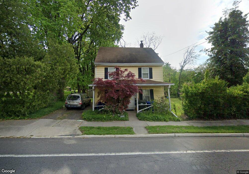
590 Main St Lumberton, NJ 08048
Estimated Value: $278,544 - $359,000
--
Bed
--
Bath
1,632
Sq Ft
$200/Sq Ft
Est. Value
About This Home
This home is located at 590 Main St, Lumberton, NJ 08048 and is currently estimated at $325,886, approximately $199 per square foot. 590 Main St is a home located in Burlington County with nearby schools including Ashbrook Elementary School, Bobby’s Run School, and Lumberton Middle School.
Ownership History
Date
Name
Owned For
Owner Type
Purchase Details
Closed on
Mar 17, 2003
Sold by
Highway 34 Investment Co
Bought by
Dietz Susan L
Current Estimated Value
Home Financials for this Owner
Home Financials are based on the most recent Mortgage that was taken out on this home.
Original Mortgage
$94,400
Interest Rate
5.93%
Mortgage Type
Purchase Money Mortgage
Purchase Details
Closed on
Jul 29, 2002
Sold by
Barthmaier James S and Barthmaier Beverly P
Bought by
Highway 34 Investment Co
Create a Home Valuation Report for This Property
The Home Valuation Report is an in-depth analysis detailing your home's value as well as a comparison with similar homes in the area
Home Values in the Area
Average Home Value in this Area
Purchase History
| Date | Buyer | Sale Price | Title Company |
|---|---|---|---|
| Dietz Susan L | $118,000 | Commonwealth Land Title Ins | |
| Highway 34 Investment Co | $38,100 | Commonwealth Land Title Ins |
Source: Public Records
Mortgage History
| Date | Status | Borrower | Loan Amount |
|---|---|---|---|
| Previous Owner | Dietz Susan L | $94,400 |
Source: Public Records
Tax History Compared to Growth
Tax History
| Year | Tax Paid | Tax Assessment Tax Assessment Total Assessment is a certain percentage of the fair market value that is determined by local assessors to be the total taxable value of land and additions on the property. | Land | Improvement |
|---|---|---|---|---|
| 2025 | $4,826 | $181,300 | $61,000 | $120,300 |
| 2024 | $4,538 | $181,300 | $61,000 | $120,300 |
| 2023 | $4,538 | $181,300 | $61,000 | $120,300 |
| 2022 | $4,433 | $181,300 | $61,000 | $120,300 |
| 2021 | $4,420 | $181,300 | $61,000 | $120,300 |
| 2020 | $4,382 | $181,300 | $61,000 | $120,300 |
| 2019 | $4,333 | $181,300 | $61,000 | $120,300 |
| 2018 | $4,268 | $181,300 | $61,000 | $120,300 |
| 2017 | $4,188 | $181,300 | $61,000 | $120,300 |
| 2016 | $4,097 | $181,300 | $61,000 | $120,300 |
| 2015 | $4,067 | $181,300 | $61,000 | $120,300 |
| 2014 | $3,912 | $181,300 | $61,000 | $120,300 |
Source: Public Records
Map
Nearby Homes
- 587 Main St
- 26 Chestnut St
- 485 Main St
- 15 Wellington Dr
- 10 Whitehaven Dr
- 23 Creek Rd
- 5 Middleton Dr
- 20 Jasmine Rd
- 71 Kingsbridge Dr
- 18 Azalea Dr
- 18 Westminster Dr
- 25 Sunflower Cir
- 44 Rockland Terrace
- 39 Bridge Rd
- 5 Beulah Ave
- 12 Bancroft Ln
- 511 Hamilton Ave
- 8 Hollybrook Ave
- 11 Abington Way
- 1476 Route 38 Unit 3