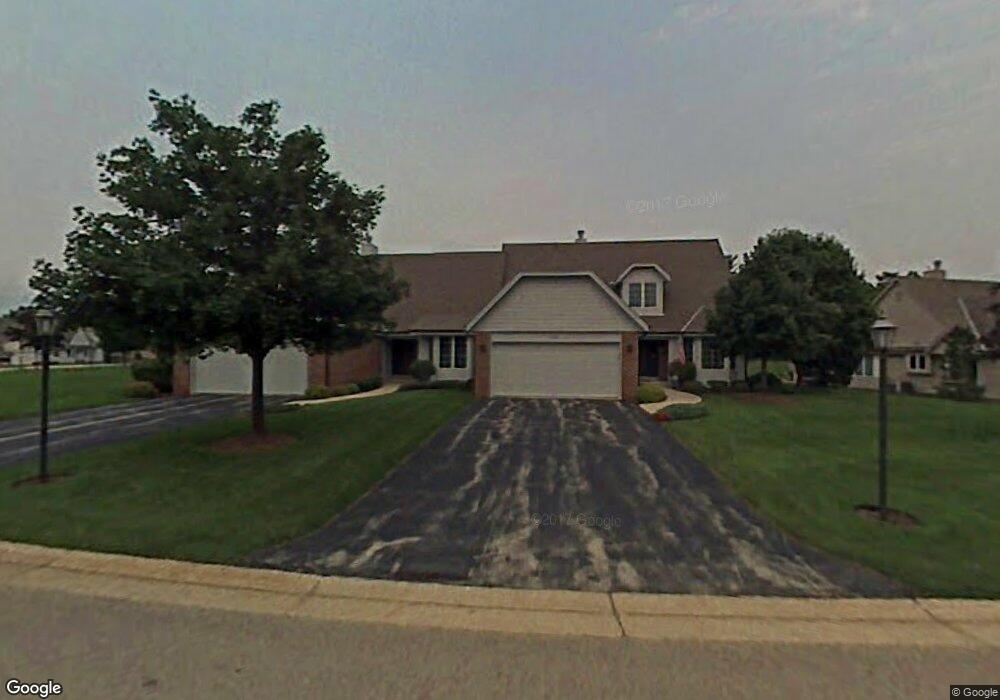
590 S Stonehedge Dr Unit B Brookfield, WI 53045
Estimated Value: $466,000 - $518,000
3
Beds
3
Baths
2,366
Sq Ft
$210/Sq Ft
Est. Value
About This Home
This home is located at 590 S Stonehedge Dr Unit B, Brookfield, WI 53045 and is currently estimated at $497,067, approximately $210 per square foot. 590 S Stonehedge Dr Unit B is a home located in Waukesha County with nearby schools including Hillcrest Elementary School, Horning Middle School, and South High School.
Ownership History
Date
Name
Owned For
Owner Type
Purchase Details
Closed on
Apr 24, 2017
Sold by
Maio Karl J and Maio Kathleen J
Bought by
The Karl J Malo And Kathleen J Malo Join
Current Estimated Value
Home Financials for this Owner
Home Financials are based on the most recent Mortgage that was taken out on this home.
Original Mortgage
$200,000
Outstanding Balance
$165,927
Interest Rate
4.1%
Mortgage Type
Purchase Money Mortgage
Estimated Equity
$331,140
Purchase Details
Closed on
Apr 7, 2017
Sold by
Vitale Amy
Bought by
Maio Karl J and Maio Kathleen J
Home Financials for this Owner
Home Financials are based on the most recent Mortgage that was taken out on this home.
Original Mortgage
$200,000
Outstanding Balance
$165,927
Interest Rate
4.1%
Mortgage Type
Purchase Money Mortgage
Estimated Equity
$331,140
Create a Home Valuation Report for This Property
The Home Valuation Report is an in-depth analysis detailing your home's value as well as a comparison with similar homes in the area
Home Values in the Area
Average Home Value in this Area
Purchase History
| Date | Buyer | Sale Price | Title Company |
|---|---|---|---|
| The Karl J Malo And Kathleen J Malo Join | -- | None Available | |
| Maio Karl J | $340,000 | None Available |
Source: Public Records
Mortgage History
| Date | Status | Borrower | Loan Amount |
|---|---|---|---|
| Open | Maio Karl J | $200,000 |
Source: Public Records
Tax History
| Year | Tax Paid | Tax Assessment Tax Assessment Total Assessment is a certain percentage of the fair market value that is determined by local assessors to be the total taxable value of land and additions on the property. | Land | Improvement |
|---|---|---|---|---|
| 2024 | $4,571 | $458,900 | $100,000 | $358,900 |
| 2023 | $4,567 | $458,900 | $100,000 | $358,900 |
| 2022 | $4,853 | $361,900 | $90,000 | $271,900 |
| 2021 | $4,913 | $361,900 | $90,000 | $271,900 |
| 2020 | $5,040 | $361,900 | $90,000 | $271,900 |
| 2019 | $4,952 | $361,900 | $90,000 | $271,900 |
| 2018 | $4,388 | $320,500 | $70,000 | $250,500 |
| 2017 | $5,167 | $320,500 | $70,000 | $250,500 |
| 2016 | $4,714 | $320,500 | $70,000 | $250,500 |
| 2015 | $4,488 | $320,500 | $70,000 | $250,500 |
| 2014 | $4,867 | $320,500 | $70,000 | $250,500 |
| 2013 | $4,867 | $320,500 | $70,000 | $250,500 |
Source: Public Records
Map
Nearby Homes
- 550 McPride Ln Unit B
- Lt1 Davidson Rd
- 19770 Foxkirk Ct
- 655 Mac Henry Cir Unit B
- 18785 Davidson Rd
- 675 Charleston Ct Unit B
- 18425 Emerald Dr Unit G
- 18925 Eagle Dr Unit 101
- 18925 Eagle Dr Unit 102
- 18925 Eagle Dr Unit 202
- 18925 Eagle Dr Unit 201
- 18535 Stonehedge Dr Unit A
- 165 Aerie Cir Unit 105
- 18710 Follett Dr Unit 502
- 18775 Brookfield Lake Dr Unit 8
- 18500 Brookfield Lake Dr Unit 74
- 18275 Brookfield Lake Dr Unit 93
- 18575 Brookfield Lake Dr Unit 61
- 860 Anthony Ln
- Lt0 Russet Dr
- 590 S Stonehedge Dr Unit A
- 585 S Stonehedge Dr Unit B
- 585 S Stonehedge Dr Unit A
- 630 S Stonehedge Dr Unit B
- 625 S Stonehedge Dr Unit A
- 625 S Stonehedge Dr Unit B
- 19475 Stonehedge Dr Unit B
- 19475 Stonehedge Dr Unit A
- 565 McPride Ln Unit B
- 565 McPride Ln Unit A
- 550 McPride Ln Unit A
- 660 S Stonehedge Dr Unit A
- 660 S Stonehedge Dr Unit B
- 655 S Stonehedge Dr Unit B
- 655 S Stonehedge Dr Unit A
- 19435 Stonehedge Dr Unit B
- 19435 Stonehedge Dr Unit A
- 19435 Stonehedge Dr Unit 19435
- 19450 Davidson Rd
- 535 McPride Ln Unit A