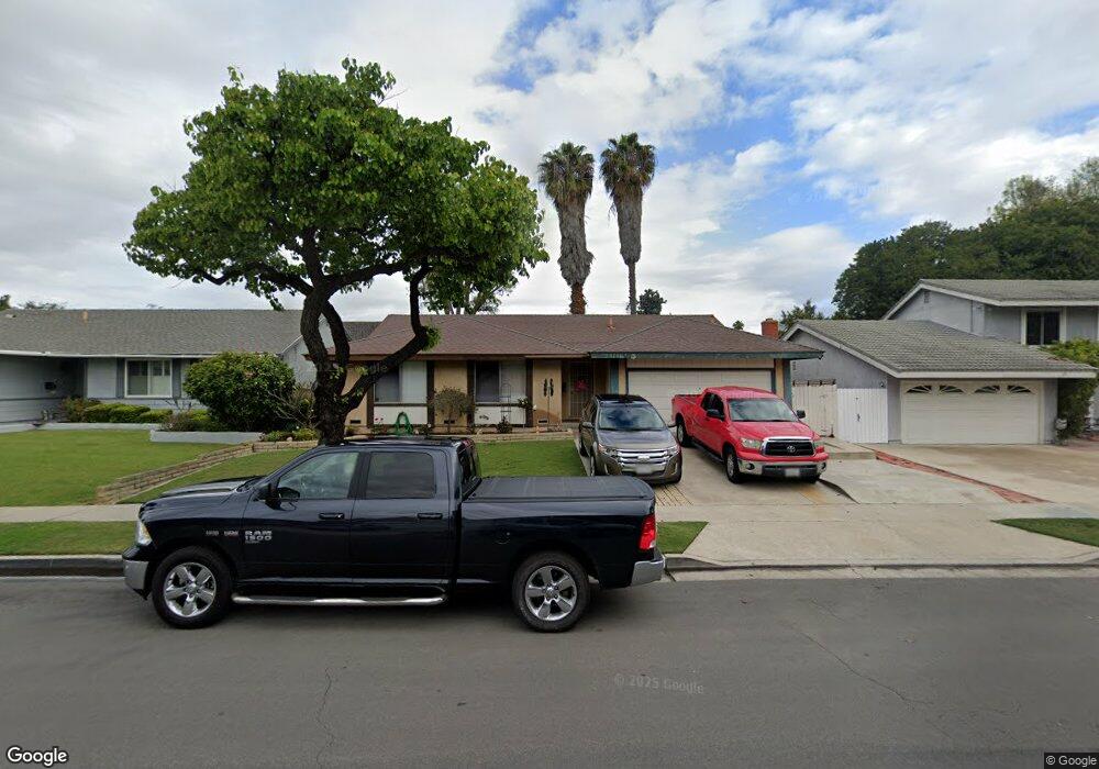
5901 Brannen Dr Huntington Beach, CA 92649
Estimated Value: $1,305,334 - $1,509,000
3
Beds
2
Baths
1,720
Sq Ft
$823/Sq Ft
Est. Value
About This Home
This home is located at 5901 Brannen Dr, Huntington Beach, CA 92649 and is currently estimated at $1,415,834, approximately $823 per square foot. 5901 Brannen Dr is a home located in Orange County with nearby schools including Hope View Elementary School, Marine View Middle, and Huntington Beach High School.
Ownership History
Date
Name
Owned For
Owner Type
Purchase Details
Closed on
Nov 17, 2015
Sold by
Hansen Edvin Peter and Hansen Joan Aagard
Bought by
Peter & Joan A Hansen Family Trust
Current Estimated Value
Purchase Details
Closed on
Nov 23, 2011
Sold by
Sokierko Emil
Bought by
Sokierko Emil and Emil Sokierko Trust
Create a Home Valuation Report for This Property
The Home Valuation Report is an in-depth analysis detailing your home's value as well as a comparison with similar homes in the area
Home Values in the Area
Average Home Value in this Area
Purchase History
| Date | Buyer | Sale Price | Title Company |
|---|---|---|---|
| Peter & Joan A Hansen Family Trust | -- | None Available | |
| Hansen Edvin Peter | -- | None Available | |
| Sokierko Emil | -- | None Available |
Source: Public Records
Tax History Compared to Growth
Tax History
| Year | Tax Paid | Tax Assessment Tax Assessment Total Assessment is a certain percentage of the fair market value that is determined by local assessors to be the total taxable value of land and additions on the property. | Land | Improvement |
|---|---|---|---|---|
| 2025 | $9,360 | $835,281 | $733,348 | $101,933 |
| 2024 | $9,360 | $818,903 | $718,968 | $99,935 |
| 2023 | $9,150 | $802,847 | $704,871 | $97,976 |
| 2022 | $9,018 | $787,105 | $691,050 | $96,055 |
| 2021 | $8,853 | $771,672 | $677,500 | $94,172 |
| 2020 | $8,754 | $763,760 | $670,553 | $93,207 |
| 2019 | $8,601 | $748,785 | $657,405 | $91,380 |
| 2018 | $8,407 | $734,103 | $644,514 | $89,589 |
| 2017 | $8,274 | $719,709 | $631,876 | $87,833 |
| 2016 | $7,932 | $705,598 | $619,487 | $86,111 |
| 2015 | $7,811 | $695,000 | $610,182 | $84,818 |
| 2014 | $5,003 | $434,387 | $358,851 | $75,536 |
Source: Public Records
Map
Nearby Homes
- 6051 Summerdale Dr
- 17071 Pinehurst Ln
- 17372 Forbes Ln
- 17231 Lido Ln
- 17042 Twain Ln
- 17532 Montbury Cir
- 6301 Warner Ave Unit 88
- 6301 Warner Ave Unit 40
- 5862 Raphael Dr
- 5812 Raphael Dr
- 16652 Busby Ln
- 6600 Warner Ave Unit 50
- 6600 Warner Ave
- 16542 Los Verdes Ln
- 5262 Glenroy Dr
- 5241 Glenroy Dr
- 6171 Kiser Dr
- 6292 Heil Ave
- 6672 Sun Dr Unit B
- 17202 Corbina Ln Unit 108
- 5921 Brannen Dr
- 5891 Brannen Dr
- 5931 Brannen Dr
- 5881 Brannen Dr
- 5902 Brannen Dr
- 5922 Brannen Dr
- 5941 Brannen Dr
- 5871 Brannen Dr
- 5892 Brannen Dr
- 17101 Springdale St
- 17101 Springdale St Unit 120
- 17101 Springdale St Unit 133
- 17101 Springdale St Unit 208
- 17101 Springdale St Unit 135
- 17101 Springdale St Unit 204
- 17101 Springdale St Unit 105
- 17101 Springdale St Unit 228
- 17101 Springdale St Unit 201
- 17101 Springdale St Unit 206
- 17101 Springdale St Unit 207