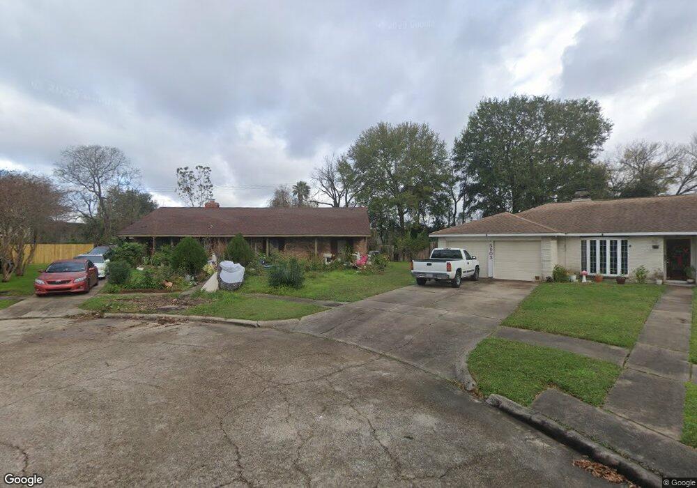
5902 Burning Tree Dr Houston, TX 77036
Sharpstown NeighborhoodEstimated Value: $307,102 - $319,000
4
Beds
2
Baths
2,041
Sq Ft
$154/Sq Ft
Est. Value
About This Home
This home is located at 5902 Burning Tree Dr, Houston, TX 77036 and is currently estimated at $313,776, approximately $153 per square foot. 5902 Burning Tree Dr is a home located in Harris County with nearby schools including Emerson Elementary School, Paul Revere Middle School, and Wisdom High School.
Ownership History
Date
Name
Owned For
Owner Type
Purchase Details
Closed on
Mar 23, 2019
Sold by
Kirkconnell Gail
Bought by
Kirkconnell Kamron
Current Estimated Value
Purchase Details
Closed on
Jun 29, 2000
Sold by
Brzozowski Lawrence Daniel
Bought by
Leal Juan and Flores Maria R
Home Financials for this Owner
Home Financials are based on the most recent Mortgage that was taken out on this home.
Original Mortgage
$98,901
Interest Rate
8.66%
Mortgage Type
Stand Alone First
Purchase Details
Closed on
Jun 19, 2000
Sold by
Brzozowski Lawrence Daniel
Bought by
Brzozowski Lawrence Daniel
Home Financials for this Owner
Home Financials are based on the most recent Mortgage that was taken out on this home.
Original Mortgage
$98,901
Interest Rate
8.66%
Mortgage Type
Stand Alone First
Create a Home Valuation Report for This Property
The Home Valuation Report is an in-depth analysis detailing your home's value as well as a comparison with similar homes in the area
Home Values in the Area
Average Home Value in this Area
Purchase History
| Date | Buyer | Sale Price | Title Company |
|---|---|---|---|
| Kirkconnell Kamron | -- | Capital Title | |
| Leal Juan | -- | American Title Co | |
| Brzozowski Lawrence Daniel | -- | American Title Co |
Source: Public Records
Mortgage History
| Date | Status | Borrower | Loan Amount |
|---|---|---|---|
| Previous Owner | Leal Juan | $98,901 |
Source: Public Records
Tax History
| Year | Tax Paid | Tax Assessment Tax Assessment Total Assessment is a certain percentage of the fair market value that is determined by local assessors to be the total taxable value of land and additions on the property. | Land | Improvement |
|---|---|---|---|---|
| 2025 | $355 | $294,749 | $82,008 | $212,741 |
| 2024 | $355 | $271,705 | $82,008 | $189,697 |
| 2023 | $355 | $297,806 | $82,008 | $215,798 |
| 2022 | $5,332 | $277,764 | $82,008 | $195,756 |
| 2021 | $4,951 | $246,015 | $73,221 | $172,794 |
| 2020 | $4,831 | $193,116 | $61,506 | $131,610 |
| 2019 | $5,041 | $193,116 | $61,506 | $131,610 |
| 2018 | $3,637 | $203,638 | $61,506 | $142,132 |
| 2017 | $4,591 | $200,864 | $61,506 | $139,358 |
| 2016 | $4,174 | $160,000 | $61,506 | $98,494 |
| 2015 | $2,835 | $170,000 | $61,506 | $108,494 |
| 2014 | $2,835 | $168,160 | $61,506 | $106,654 |
Source: Public Records
Map
Nearby Homes
- 8435 Sands Point Dr
- 8365 Sands Point Dr Unit 221
- 8359 Sands Point Dr Unit 218
- 8335 Sands Point Dr Unit 206
- 8275 Sands Point Dr Unit 176
- 8511 Hornwood Dr
- 8301 Sands Point Dr Unit 189
- 8267 Sands Point Dr Unit 172
- 8257 Sands Point Dr Unit 167
- 8030 Sands Point Dr Unit C
- 8030 Sands Point Dr Unit D
- 4001 Tanglewilde St Unit 1402
- 4001 Tanglewilde St Unit 1204
- 4001 Tanglewilde St Unit 1203
- 4001 Tanglewilde St Unit 1103
- 8149 Sands Point Dr Unit 113
- 3800 Tanglewilde St Unit 504
- 3800 Tanglewilde St Unit 109
- 3800 Tanglewilde St Unit 605
- 3800 Tanglewilde St Unit 803
- 5903 Burning Tree Dr
- 5904 Burning Tree Dr
- 5907 Burning Tree Dr
- 5910 Burning Tree Dr
- 5911 Burning Tree Dr
- 5907 Redding Rd
- 5911 Redding Rd
- 5902 Redding Rd
- 6002 Burning Tree Dr
- 6003 Redding Rd
- 6006 Burning Tree Dr
- 5904 Redding Rd
- 6005 Burning Tree Dr
- 5906 Redding Rd
- 6007 Redding Rd
- 8591 Sands Point Dr Unit 108
- 5910 Redding Rd
- 8589 Sands Point Dr Unit 107
- 8575 Sands Point Dr Unit 100
- 8599 Sands Point Dr Unit 112
Your Personal Tour Guide
Ask me questions while you tour the home.