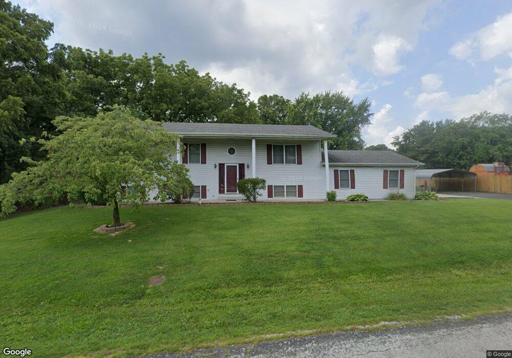
5902 Roach Rd Godfrey, IL 62035
Estimated Value: $247,000 - $262,000
3
Beds
2
Baths
1,152
Sq Ft
$221/Sq Ft
Est. Value
About This Home
This home is located at 5902 Roach Rd, Godfrey, IL 62035 and is currently estimated at $254,478, approximately $220 per square foot. 5902 Roach Rd is a home located in Madison County with nearby schools including Lewis & Clark Elementary School, Alton Middle School, and Alton High School.
Ownership History
Date
Name
Owned For
Owner Type
Purchase Details
Closed on
May 9, 2003
Sold by
File Alison C and File Alan J
Bought by
Curtis Darryle E
Current Estimated Value
Home Financials for this Owner
Home Financials are based on the most recent Mortgage that was taken out on this home.
Original Mortgage
$115,900
Outstanding Balance
$50,666
Interest Rate
5.87%
Mortgage Type
Unknown
Estimated Equity
$203,812
Create a Home Valuation Report for This Property
The Home Valuation Report is an in-depth analysis detailing your home's value as well as a comparison with similar homes in the area
Purchase History
| Date | Buyer | Sale Price | Title Company |
|---|---|---|---|
| Curtis Darryle E | $122,000 | -- |
Source: Public Records
Mortgage History
| Date | Status | Borrower | Loan Amount |
|---|---|---|---|
| Open | Curtis Darryle E | $115,900 |
Source: Public Records
Tax History
| Year | Tax Paid | Tax Assessment Tax Assessment Total Assessment is a certain percentage of the fair market value that is determined by local assessors to be the total taxable value of land and additions on the property. | Land | Improvement |
|---|---|---|---|---|
| 2024 | $4,668 | $75,240 | $8,610 | $66,630 |
| 2023 | $4,668 | $69,460 | $7,950 | $61,510 |
| 2022 | $4,427 | $63,520 | $7,270 | $56,250 |
| 2021 | $4,001 | $59,740 | $6,840 | $52,900 |
| 2020 | $3,920 | $58,450 | $6,690 | $51,760 |
| 2019 | $4,005 | $56,930 | $6,520 | $50,410 |
| 2018 | $3,938 | $54,500 | $6,240 | $48,260 |
| 2017 | $3,755 | $54,500 | $6,240 | $48,260 |
| 2016 | $3,648 | $54,500 | $6,240 | $48,260 |
| 2015 | $3,269 | $52,780 | $6,040 | $46,740 |
| 2014 | $3,269 | $52,780 | $6,040 | $46,740 |
| 2013 | $3,269 | $52,780 | $6,040 | $46,740 |
Source: Public Records
Map
Nearby Homes
- 611 Saint Rose Dr
- 5667 Humbert Rd
- 0 Humbert Rd Unit MIS25052876
- 4821 Wick Mor Dr
- 4832 Bambi Dr
- 5205 Wickway Dr
- 00 Pine Ridge Lot#52 Dr
- 208 Pine Ridge Dr
- 201 Pine Ridge Dr
- 4803 Azalea Place Unit 1
- 4709 Snow White Terrace
- 4715 Richland Woods Ct
- 406 Celesta St Unit 91
- 801 Stamper Ln
- 5214 Willis Ave Unit 201
- 2304 Fontaine Dr
- 4443 Delta Queen Ln
- Tbd Godfrey Rd
- 0 Montclair Hwy 255 Unit MIS26010866
- 0 Montclair Hwy 255 Unit MIS26012707
- 5906 Roach Rd
- 408 Saint Anthony Dr
- 5910 Roach Rd
- 406 Saint Anthony Dr
- 410 Saint Anthony Dr
- 5914 Roach Rd
- 5816 Roach Rd
- 404 Saint Anthony Dr
- 409 Saint Anthony Dr
- 5920 Roach Rd
- 407 Saint Anthony Dr
- 405 Saint Anthony Dr
- 403 Saint Anthony Dr
- 5924 Roach Rd
- 400 Saint Anthony Dr
- 5811 Roach Rd
- 406 Saint Rose Dr
- 404 Saint Rose Dr
- 401 Saint Anthony Dr
- 402 Saint Rose Dr
Your Personal Tour Guide
Ask me questions while you tour the home.