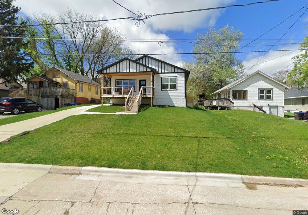
5902 SW 5th St Des Moines, IA 50315
South Central DSM NeighborhoodEstimated Value: $287,000 - $344,080
3
Beds
3
Baths
1,523
Sq Ft
$203/Sq Ft
Est. Value
About This Home
This home is located at 5902 SW 5th St, Des Moines, IA 50315 and is currently estimated at $308,770, approximately $202 per square foot. 5902 SW 5th St is a home located in Polk County with nearby schools including South Union Elementary School, Mccombs Middle School, and Lincoln High School.
Ownership History
Date
Name
Owned For
Owner Type
Purchase Details
Closed on
Dec 30, 2020
Sold by
11T Ia Llc
Bought by
Ceballos Enrique Avila
Current Estimated Value
Purchase Details
Closed on
Nov 12, 2020
Sold by
Kilian Land Highlands Llc
Bought by
Lit Ia Llc
Purchase Details
Closed on
Oct 16, 2020
Sold by
County Of Polk
Bought by
Kilian Land Holdings Llc
Purchase Details
Closed on
Oct 13, 2020
Sold by
Polk County Bank
Bought by
Kilian Land Holdings Llc
Create a Home Valuation Report for This Property
The Home Valuation Report is an in-depth analysis detailing your home's value as well as a comparison with similar homes in the area
Home Values in the Area
Average Home Value in this Area
Purchase History
| Date | Buyer | Sale Price | Title Company |
|---|---|---|---|
| Ceballos Enrique Avila | $19,500 | None Available | |
| Lit Ia Llc | -- | None Available | |
| 11T Ia Llc | -- | None Listed On Document | |
| Kilian Land Holdings Llc | $834 | None Available | |
| Kilian Land Holdings Llc | -- | None Listed On Document |
Source: Public Records
Tax History Compared to Growth
Tax History
| Year | Tax Paid | Tax Assessment Tax Assessment Total Assessment is a certain percentage of the fair market value that is determined by local assessors to be the total taxable value of land and additions on the property. | Land | Improvement |
|---|---|---|---|---|
| 2025 | $564 | $419,400 | $40,900 | $378,500 |
| 2024 | $564 | $28,700 | $28,700 | $0 |
| 2023 | $556 | $28,700 | $28,700 | $0 |
| 2022 | $1,246 | $23,600 | $23,600 | $0 |
| 2021 | $1,166 | $53,300 | $29,500 | $23,800 |
| 2020 | $1,562 | $46,700 | $25,900 | $20,800 |
| 2019 | $6,387 | $46,700 | $25,900 | $20,800 |
| 2018 | $1,393 | $41,400 | $22,800 | $18,600 |
| 2017 | $786 | $41,400 | $22,800 | $18,600 |
| 2016 | $762 | $37,600 | $20,700 | $16,900 |
| 2015 | $762 | $37,600 | $20,700 | $16,900 |
| 2014 | $728 | $36,100 | $19,800 | $16,300 |
Source: Public Records
Map
Nearby Homes
- 5812 SW 5th St
- 5814 SW 3rd St
- 5936 SW 2nd St
- 6204 SW 5th St
- 303 Porter Ave
- 5402 SW 8th St
- 5407 SW 9th St
- 5501 S Union St
- 1010 Frederick Ave
- 217 E Payton Ave
- 520 Hackley Ave
- 299 Hackley Ave
- 1210 Highview Dr
- 313 E Payton Ave
- 212 Titus Ave
- 1029 Bundy St
- 5600 SE 4th St
- 401 E Wall Ave
- 1207 Kenyon Ave
- 1304 Wall Ave