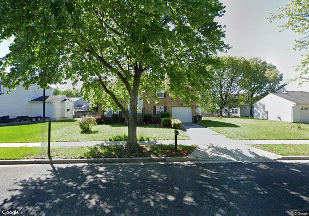
5903 Plata St Clinton, MD 20735
Estimated Value: $431,000 - $446,300
Studio
3
Baths
1,144
Sq Ft
$386/Sq Ft
Est. Value
About This Home
This home is located at 5903 Plata St, Clinton, MD 20735 and is currently estimated at $441,075, approximately $385 per square foot. 5903 Plata St is a home located in Prince George's County with nearby schools including James Ryder Randall Elementary School, Stephen Decatur Middle School, and Surrattsville High School.
Ownership History
Date
Name
Owned For
Owner Type
Purchase Details
Closed on
Oct 19, 2022
Sold by
Rogers Patricia Marie
Bought by
Patricia Marie Rogers Revocable Living Trust
Current Estimated Value
Purchase Details
Closed on
Oct 17, 2001
Sold by
Hudson Reginald D
Bought by
Smith Vincent E and Smith Angela
Purchase Details
Closed on
Jun 4, 1993
Sold by
Taylor Ralph L and Taylor Linda R
Bought by
Hudson Reginald D and Hudson Grenda C
Create a Home Valuation Report for This Property
The Home Valuation Report is an in-depth analysis detailing your home's value as well as a comparison with similar homes in the area
Home Values in the Area
Average Home Value in this Area
Purchase History
| Date | Buyer | Sale Price | Title Company |
|---|---|---|---|
| Patricia Marie Rogers Revocable Living Trust | -- | -- | |
| Patricia Marie Rogers Revocable Living Trust | -- | None Listed On Document | |
| Smith Vincent E | $178,500 | -- | |
| Hudson Reginald D | $153,000 | -- |
Source: Public Records
Tax History
| Year | Tax Paid | Tax Assessment Tax Assessment Total Assessment is a certain percentage of the fair market value that is determined by local assessors to be the total taxable value of land and additions on the property. | Land | Improvement |
|---|---|---|---|---|
| 2025 | $5,084 | $378,500 | $101,100 | $277,400 |
| 2024 | $5,084 | $364,300 | -- | -- |
| 2023 | $4,972 | $350,100 | $0 | $0 |
| 2022 | $4,767 | $335,900 | $101,100 | $234,800 |
| 2021 | $4,604 | $329,333 | $0 | $0 |
| 2020 | $4,547 | $322,767 | $0 | $0 |
| 2019 | $4,464 | $316,200 | $100,500 | $215,700 |
| 2018 | $4,269 | $291,200 | $0 | $0 |
| 2017 | $4,096 | $266,200 | $0 | $0 |
| 2016 | -- | $241,200 | $0 | $0 |
| 2015 | $3,678 | $238,400 | $0 | $0 |
| 2014 | $3,678 | $235,600 | $0 | $0 |
Source: Public Records
Map
Nearby Homes
- 6004 Butterfield Dr
- 6003 Plata St
- 6005 Plata St
- 5715 Butterfield Dr
- 6106 Manor Rd
- 6316 Springbrook Ln
- 5801 San Juan Dr
- 5704 San Juan Dr
- 5913 Woodland Ln
- 8907 Chad Way
- 8831 Hardesty Dr
- 5415 Kirby Rd
- 9100 Hardesty Dr
- 5209 Sumter Ct
- 9146 Hardesty Dr
- 8605 Sumter Ln
- 9003 Woodyard Rd
- 5210 Vienna Dr
- 7400 Pembroke Dr
- 9003 Anna Dr
- 5905 Plata St
- 5901 Plata St
- 8003 Maxfield Ct
- 8005 Maxfield Ct
- 8007 Maxfield Ct
- 5907 Plata St
- 8009 Maxfield Ct
- 5900 Plata St
- 5902 Plata St
- 5904 Plata St
- 5909 Plata St
- 5906 Plata St
- 8301 Joan Place
- 8103 Maxfield Dr
- 5817 Plata St
- 8004 Maxfield Ct
- 5908 Plata St
- 8006 Maxfield Ct
- 8008 Maxfield Ct
- 8100 Maxfield Dr
Your Personal Tour Guide
Ask me questions while you tour the home.