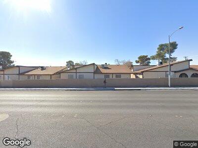
5905 Smoke Ranch Rd Unit D Las Vegas, NV 89108
Michael Way NeighborhoodEstimated Value: $194,644 - $209,000
2
Beds
1
Bath
844
Sq Ft
$238/Sq Ft
Est. Value
About This Home
This home is located at 5905 Smoke Ranch Rd Unit D, Las Vegas, NV 89108 and is currently estimated at $200,661, approximately $237 per square foot. 5905 Smoke Ranch Rd Unit D is a home located in Clark County with nearby schools including Bertha Ronzone Elementary School, J. Harold Brinley Middle School, and Western High School.
Ownership History
Date
Name
Owned For
Owner Type
Purchase Details
Closed on
Jun 16, 2005
Sold by
Sell Michael C
Bought by
Valdez Cruz
Current Estimated Value
Home Financials for this Owner
Home Financials are based on the most recent Mortgage that was taken out on this home.
Original Mortgage
$88,000
Interest Rate
5.46%
Mortgage Type
Fannie Mae Freddie Mac
Purchase Details
Closed on
Apr 30, 2001
Sold by
Ashford Park Llc
Bought by
Sell Michael C
Home Financials for this Owner
Home Financials are based on the most recent Mortgage that was taken out on this home.
Original Mortgage
$59,073
Interest Rate
6.89%
Mortgage Type
FHA
Create a Home Valuation Report for This Property
The Home Valuation Report is an in-depth analysis detailing your home's value as well as a comparison with similar homes in the area
Home Values in the Area
Average Home Value in this Area
Purchase History
| Date | Buyer | Sale Price | Title Company |
|---|---|---|---|
| Valdez Cruz | $125,000 | Old Republic Title Co Of Nv | |
| Sell Michael C | $60,000 | Stewart Title |
Source: Public Records
Mortgage History
| Date | Status | Borrower | Loan Amount |
|---|---|---|---|
| Previous Owner | Valdez Cruz | $88,000 | |
| Previous Owner | Sell Michael C | $59,073 |
Source: Public Records
Tax History Compared to Growth
Tax History
| Year | Tax Paid | Tax Assessment Tax Assessment Total Assessment is a certain percentage of the fair market value that is determined by local assessors to be the total taxable value of land and additions on the property. | Land | Improvement |
|---|---|---|---|---|
| 2025 | $552 | $29,152 | $16,100 | $13,052 |
| 2024 | $511 | $29,152 | $16,100 | $13,052 |
| 2023 | $340 | $25,827 | $13,300 | $12,527 |
| 2022 | $474 | $23,033 | $10,850 | $12,183 |
| 2021 | $439 | $20,691 | $10,500 | $10,191 |
| 2020 | $405 | $19,304 | $8,400 | $10,904 |
| 2019 | $379 | $16,960 | $5,950 | $11,010 |
| 2018 | $362 | $15,613 | $4,900 | $10,713 |
| 2017 | $518 | $15,227 | $4,900 | $10,327 |
| 2016 | $340 | $14,715 | $3,850 | $10,865 |
| 2015 | $338 | $13,116 | $3,150 | $9,966 |
| 2014 | $328 | $9,783 | $3,150 | $6,633 |
Source: Public Records
Map
Nearby Homes
- 2349 N Mallard St
- 5921 San Fernando Dr
- 2499 N Jones Blvd
- 2349 Cardiff Ln Unit B
- 5804 Balzar Ave
- 5800 Balzar Ave
- 5638 Alfred Dr
- 5600 W Bartlett Ave
- 2349 Wooster Cir Unit A
- 2301 Maverick St
- 6104 Daisy Lee Ave
- 6117 Daisy Lee Ave
- 6231 Santa Maria Ave
- 5536 Cleary Ct
- 5505 Reiter Ave
- 6204 Robin Hood Cir
- 6149 Ethel May Ave
- 2720 Mickey Mantle Ct
- 2031 San Simeon St
- 2512 Rialto Rd
- 5905 Smoke Ranch Rd Unit D
- 5905 Smoke Ranch Rd Unit C
- 5909 Smoke Ranch Rd Unit D
- 5909 Smoke Ranch Rd Unit C
- 5909 Smoke Ranch Rd Unit B
- 5909 Smoke Ranch Rd Unit A
- 5901 Smoke Ranch Rd Unit C
- 5901 Smoke Ranch Rd Unit A
- 5901 Smoke Ranch Rd Unit B
- 5901 Smoke Ranch Rd Unit D
- 5913 Smoke Ranch Rd Unit D
- 5913 Smoke Ranch Rd Unit C
- 5913 Smoke Ranch Rd Unit B
- 5913 Smoke Ranch Rd Unit A
- 5917 Smoke Ranch Rd Unit D
- 5917 Smoke Ranch Rd Unit A
- 5917 Smoke Ranch Rd Unit B
- 5917 Smoke Ranch Rd Unit C
- 5921 Smoke Ranch Rd Unit D
- 5921 Smoke Ranch Rd Unit A