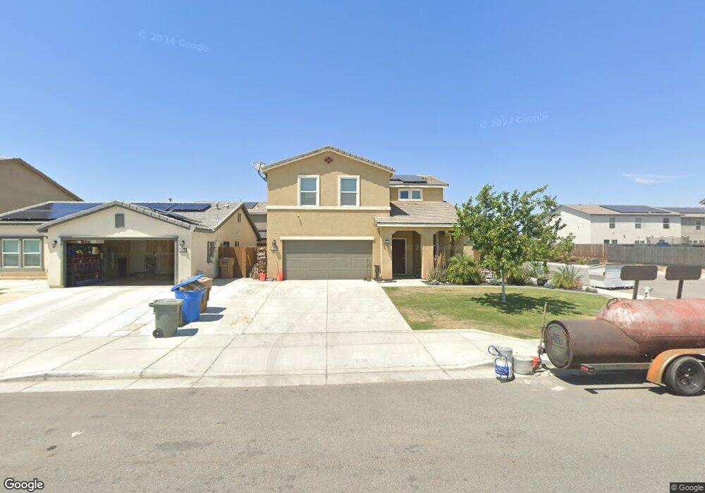
5906 Commonwealth Ave Unit Lot12 Bakersfield, CA 93313
Panama NeighborhoodEstimated Value: $416,262 - $427,000
4
Beds
3
Baths
1,865
Sq Ft
$226/Sq Ft
Est. Value
About This Home
This home is located at 5906 Commonwealth Ave Unit Lot12, Bakersfield, CA 93313 and is currently estimated at $422,066, approximately $226 per square foot. 5906 Commonwealth Ave Unit Lot12 is a home located in Kern County with nearby schools including Panama Elementary School, Stonecreek Junior High School, and Ridgeview High School.
Ownership History
Date
Name
Owned For
Owner Type
Purchase Details
Closed on
Jul 2, 2025
Sold by
Armstrong Michael
Bought by
Leon Daniel and Gomez Alma Consuelo
Current Estimated Value
Home Financials for this Owner
Home Financials are based on the most recent Mortgage that was taken out on this home.
Original Mortgage
$412,392
Outstanding Balance
$411,694
Interest Rate
6.85%
Mortgage Type
FHA
Estimated Equity
$10,372
Purchase Details
Closed on
Nov 28, 2018
Sold by
Armstrong Judith
Bought by
Armstrong Michael
Home Financials for this Owner
Home Financials are based on the most recent Mortgage that was taken out on this home.
Original Mortgage
$260,988
Interest Rate
4.87%
Mortgage Type
FHA
Purchase Details
Closed on
Nov 12, 2018
Sold by
Western Pacific Housing Inc
Bought by
Armstrong Michael
Home Financials for this Owner
Home Financials are based on the most recent Mortgage that was taken out on this home.
Original Mortgage
$260,988
Interest Rate
4.87%
Mortgage Type
FHA
Create a Home Valuation Report for This Property
The Home Valuation Report is an in-depth analysis detailing your home's value as well as a comparison with similar homes in the area
Home Values in the Area
Average Home Value in this Area
Purchase History
| Date | Buyer | Sale Price | Title Company |
|---|---|---|---|
| Leon Daniel | $420,000 | Chicago Title Company | |
| Armstrong Michael | -- | Fidelity National Title Co | |
| Armstrong Michael | $285,000 | Fidelity National Title Co |
Source: Public Records
Mortgage History
| Date | Status | Borrower | Loan Amount |
|---|---|---|---|
| Open | Leon Daniel | $412,392 | |
| Previous Owner | Armstrong Michael | $260,988 |
Source: Public Records
Tax History Compared to Growth
Tax History
| Year | Tax Paid | Tax Assessment Tax Assessment Total Assessment is a certain percentage of the fair market value that is determined by local assessors to be the total taxable value of land and additions on the property. | Land | Improvement |
|---|---|---|---|---|
| 2025 | $4,480 | $317,918 | $66,929 | $250,989 |
| 2024 | $4,480 | $311,685 | $65,617 | $246,068 |
| 2023 | $4,405 | $305,575 | $64,331 | $241,244 |
| 2022 | $4,227 | $299,584 | $63,070 | $236,514 |
| 2021 | $4,101 | $293,711 | $61,834 | $231,877 |
| 2020 | $4,045 | $290,700 | $61,200 | $229,500 |
| 2019 | $4,122 | $290,700 | $61,200 | $229,500 |
| 2018 | $737 | $55,000 | $55,000 | $0 |
Source: Public Records
Map
Nearby Homes
- 5831 Mardal Ave
- 5808 Esmerelda Ave
- 6021 Bogart Dr
- 6028 Bogart Dr
- 6200 Whaleback Ave
- 6230 Taft Hwy
- 9402 Cobble Mountain Rd
- 9623 Kanosh Cobble Dr
- 9301 Cobble Mountain Rd
- 6115 Cape Cod Ave
- 6201 Cape Cod Ave
- 6225 Thorton Ave
- 6310 Thorton Ave
- 6040 Samuelson St
- 5103 Green Clover Ave
- 9003 Great Harvest Dr
- 5815 Pearl Ridge Dr
- 4620 Taft Hwy
- 5400 Saddleback Ridge Ct
- 5518 Coburn Ridge Ct
- 5902 Commonwealth Ave Unit Lot13
- 5910 Commonwealth Ave Unit Lot13
- 5910 Commonwealth Ave
- 5903 Mardal Ave Unit 35
- 5903 Mardal Ave
- 5914 Commonwealth Ave Unit Lot14
- 5914 Commonwealth Ave
- 5907 Mardal Ave Unit 36
- 5907 Mardal Ave
- 5903 Commonwealth Ave
- 5911 Mardal Ave Unit 37
- 5911 Mardal Ave
- 5828 Commonwealth Ave
- 5918 Commonwealth Ave Unit Lot15
- 5918 Commonwealth Ave
- 5907 Commonwealth Ave Unit Lot28
- 5907 Commonwealth Ave
- 5831 Mardal Ave Unit 34
- 5833 Commonwealth Ave Unit Lot30
- 5833 Commonwealth Ave