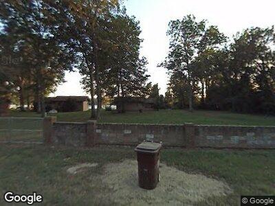
5906 Knotts Island Rd Unit A Altheimer, AR 72004
Estimated Value: $47,095 - $389,000
--
Bed
1
Bath
576
Sq Ft
$280/Sq Ft
Est. Value
About This Home
This home is located at 5906 Knotts Island Rd Unit A, Altheimer, AR 72004 and is currently estimated at $161,365, approximately $280 per square foot. 5906 Knotts Island Rd Unit A is a home located in Jefferson County with nearby schools including Matthews Elementary School, Robert F. Morehead Middle School, and Dollarway High School.
Ownership History
Date
Name
Owned For
Owner Type
Purchase Details
Closed on
Mar 31, 2022
Sold by
Not Available From County
Bought by
Mckinney Brian and Dial Stacey Lee
Current Estimated Value
Purchase Details
Closed on
Jan 12, 2015
Sold by
Viralene Viralene
Bought by
Coleman Ronald A
Purchase Details
Closed on
Apr 22, 2011
Sold by
Coleman Ronald A
Bought by
Coleman Viralene
Purchase Details
Closed on
Aug 20, 2003
Bought by
Coleman Ronald A
Purchase Details
Closed on
May 2, 2001
Bought by
Coleman Viralene
Purchase Details
Closed on
Feb 7, 1989
Bought by
Coleman Elijah
Create a Home Valuation Report for This Property
The Home Valuation Report is an in-depth analysis detailing your home's value as well as a comparison with similar homes in the area
Home Values in the Area
Average Home Value in this Area
Purchase History
| Date | Buyer | Sale Price | Title Company |
|---|---|---|---|
| Mckinney Brian | $20,000 | -- | |
| Coleman Ronald A | -- | -- | |
| Coleman Viralene | -- | -- | |
| Coleman Ronald A | -- | -- | |
| Coleman Viralene | -- | -- | |
| Coleman Elijah | $3,000 | -- |
Source: Public Records
Tax History Compared to Growth
Tax History
| Year | Tax Paid | Tax Assessment Tax Assessment Total Assessment is a certain percentage of the fair market value that is determined by local assessors to be the total taxable value of land and additions on the property. | Land | Improvement |
|---|---|---|---|---|
| 2024 | $237 | $4,130 | $2,880 | $1,250 |
| 2023 | $237 | $6,750 | $5,500 | $1,250 |
| 2022 | $248 | $4,910 | $3,750 | $1,160 |
| 2021 | $248 | $4,910 | $3,750 | $1,160 |
| 2020 | $256 | $5,070 | $3,750 | $1,320 |
| 2019 | $256 | $6,890 | $3,750 | $3,140 |
| 2018 | $348 | $6,890 | $3,750 | $3,140 |
| 2017 | $347 | $6,690 | $2,880 | $3,810 |
| 2016 | $397 | $6,690 | $2,880 | $3,810 |
| 2015 | $397 | $7,900 | $2,880 | $5,020 |
| 2014 | $347 | $7,900 | $2,880 | $5,020 |
Source: Public Records
Map
Nearby Homes
- 213 Us Highway 425 S
- 3111 Holiday Dr
- 3223 Canal Dr
- 109 S Olive St
- 2804 Claremont Ave
- 2713 Claremont Ave
- 2706 Claremont Ave
- 206 N Division St
- 904 Belmont Dr
- 2700 Auburn Dr
- 1503 Collins Dr
- 2221 E 6th Ave
- 1210 Brentwood Dr
- 1306 Boston Dr
- 1204 Bloomfield Dr
- 1607 Belmoor Dr
- 1718 E 5th Ave
- 5801,05,07 Womack
- 000 S 65 Hwy
- 00 NE Corner Hwy 65 425-81
