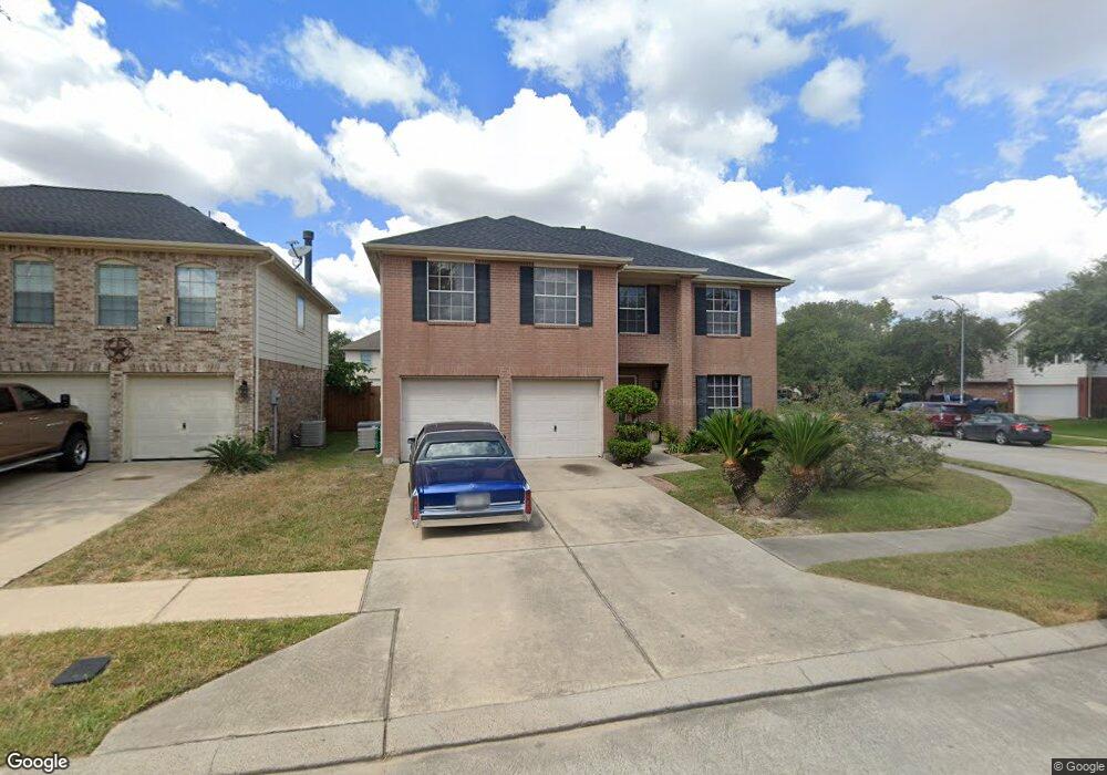
5906 Stirring Winds Ln Houston, TX 77086
North Houston NeighborhoodEstimated Value: $278,075 - $308,000
5
Beds
3
Baths
2,654
Sq Ft
$109/Sq Ft
Est. Value
About This Home
This home is located at 5906 Stirring Winds Ln, Houston, TX 77086 and is currently estimated at $290,269, approximately $109 per square foot. 5906 Stirring Winds Ln is a home located in Harris County with nearby schools including Kujawa EC/Pre-K/K School, Wilson Intermediate School, and Shotwell Middle School.
Ownership History
Date
Name
Owned For
Owner Type
Purchase Details
Closed on
Dec 2, 2005
Sold by
Mayes Austin J and Collins Wilber
Bought by
Beal Carolyn
Current Estimated Value
Home Financials for this Owner
Home Financials are based on the most recent Mortgage that was taken out on this home.
Original Mortgage
$101,600
Outstanding Balance
$56,270
Interest Rate
6.12%
Mortgage Type
Fannie Mae Freddie Mac
Estimated Equity
$233,999
Purchase Details
Closed on
Jun 6, 2002
Sold by
Kb Home Lone Star Lp
Bought by
Mayes Austin J and Collins Wilber
Home Financials for this Owner
Home Financials are based on the most recent Mortgage that was taken out on this home.
Original Mortgage
$138,100
Interest Rate
6.77%
Mortgage Type
FHA
Create a Home Valuation Report for This Property
The Home Valuation Report is an in-depth analysis detailing your home's value as well as a comparison with similar homes in the area
Home Values in the Area
Average Home Value in this Area
Purchase History
| Date | Buyer | Sale Price | Title Company |
|---|---|---|---|
| Beal Carolyn | -- | Startex 07 Title Company | |
| Mayes Austin J | -- | First American Title |
Source: Public Records
Mortgage History
| Date | Status | Borrower | Loan Amount |
|---|---|---|---|
| Open | Beal Carolyn | $101,600 | |
| Previous Owner | Mayes Austin J | $138,100 |
Source: Public Records
Tax History Compared to Growth
Tax History
| Year | Tax Paid | Tax Assessment Tax Assessment Total Assessment is a certain percentage of the fair market value that is determined by local assessors to be the total taxable value of land and additions on the property. | Land | Improvement |
|---|---|---|---|---|
| 2025 | $4,275 | $263,330 | $37,876 | $225,454 |
| 2024 | $4,275 | $276,012 | $37,876 | $238,136 |
| 2023 | $4,275 | $276,012 | $38,688 | $237,324 |
| 2022 | $4,894 | $247,408 | $29,760 | $217,648 |
| 2021 | $4,439 | $202,356 | $29,760 | $172,596 |
| 2020 | $4,486 | $178,000 | $29,760 | $148,240 |
| 2019 | $4,240 | $183,644 | $20,832 | $162,812 |
| 2018 | $1,613 | $163,339 | $20,832 | $142,507 |
| 2017 | $3,379 | $163,339 | $20,832 | $142,507 |
| 2016 | $3,072 | $154,503 | $20,832 | $133,671 |
| 2015 | $2,224 | $138,124 | $20,832 | $117,292 |
| 2014 | $2,224 | $115,543 | $20,832 | $94,711 |
Source: Public Records
Map
Nearby Homes
- 5914 Stirring Winds Ln
- 12623 Ann Louise Rd
- 00 Essie Rd
- 10730 Antoine Dr
- 6411 Halstead Meadows Cir
- 3265 Frick Rd
- 3127 Frick Rd
- 00 Romona Blvd
- 6622 Sutton Meadows Dr
- 10214 Trade Winds Dr
- 6706 Redding Springs Ln
- 6703 Deer Ridge Ln
- 13308 Ann Louise Rd
- 10306 Jillana Kaye Dr
- 0 Tomball Pkwy
- 2838 Packard Elm St
- 5930 Killough St
- 2835 Oakland Brook St
- 6830 Desert Rose Ln
- 2831 Oakland Brook St
- 5910 Stirring Winds Ln
- 5915 Drenner Park Ln
- 5919 Drenner Park Ln
- 5823 Sattler Park Dr
- 5819 Sattler Park Dr
- 5918 Stirring Winds Ln
- 5923 Drenner Park Ln
- 5815 Sattler Park Dr
- 5827 Sattler Park Dr
- 5907 Stirring Winds Ln
- 5911 Stirring Winds Ln
- 5903 Stirring Winds Ln
- 5811 Sattler Park Dr
- 5915 Stirring Winds Ln
- 5831 Sattler Park Dr
- 5927 Drenner Park Ln
- 5922 Stirring Winds Ln
- 5919 Stirring Winds Ln
- 5807 Sattler Park Dr
- 5931 Drenner Park Ln