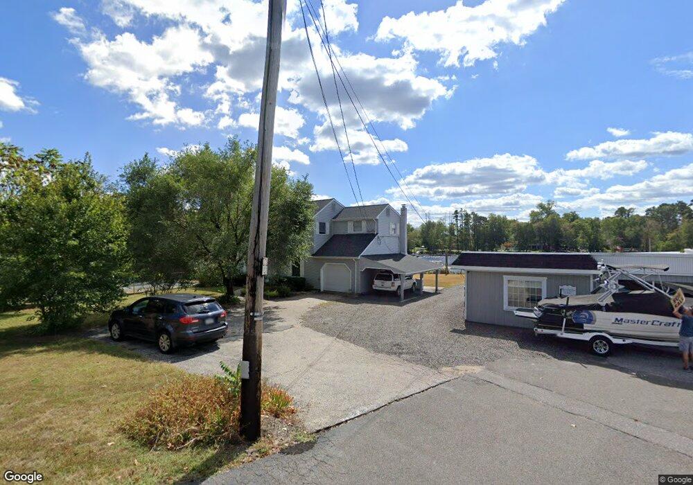
5908 Route 617 Mays Landing, NJ 08330
Estimated Value: $314,000 - $401,000
3
Beds
3
Baths
1,650
Sq Ft
$225/Sq Ft
Est. Value
About This Home
This home is located at 5908 Route 617, Mays Landing, NJ 08330 and is currently estimated at $371,610, approximately $225 per square foot. 5908 Route 617 is a home located in Atlantic County with nearby schools including Joseph Shaner School, George L. Hess Educational Complex, and William Davies Middle School.
Ownership History
Date
Name
Owned For
Owner Type
Purchase Details
Closed on
Sep 24, 2007
Sold by
Seigfried Jason
Bought by
Seigfried Jason and Seigfried Doris
Current Estimated Value
Purchase Details
Closed on
Oct 8, 1998
Sold by
Harris Thomas R
Bought by
Seigfried Jason
Home Financials for this Owner
Home Financials are based on the most recent Mortgage that was taken out on this home.
Original Mortgage
$137,200
Interest Rate
6.46%
Purchase Details
Closed on
Jul 21, 1993
Sold by
Carll William B
Bought by
Carll William B and Carll Cecelia M
Create a Home Valuation Report for This Property
The Home Valuation Report is an in-depth analysis detailing your home's value as well as a comparison with similar homes in the area
Home Values in the Area
Average Home Value in this Area
Purchase History
| Date | Buyer | Sale Price | Title Company |
|---|---|---|---|
| Seigfried Jason | -- | None Available | |
| Seigfried Jason | $171,500 | Fidelity National Title | |
| Carll William B | -- | -- |
Source: Public Records
Mortgage History
| Date | Status | Borrower | Loan Amount |
|---|---|---|---|
| Closed | Seigfried Jason | $137,200 |
Source: Public Records
Tax History Compared to Growth
Tax History
| Year | Tax Paid | Tax Assessment Tax Assessment Total Assessment is a certain percentage of the fair market value that is determined by local assessors to be the total taxable value of land and additions on the property. | Land | Improvement |
|---|---|---|---|---|
| 2025 | $8,766 | $255,500 | $57,200 | $198,300 |
| 2024 | $8,766 | $255,500 | $57,200 | $198,300 |
| 2023 | $8,242 | $255,500 | $57,200 | $198,300 |
| 2022 | $8,242 | $255,500 | $57,200 | $198,300 |
| 2021 | $8,225 | $255,500 | $57,200 | $198,300 |
| 2020 | $8,225 | $255,500 | $57,200 | $198,300 |
| 2019 | $8,245 | $255,500 | $57,200 | $198,300 |
| 2018 | $7,956 | $255,500 | $57,200 | $198,300 |
| 2017 | $7,831 | $255,500 | $57,200 | $198,300 |
| 2016 | $7,480 | $251,100 | $57,200 | $193,900 |
| 2015 | $7,227 | $251,100 | $57,200 | $193,900 |
| 2014 | $7,072 | $269,200 | $64,600 | $204,600 |
Source: Public Records
Map
Nearby Homes
- Rt 50 and Old Mays Landing Rd
- 225 Old River Rd
- 5745 2nd St
- 0 3rd St
- 246 Old River Rd
- 80 Mill St
- 6126 Longwood Ave
- 535 Park Rd
- 526 Bainbridge Ave
- 565 Park Rd
- 15 Lowell St
- 717 Route 50
- 504 Meadowbrook Dr
- 22 Ernst Ct
- 116 Post Rd
- 6140 Robin Dr
- 1305 Matthews Ave
- 0 Cape May Ave
- 1 Lafayette Ave
- 42 Ernst Ct
- 5914 River Dr
- 5914 Route 617
- 11 Pennington Ave
- 14 Pennington Ave
- 13 Pennington Ave
- 15 Farragut Ave
- 16 Pennington Ave
- 15 Pennington Ave
- 18 Pennington Ave
- 19 Pennington Ave
- 5907 Gaskill St
- 20 Pennington Ave
- 21 Farragut Ave
- 23 Pennington Ave
- 6003 Dannenhauer Ln
- 6009 Dannenhauer Ln
- 24 Pennington Ave
- 15 Taylor Ave
- 25 Pennington Ave
- 5908 Gaskill St