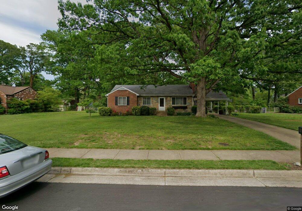
5909 Brookland Rd Alexandria, VA 22310
Rose Hill NeighborhoodEstimated Value: $590,000 - $699,000
3
Beds
2
Baths
1,036
Sq Ft
$617/Sq Ft
Est. Value
About This Home
This home is located at 5909 Brookland Rd, Alexandria, VA 22310 and is currently estimated at $638,916, approximately $616 per square foot. 5909 Brookland Rd is a home located in Fairfax County with nearby schools including Bush Hill Elementary School, Twain Middle School, and Edison High School.
Ownership History
Date
Name
Owned For
Owner Type
Purchase Details
Closed on
Dec 31, 1996
Sold by
Jesen + Todd L
Bought by
Conway Michael Sean
Current Estimated Value
Home Financials for this Owner
Home Financials are based on the most recent Mortgage that was taken out on this home.
Original Mortgage
$164,350
Outstanding Balance
$17,525
Interest Rate
7.55%
Mortgage Type
New Conventional
Estimated Equity
$621,391
Create a Home Valuation Report for This Property
The Home Valuation Report is an in-depth analysis detailing your home's value as well as a comparison with similar homes in the area
Home Values in the Area
Average Home Value in this Area
Purchase History
| Date | Buyer | Sale Price | Title Company |
|---|---|---|---|
| Conway Michael Sean | $173,000 | -- |
Source: Public Records
Mortgage History
| Date | Status | Borrower | Loan Amount |
|---|---|---|---|
| Open | Conway Michael Sean | $164,350 |
Source: Public Records
Tax History Compared to Growth
Tax History
| Year | Tax Paid | Tax Assessment Tax Assessment Total Assessment is a certain percentage of the fair market value that is determined by local assessors to be the total taxable value of land and additions on the property. | Land | Improvement |
|---|---|---|---|---|
| 2025 | $7,191 | $598,720 | $283,000 | $315,720 |
| 2024 | $7,191 | $572,840 | $268,000 | $304,840 |
| 2023 | $6,828 | $561,650 | $263,000 | $298,650 |
| 2022 | $6,110 | $492,750 | $223,000 | $269,750 |
| 2021 | $5,877 | $466,730 | $214,000 | $252,730 |
| 2020 | $5,903 | $467,510 | $214,000 | $253,510 |
| 2019 | $5,481 | $430,580 | $198,000 | $232,580 |
| 2018 | $4,902 | $426,280 | $196,000 | $230,280 |
| 2017 | $5,062 | $406,310 | $187,000 | $219,310 |
| 2016 | $4,920 | $394,920 | $182,000 | $212,920 |
| 2015 | $4,428 | $365,870 | $173,000 | $192,870 |
| 2014 | $4,186 | $344,950 | $163,000 | $181,950 |
Source: Public Records
Map
Nearby Homes
- 5886 Woodfield Estates Dr
- 5910 Woodfield Estates Dr
- 6010 Brookland Rd
- 5822 Brookview Dr
- 5405 Brookland Rd
- 5812 Piedmont Dr
- 5413 Waycross Dr
- 5206 Ninian Ave
- 6028 Crown Royal Cir
- 5963 Founders Hill Dr Unit 101
- 5916 Founders Hill Dr Unit 304
- 5930 Langton Dr
- 5924 Jane Way
- 6029 Heatherwood Dr
- 5004 Larno Dr
- 5554 Jowett Ct
- 6339 Dunman Way
- 5818 Cowling Ct
- 6117 Rose Hill Dr
- 5804 Summers Grove Rd
- 5907 Brookland Rd
- 5911 Brookland Rd
- 5914 Brookview Dr
- 5912 Brookview Dr
- 5916 Brookview Dr
- 5906 Brookland Rd
- 5908 Brookland Rd
- 5905 Brookland Rd
- 5913 Brookland Rd
- 5904 Brookland Rd
- 5918 Brookview Dr
- 5910 Brookland Rd
- 5918 Brookland Rd
- 5908 Brookview Dr
- 5902 Brookland Rd
- 5920 Brookview Dr
- 5912 Brookland Rd
- 5903 Brookland Rd
- 5915 Brookland Rd
- 5915 Brookview Dr