Estimated Value: $558,000 - $745,000
4
Beds
3
Baths
3,776
Sq Ft
$177/Sq Ft
Est. Value
About This Home
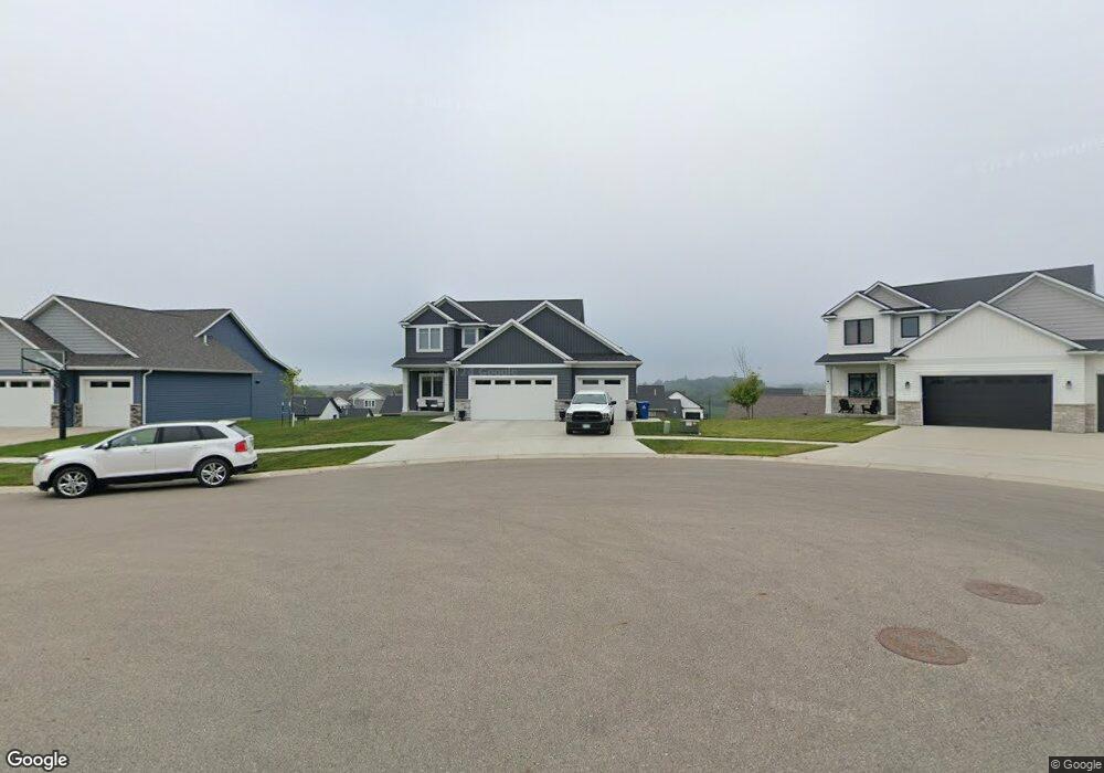
This home is located at 591 Haar Ln NE, Byron, MN 55920 and is currently estimated at $667,044, approximately $176 per square foot. 591 Haar Ln NE is a home located in Olmsted County with nearby schools including Byron Intermediate School, Byron Middle School, and Byron Senior High School.
Ownership History
Date
Name
Owned For
Owner Type
Purchase Details
Closed on
Dec 27, 2021
Sold by
H & H Company Of Rochester Llc
Bought by
Carlson Tyler and Carlson Leah
Current Estimated Value
Home Financials for this Owner
Home Financials are based on the most recent Mortgage that was taken out on this home.
Original Mortgage
$512,100
Outstanding Balance
$471,155
Interest Rate
2.98%
Mortgage Type
New Conventional
Estimated Equity
$195,889
Purchase Details
Closed on
Jan 4, 2021
Sold by
The East Village Bryon Llc
Bought by
H & H Company Of Rochester Llc
Purchase Details
Closed on
Nov 19, 2019
Sold by
Decook Bryce and Decook Brenda
Bought by
The East Village Byrom Llc
Create a Home Valuation Report for This Property
The Home Valuation Report is an in-depth analysis detailing your home's value as well as a comparison with similar homes in the area
Home Values in the Area
Average Home Value in this Area
Purchase History
| Date | Buyer | Sale Price | Title Company |
|---|---|---|---|
| Carlson Tyler | $584,459 | -- | |
| H & H Company Of Rochester Llc | $80,509 | Rochester Title & Escrow Co | |
| The East Village Byrom Llc | -- | None Available | |
| -- | $80,500 | -- |
Source: Public Records
Mortgage History
| Date | Status | Borrower | Loan Amount |
|---|---|---|---|
| Open | Carlson Tyler | $512,100 |
Source: Public Records
Tax History
| Year | Tax Paid | Tax Assessment Tax Assessment Total Assessment is a certain percentage of the fair market value that is determined by local assessors to be the total taxable value of land and additions on the property. | Land | Improvement |
|---|---|---|---|---|
| 2024 | $9,490 | $570,800 | $80,000 | $490,800 |
| 2023 | $9,286 | $571,300 | $80,000 | $491,300 |
| 2022 | $1,688 | $577,200 | $80,000 | $497,200 |
| 2021 | $1,584 | $75,000 | $75,000 | $0 |
| 2020 | $55 | $75,000 | $75,000 | $0 |
| 2019 | $55 | $3,500 | $3,500 | $0 |
Source: Public Records
Map
Nearby Homes
- 1761 Brandt Dr NE
- 1705 Brandt Dr NE
- 1644 Brandt Dr NE
- 830 Towne Dr NE
- 1792 (L3,B1) Brandt Dr NE
- 1667 Brandt Dr NE
- 1863 (L13,B2) Robinson Ln NE
- 1886 (L11,B2) Robinson Ln NE
- 1844 (L8,B2) Robinson Ln NE
- 1830 (L7,B2) Robinson Ln NE
- 1860 (L9,B2) Robinson Ln NE
- 1872 (L10,B2) Robinson Ln NE
- 1807 (L14,B2) Robinson Ln NE
- 1806 Brandt Dr NE
- 1812 Brandt Dr NE
- 1582 Brandt Dr NE
- 1574 Brandt Dr NE
- 1861 4th St NE
- 762 Towne Dr NE
- 1830 Brandt Dr NE
- 583 Haar Ln NE
- 599 Haar Ln NE
- 1668 Brandt Dr NE
- 594 Haar Ln NE
- 575 Haar Ln NE
- 1656 Brandt Dr NE
- 578 Haar Ln NE
- 1702 Brandt Dr NE
- 586 Haar Ln NE
- 570 Haar Ln NE
- 1786 Brandt Dr NE
- 1710 Brandt Dr NE
- 843 Towne Dr NE
- L2 B1 the East Village 2nd Addition NE
- 1718 Brandt Dr NE
- L3 B1 the East Village 2nd Addition NE
- 1726 Brandt Dr NE
- 851 Towne Dr NE
- 1651 Brandt Dr NE
- 1818 (L6,B1) Brandt Dr NE
Your Personal Tour Guide
Ask me questions while you tour the home.