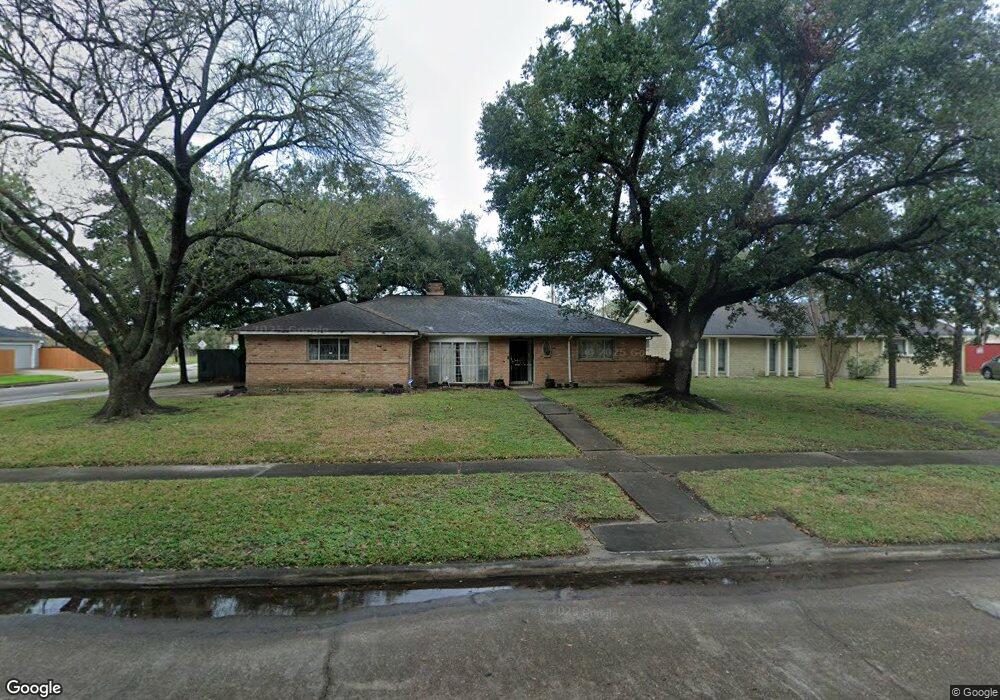
5910 Redding Rd Houston, TX 77036
Sharpstown NeighborhoodEstimated Value: $302,000 - $338,000
4
Beds
2
Baths
2,158
Sq Ft
$149/Sq Ft
Est. Value
About This Home
This home is located at 5910 Redding Rd, Houston, TX 77036 and is currently estimated at $321,472, approximately $148 per square foot. 5910 Redding Rd is a home located in Harris County with nearby schools including Emerson Elementary School, Paul Revere Middle School, and Wisdom High School.
Ownership History
Date
Name
Owned For
Owner Type
Purchase Details
Closed on
Jun 15, 1999
Sold by
Beeler Thomas Edward
Bought by
Chavez Kevin M
Current Estimated Value
Home Financials for this Owner
Home Financials are based on the most recent Mortgage that was taken out on this home.
Original Mortgage
$82,000
Outstanding Balance
$21,573
Interest Rate
7.02%
Estimated Equity
$299,899
Create a Home Valuation Report for This Property
The Home Valuation Report is an in-depth analysis detailing your home's value as well as a comparison with similar homes in the area
Home Values in the Area
Average Home Value in this Area
Purchase History
| Date | Buyer | Sale Price | Title Company |
|---|---|---|---|
| Chavez Kevin M | -- | Commonwealth Land Title Co |
Source: Public Records
Mortgage History
| Date | Status | Borrower | Loan Amount |
|---|---|---|---|
| Open | Chavez Kevin M | $82,000 |
Source: Public Records
Tax History Compared to Growth
Tax History
| Year | Tax Paid | Tax Assessment Tax Assessment Total Assessment is a certain percentage of the fair market value that is determined by local assessors to be the total taxable value of land and additions on the property. | Land | Improvement |
|---|---|---|---|---|
| 2025 | $3,419 | $274,825 | $72,671 | $202,154 |
| 2024 | $3,419 | $255,697 | $72,671 | $183,026 |
| 2023 | $3,419 | $278,414 | $72,671 | $205,743 |
| 2022 | $5,699 | $258,276 | $72,671 | $185,605 |
| 2021 | $5,292 | $227,042 | $64,885 | $162,157 |
| 2020 | $5,229 | $209,033 | $54,503 | $154,530 |
| 2019 | $5,457 | $209,033 | $54,503 | $154,530 |
| 2018 | $3,719 | $200,545 | $54,503 | $146,042 |
| 2017 | $4,686 | $197,407 | $54,503 | $142,904 |
| 2016 | $4,260 | $175,780 | $54,503 | $121,277 |
| 2015 | $2,611 | $175,780 | $54,503 | $121,277 |
| 2014 | $2,611 | $160,675 | $54,503 | $106,172 |
Source: Public Records
Map
Nearby Homes
- 8579 Sands Point Dr Unit 102
- 8543 Sands Point Dr
- 8555 Sands Point Dr Unit 90
- 6411 Redding Rd
- 8435 Sands Point Dr
- 8411 Sands Point Dr Unit 18
- 8359 Sands Point Dr Unit 218
- 8275 Sands Point Dr Unit 176
- 8267 Sands Point Dr Unit 172
- 4001 Tanglewilde St Unit 1103
- 4001 Tanglewilde St Unit 1204
- 4001 Tanglewilde St Unit 1402
- 8257 Sands Point Dr Unit 167
- 3800 Tanglewilde St Unit 803
- 3800 Tanglewilde St Unit 605
- 3800 Tanglewilde St Unit 504
- 3800 Tanglewilde St Unit 607
- 10001 Westpark Dr Unit 75
- 8231 Sands Point Dr Unit 154
- 10049 Westpark Dr Unit 136
- 5906 Redding Rd
- 6002 Redding Rd
- 5904 Redding Rd
- 5911 Redding Rd
- 6006 Redding Rd
- 5907 Redding Rd
- 5902 Redding Rd
- 6003 Redding Rd
- 6010 Redding Rd
- 6007 Redding Rd
- 5910 Burning Tree Dr
- 6011 Redding Rd
- 6102 Redding Rd
- 6002 Burning Tree Dr
- 5904 Burning Tree Dr
- 6006 Burning Tree Dr
- 6103 Redding Rd
- 6106 Redding Rd
- 6010 Burning Tree Dr
- 6107 Redding Rd