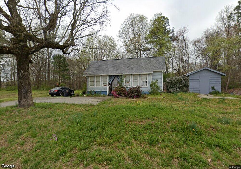
5911 Priest Rd Acworth, GA 30102
Oak Grove NeighborhoodEstimated Value: $447,000 - $807,000
5
Beds
3
Baths
3,482
Sq Ft
$177/Sq Ft
Est. Value
About This Home
This home is located at 5911 Priest Rd, Acworth, GA 30102 and is currently estimated at $616,184, approximately $176 per square foot. 5911 Priest Rd is a home located in Cherokee County with nearby schools including E. T. Booth Middle School, Etowah High School, and Cornerstone Preparatory Academy.
Ownership History
Date
Name
Owned For
Owner Type
Purchase Details
Closed on
May 30, 2019
Sold by
Wolf Terryl A
Bought by
Wolf Terryl A and Wolf David A
Current Estimated Value
Purchase Details
Closed on
May 6, 2010
Sold by
Nelson Gary N
Bought by
Wolf Terryl A
Purchase Details
Closed on
Jan 26, 2001
Sold by
Gravely Theresa A
Bought by
Gravely Max W and Gravely Theresa A
Home Financials for this Owner
Home Financials are based on the most recent Mortgage that was taken out on this home.
Original Mortgage
$119,000
Interest Rate
7.18%
Mortgage Type
New Conventional
Create a Home Valuation Report for This Property
The Home Valuation Report is an in-depth analysis detailing your home's value as well as a comparison with similar homes in the area
Home Values in the Area
Average Home Value in this Area
Purchase History
| Date | Buyer | Sale Price | Title Company |
|---|---|---|---|
| Wolf Terryl A | -- | -- | |
| Wolf Terryl A | $300,000 | -- | |
| Gravely Max W | -- | -- |
Source: Public Records
Mortgage History
| Date | Status | Borrower | Loan Amount |
|---|---|---|---|
| Previous Owner | Gravely Max W | $119,000 |
Source: Public Records
Tax History Compared to Growth
Tax History
| Year | Tax Paid | Tax Assessment Tax Assessment Total Assessment is a certain percentage of the fair market value that is determined by local assessors to be the total taxable value of land and additions on the property. | Land | Improvement |
|---|---|---|---|---|
| 2025 | $1,211 | $229,592 | $58,200 | $171,392 |
| 2024 | $1,452 | $215,632 | $43,640 | $171,992 |
| 2023 | $1,046 | $209,508 | $43,640 | $165,868 |
| 2022 | $1,201 | $181,184 | $43,640 | $137,544 |
| 2021 | $1,102 | $125,704 | $37,320 | $88,384 |
| 2020 | $1,101 | $124,104 | $37,320 | $86,784 |
| 2019 | $1,025 | $128,840 | $37,320 | $91,520 |
| 2018 | $1,044 | $128,880 | $37,320 | $91,560 |
| 2017 | $1,047 | $312,400 | $35,120 | $89,840 |
| 2016 | $1,047 | $286,300 | $29,640 | $84,880 |
| 2015 | $1,085 | $289,900 | $29,640 | $86,320 |
| 2014 | $1,072 | $278,400 | $26,320 | $85,040 |
Source: Public Records
Map
Nearby Homes
- 328 Colsen Dr
- 332 Colsen Dr
- 336 Colsen Dr
- 340 Colsen Dr
- 314 Vermillion St
- 344 Colsen Dr
- 325 Colsen Dr
- 435 Carrera Ln
- 432 Carrera Ln
- 440 Carrera Ln
- 2899 Emerald Ln
- Bolton Plan at Cherokee Township
- Brooks Plan at Cherokee Township
- Bryson Plan at Cherokee Township
- 2936 Cheryl Ct
- 2959 Creekstone Dr
- 153 Centennial Ridge Dr
- 503 Rendezvous Rd
- 5496 E Emerald Ct
- 517 Rendezvous Rd
- 201 Starwood Ct
- 106 Reunion Place
- 104 Reunion Place
- 5873 Priest Rd
- 102 Reunion Place
- 108 Reunion Place Unit 1087
- 108 Reunion Place
- 100 Reunion Place
- 110 Reunion Place Unit 1086
- 110 Reunion Place
- 200 Starwood Ct
- 112 Reunion Place Unit 1085
- 112 Reunion Place
- 202 Starwood Ct
- 103 Reunion Place Unit 1002
- 103 Reunion Place
- 101 Reunion Place
- 5913 Priest Rd
- 231 Torch Dr Unit 775
- 231 Torch Dr Unit 787