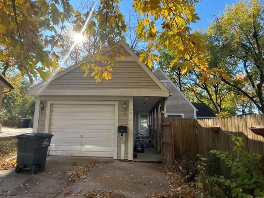
5912 Rutland Dr Des Moines, IA 50311
Waveland Woods NeighborhoodEstimated payment $1,325/month
Highlights
- Traditional Architecture
- Tile Flooring
- Family Room
- No HOA
- Forced Air Heating and Cooling System
- Dining Area
About This Home
Calling All Investors!
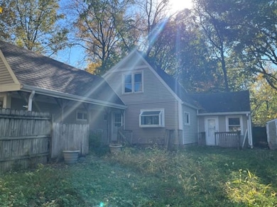
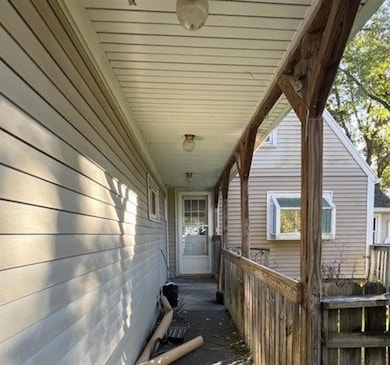
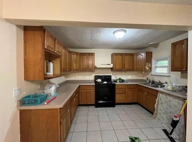
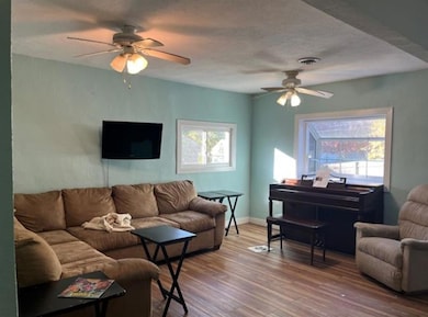
This charming story-and-a-half home offers endless potential and is ready for you to earn some sweat equity and restore it to its former charm! Features include 3 bedrooms, 1.5 bathrooms, and laundry conveniently located on the main level. The spacious primary bedroom is also on the main floor, and the bonus room can serve as an additional bedroom, office, or playroom — the choice is yours! Enjoy a bright living room and functional kitchen. Upstairs, you’ll find two additional bedrooms and a half bath. The large yard with mature trees is perfect for outdoor enjoyment. An attached two-car garage provides plenty of space for parking, storage, or hobbies. With over 1,500 sq. ft. to finish, there’s plenty of room to make this home shine. Located near a golf course, bus stop, schools, parks, and shopping, and just minutes from I-235 for easy access to suburbs and downtown. A great opportunity for investors or handy homeowners ready to bring new life to this home. Don’t miss out — this one is full of potential!
Home Details
Home Type
- Single Family
Est. Annual Taxes
- $3,940
Year Built
- Built in 1947
Lot Details
- 6,000 Sq Ft Lot
- Lot Dimensions are 60x100
- Property is Fully Fenced
- Wood Fence
- Chain Link Fence
- Property is zoned N3B
Home Design
- Traditional Architecture
- Asphalt Shingled Roof
- Vinyl Siding
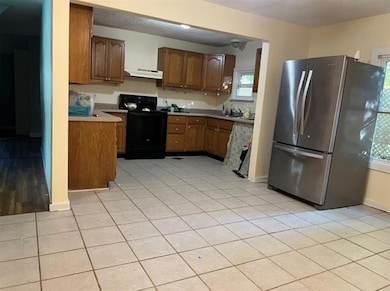
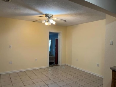
Interior Spaces
- 1,692 Sq Ft Home
- 1.5-Story Property
- Family Room
- Dining Area
- Stove
- Laundry on main level
Flooring
- Carpet
- Tile
Bedrooms and Bathrooms
Parking
- 1 Car Attached Garage
- Driveway
Utilities
- Forced Air Heating and Cooling System
Community Details
- No Home Owners Association
Listing and Financial Details
- Assessor Parcel Number 09000455000000
Map
Home Values in the Area
Average Home Value in this Area
Tax History
| Year | Tax Paid | Tax Assessment Tax Assessment Total Assessment is a certain percentage of the fair market value that is determined by local assessors to be the total taxable value of land and additions on the property. | Land | Improvement |
|---|---|---|---|---|
| 2025 | $3,500 | $209,400 | $39,700 | $169,700 |
| 2024 | $3,500 | $188,400 | $35,000 | $153,400 |
| 2023 | $3,516 | $188,400 | $35,000 | $153,400 |
| 2022 | $3,488 | $158,100 | $30,100 | $128,000 |
| 2021 | $3,478 | $158,100 | $30,100 | $128,000 |
| 2020 | $3,608 | $148,000 | $27,900 | $120,100 |
| 2019 | $2,840 | $148,000 | $27,900 | $120,100 |
| 2018 | $2,806 | $114,200 | $24,700 | $89,500 |
| 2017 | $2,522 | $114,200 | $24,700 | $89,500 |
| 2016 | $2,452 | $101,800 | $21,600 | $80,200 |
| 2015 | $2,452 | $101,800 | $21,600 | $80,200 |
| 2014 | $2,304 | $95,400 | $19,700 | $75,700 |
Property History
| Date | Event | Price | List to Sale | Price per Sq Ft |
|---|---|---|---|---|
| 11/24/2025 11/24/25 | Price Changed | $189,400 | -0.3% | $112 / Sq Ft |
| 11/20/2025 11/20/25 | Price Changed | $189,900 | -4.8% | $112 / Sq Ft |
| 11/11/2025 11/11/25 | For Sale | $199,500 | -- | $118 / Sq Ft |
Purchase History
| Date | Type | Sale Price | Title Company |
|---|---|---|---|
| Special Warranty Deed | $57,500 | None Available | |
| Sheriffs Deed | $102,000 | None Available | |
| Warranty Deed | $39,500 | -- |
Mortgage History
| Date | Status | Loan Amount | Loan Type |
|---|---|---|---|
| Closed | $46,400 | Purchase Money Mortgage | |
| Previous Owner | $100,000 | No Value Available |
Source: Des Moines Area Association of REALTORS®
MLS Number: 730247
APN: 090-00455000000
Disclaimer: Certain information contained herein is derived from information provided by parties other than Homes.com. All information provided is deemed reliable, but is not guaranteed to be accurate and should be independently verified.
![]() IDX information is provided exclusively for personal, non-commercial use, and may not be used for any purpose other than to identify prospective properties consumers may be interested in purchasing. Information is deemed reliable but not guaranteed.
IDX information is provided exclusively for personal, non-commercial use, and may not be used for any purpose other than to identify prospective properties consumers may be interested in purchasing. Information is deemed reliable but not guaranteed.
- 1051 57th St
- 1129 57th St
- 1129 64th St
- 1010 56th St
- 1215 Merle Hay Rd
- 6002 Rollins Ave
- 1304 60th St
- 1236 63rd St
- 6330 Center St
- 6423 Carpenter Ave
- 720 63rd St
- 6750 School St Unit 206
- 6750 School St Unit 205
- 6420 Center St
- 1344 57th St
- 1008 67th St
- 686 63rd St
- 1003 68th St
- 6521 Elmcrest Dr
- 6704 Elmcrest Dr
- 1148 63rd St
- 1229 Merle Hay Rd
- 6407 Carpenter Ave
- 1036 66th St Unit 1036.5
- 900 65th St
- 1539 56th St
- 1261 8th St
- 1261 8th St Unit ID1036769P
- 1261 8th St Unit ID1036848P
- 5322 Ingersoll Ave
- 4933 Woodland Ave
- 4931 Woodland Ave Unit 4931
- 6210 Franklin Ave
- 1225 11th St
- 1155 Office Park Rd
- 2004 63rd St
- 1137 11th St
- 5902 Hickman Rd
- 1200 Office Park Rd
- 5113 Lincoln Ave Unit 5113
